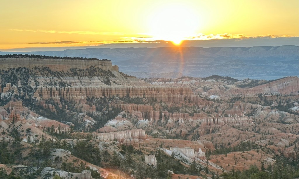
Cover Photo: Sunset at Bryce Canyon
Adventure Map Days 11-16
Day 11: 06/09/23 (Friday)
I feel like I need to add a disclaimer to this post since it’s so long. I promise that it’s worth it though. Lot’s of parks and adventures in here. I thought about breaking it into a couple of separate posts however I wanted to keep all of Utah together to make it easier for me to go back and reference. Now on with the show!
- Great nights rest at the Prospector so off we go. As always when I go through Ely I had to stop and tell the dinosaurs in front of the Prospector Hotel goodbye. They did a great job of making this hotel a fun place to stay!
- Once on the road we turned back on and listened to the Nevada audio tour about Highway 50 as we drove. Great program that you need to listen to when driving this road. Nevada is to be commended for creating it and making it available to the public. Make sure you download as many of the places on Hwy 50 don’t have cell service available.
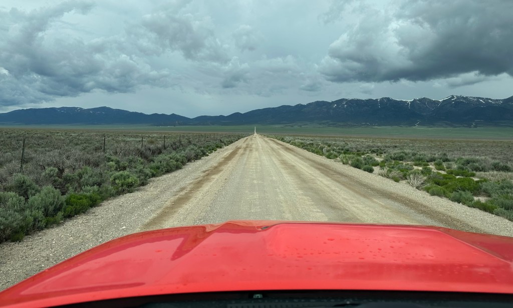
- Our first stop was pretty intriguing to me as it was the Ward Charcoal Ovens State Historic Park-beautiful fields and mountain views of Eastern NV on the drive there and up to them. Here’s the road you have to take for the last few miles to get to them.
- The Ward Charcoal Ovens are well worth the drive as well as pretty sobering once you read the info plaques by them. Basically the ovens were used to make charcoal which in turn was needed to smelt ore. Specifically silver ore in this case. They only operated from 1876-1879 or three years before the silver boom waned. Basically they filled them full of wood and reduced the wood to charcoal. The ovens allowed them to control how hot and long the fire burned. After they were “closed down” they were used as shelters by prospectors, stockmen, and the occasional outlaw.
- To give you an idea of what went on here each oven was 27 feet in diameter and 30 feet high. Filling one oven required trees from six acres of land and there were six ovens here. So to do each oven batch ONE time took 36 acres of trees! When they closed them down in 1879 they had completely stripped the land of all timber for a radius of up to 35 miles! The surrounding area is still recovering over a 100 years later.


- Having said all that they are truly beautiful to walk around, look at, and go inside. All this time and they are standing with no structural issues or problems. Talk about well constructed!


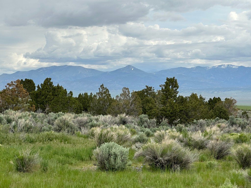
- I am happy to report though that you can go camping in the area (fee area) and have some beautiful scenery and hiking paths also. Here’s another shot of how the area is recovering. Pretty spectacular!
- About 45 minutes down the road was Great Basin National Park. I didn’t care for it that much as it didn’t strike a cord with me. If I would have been staying it would have been good to do a tour of the caves and join their stargazing party at 8:30pm that night. Not every night has a stargazing party so make sure to check the schedule before you show up. Again, lots to do here in the park; it just didn’t resonate with me.

- Driving back out of the park we stopped in Baker (just down street from Visitor Center) and got some snacks. The Strawberry Rhubarb muffin was spectacular! The owner loved my orange vehicle as was the color of her General Store and chair… so Phanta posed with the chair for her photo collection. She told us she would take pictures of her chair in different locations with different items that “matched” so we felt pretty happy to oblige!

- From there we crossed the Salt Lake Desert from NV to West, Utah on our way to Bryce Canyon. It was a long drive in a few places but always pretty and took us about 4 hours to hour next stop in Panguitch.
- Stopped in Panguitch to fill up full of gas and just HAD to ride the wild dinosaur at the Sinclair Country Store because that’s what you do right? Can’t let the kids have all the fun.

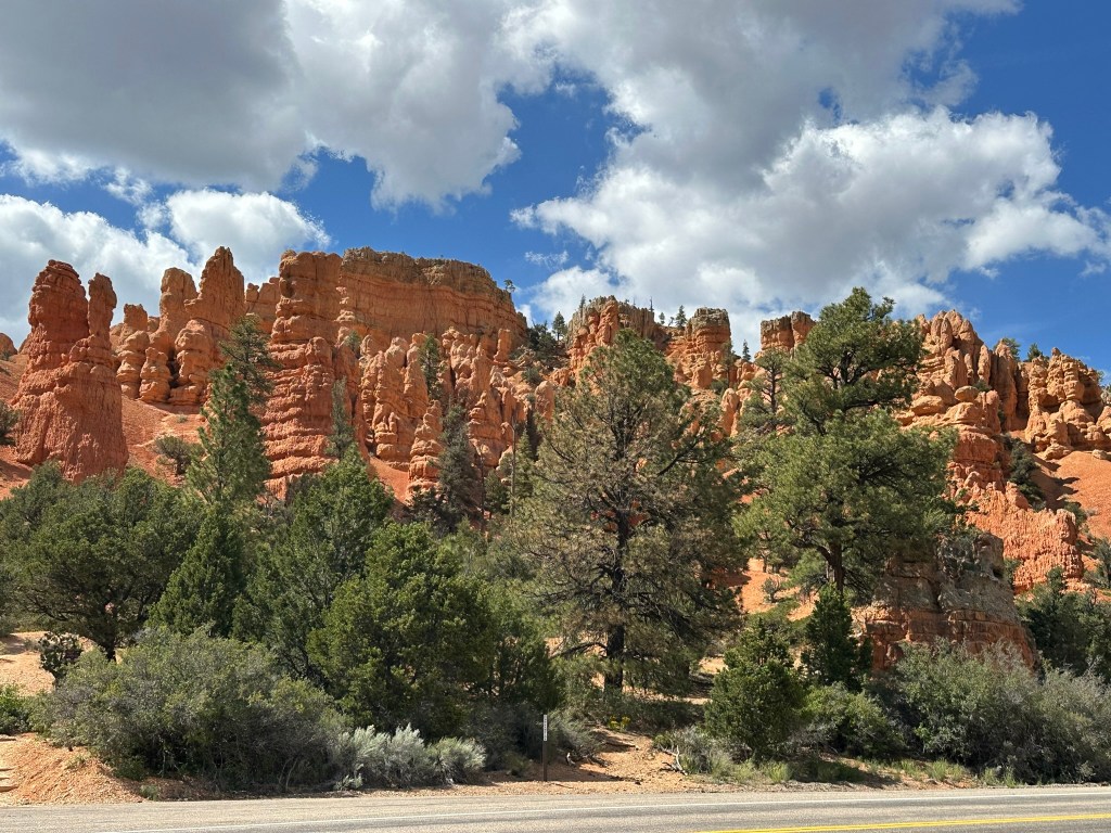
- Thirty minutes later we were driving through Red Canyon to get to Bryce Canyon. Beautiful place….need stay there also. More on Red Canyon later.
- A few minutes later we made it to Bryce Canyon and waited our turn to enter the park. Evidently someone ahead of us didn’t want to pay to get into the park and the ranger told them to turn around. They didn’t and went into the Visitor Center parking lot. The ranger about lost his mind. He got on his radio and just stood there watching for them for about 5 minutes before they reappeared and left the park. Don’t do that to the rangers!
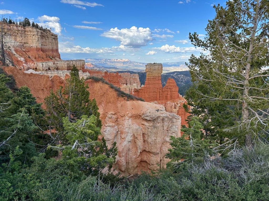
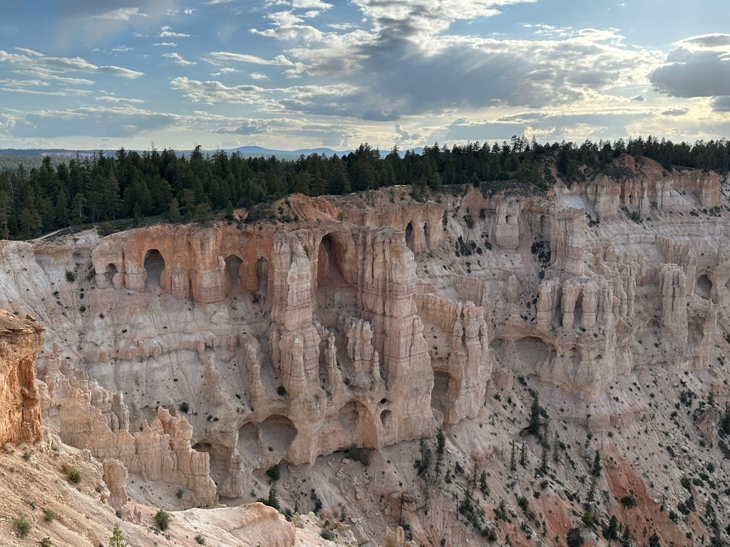
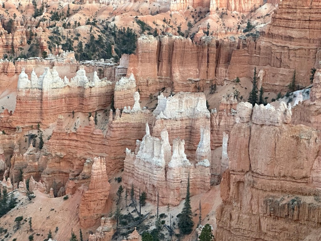
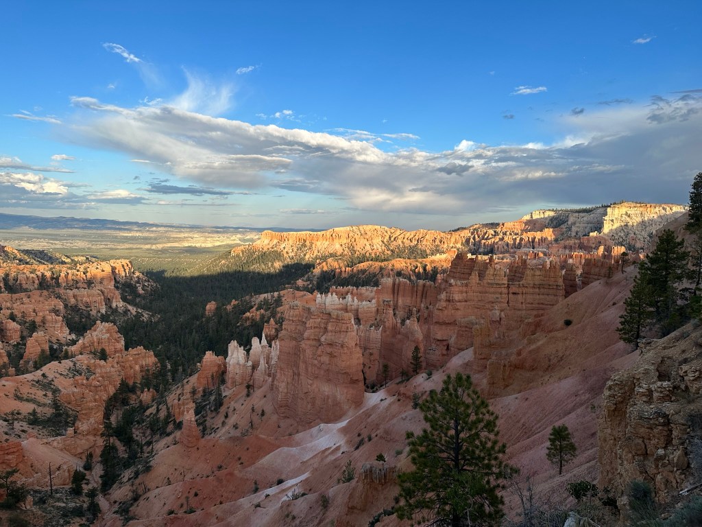
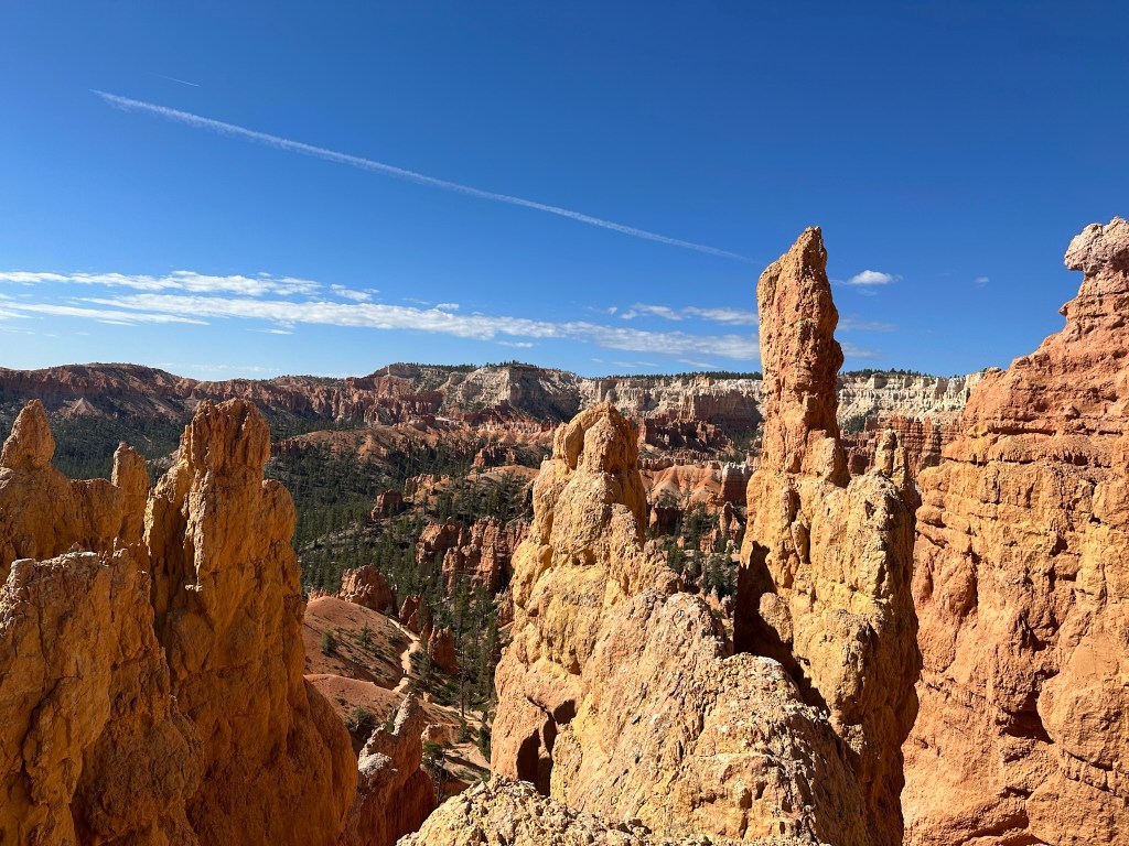
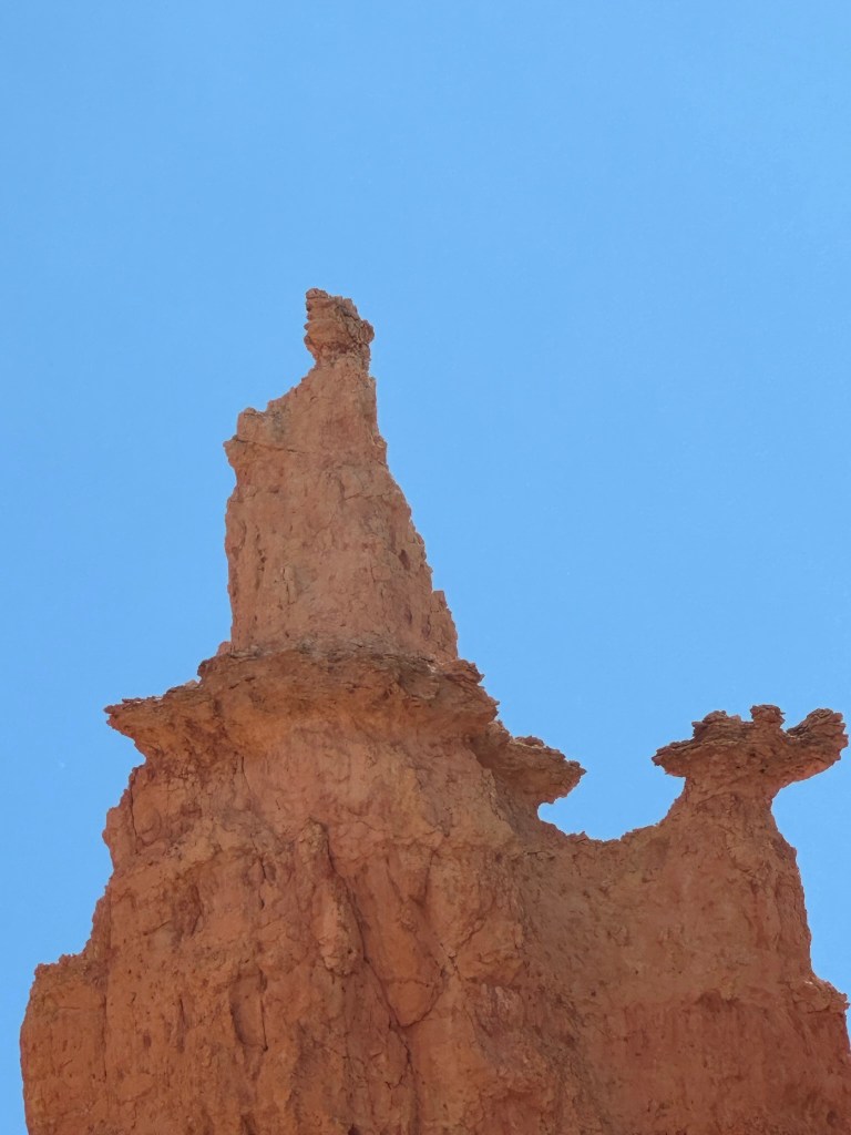
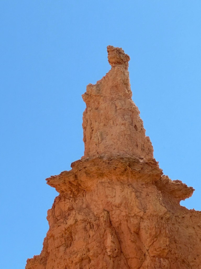
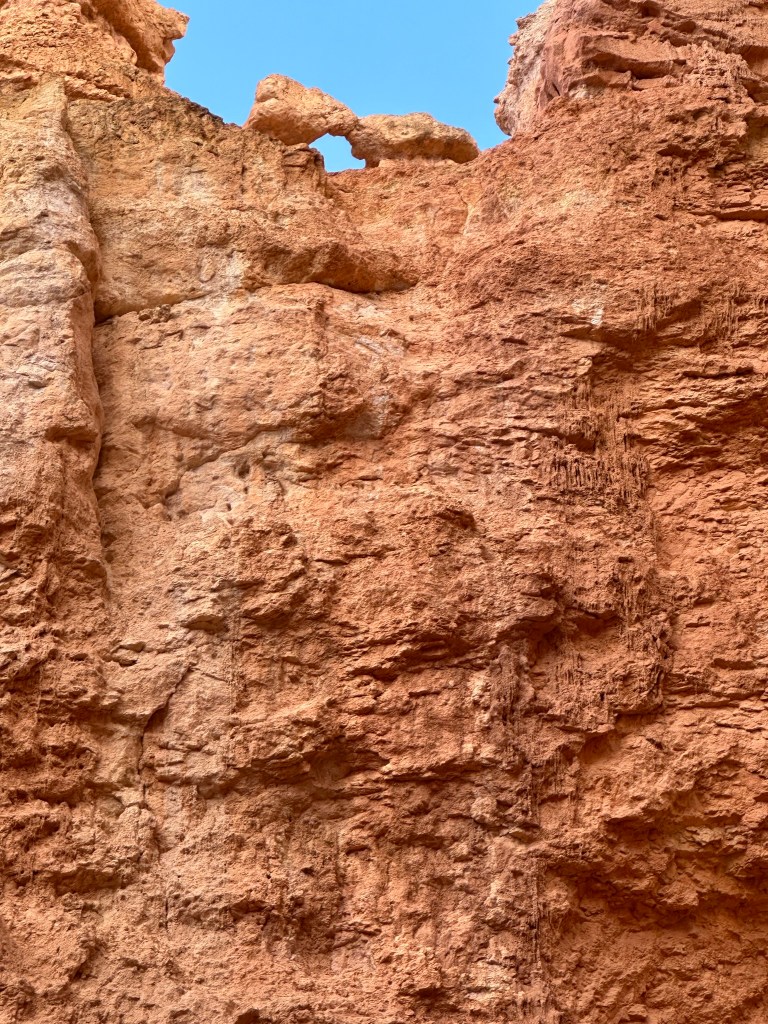
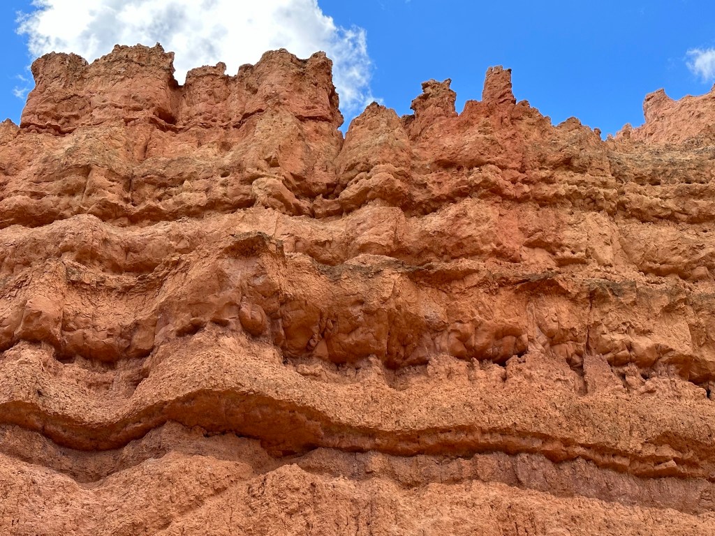
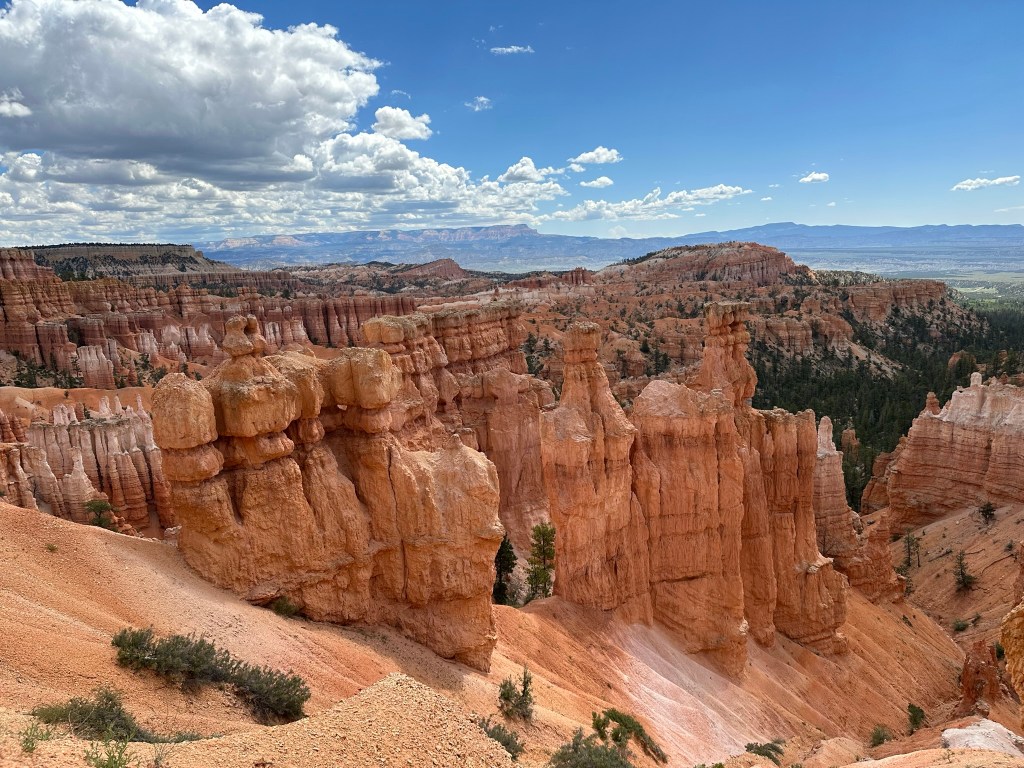
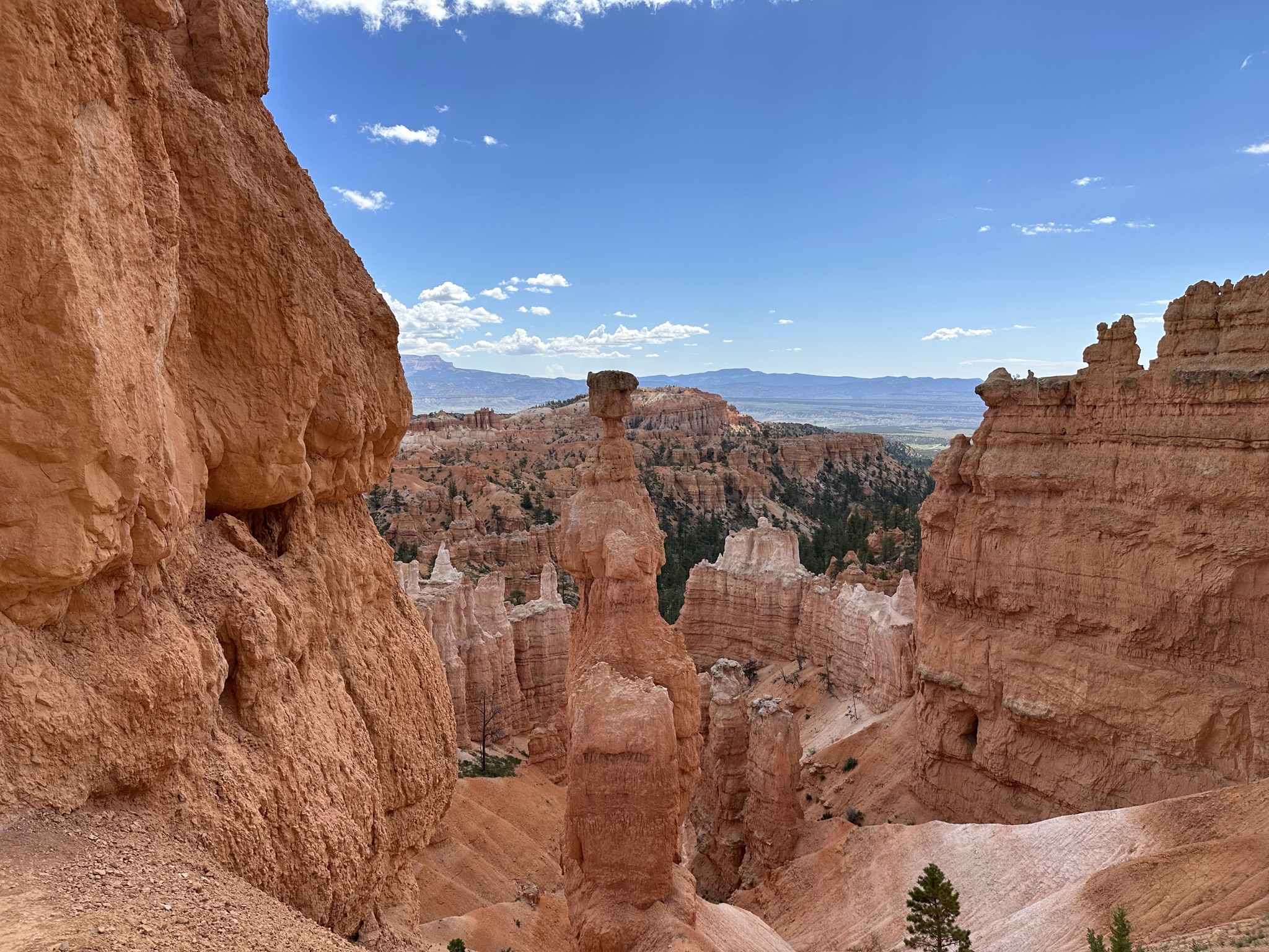
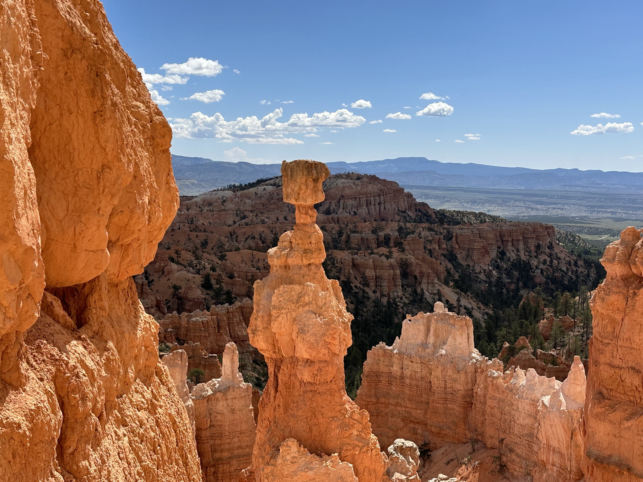
- Once in the park it was a quick trip to get checked into the Lodge where we were staying the night. Great location as the lodge is just steps from the Rim. Once we got our bags in the room we did a quick walk out to check it out. I have never seen anything like this in my life. It was just stunning! These pics are from halfway between Sunrise and Sunset Point said location which is about 100 yards from where we were lodged. The time was about 5:30pm.
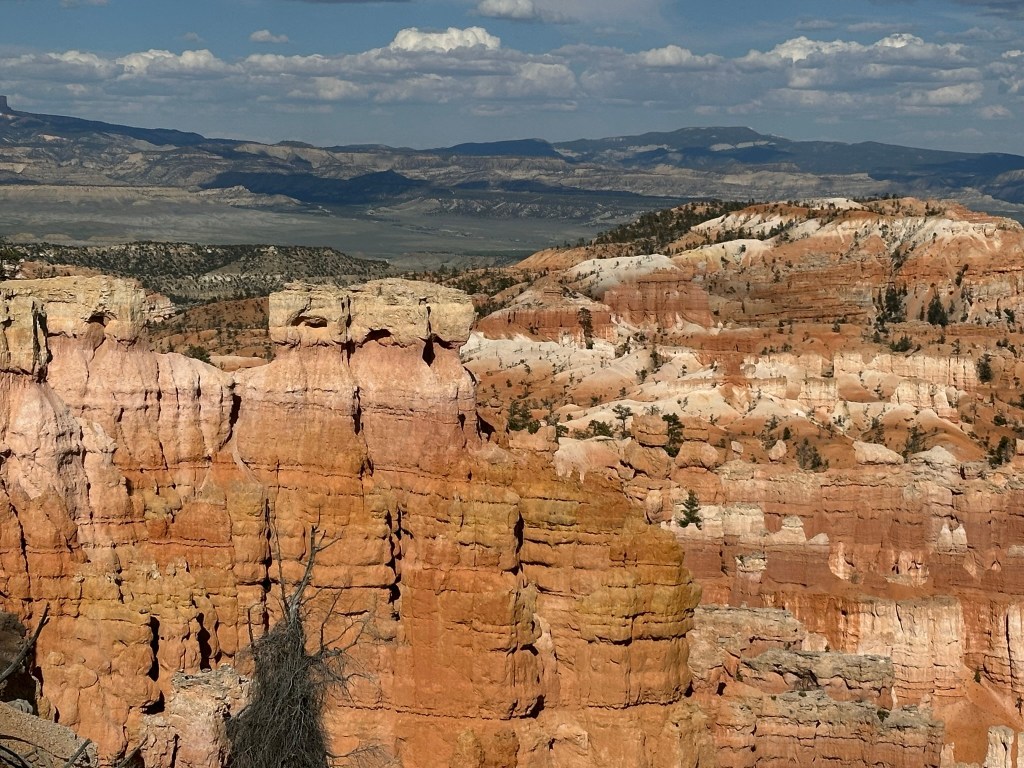

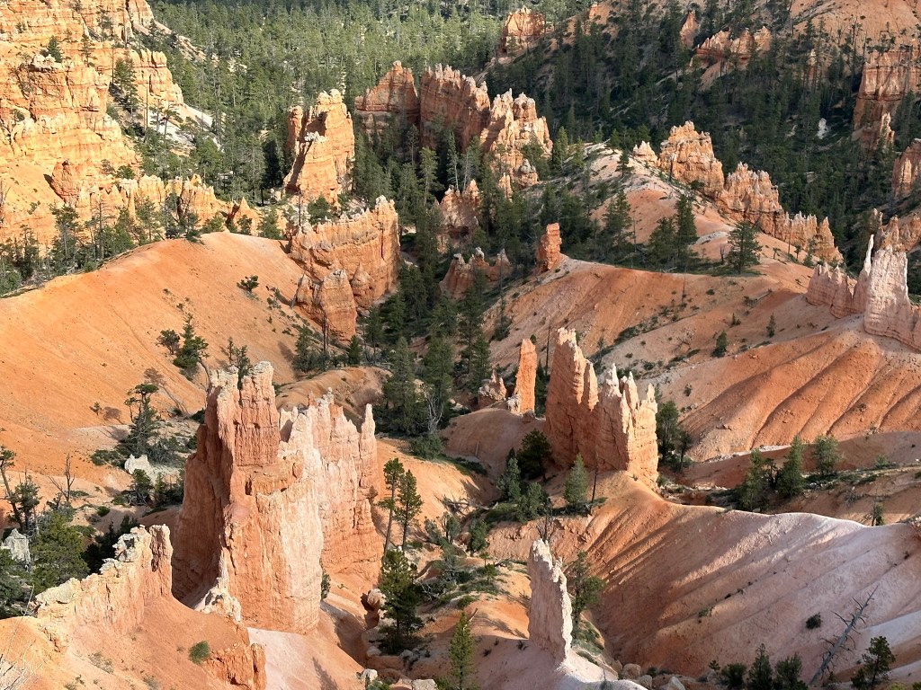

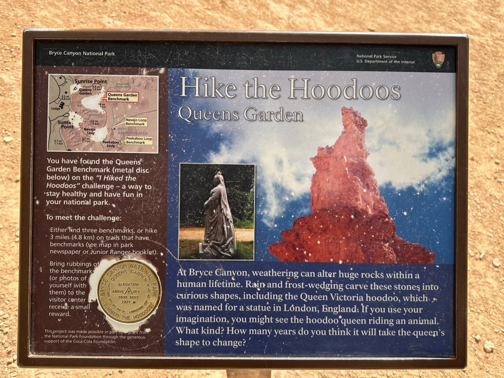
- Let’s do a quick geology lesson here before we go any further. The colors in the rock are caused by manganese oxides (blue and purple hazes) and iron oxides (yellow, orange, red, and brown) in the limestone layers. The shapes are due to erosion, chemical weathering, and lots of mechanical weathering due to water freezing/thawing which breaks rock apart. Read the pics below for more details.


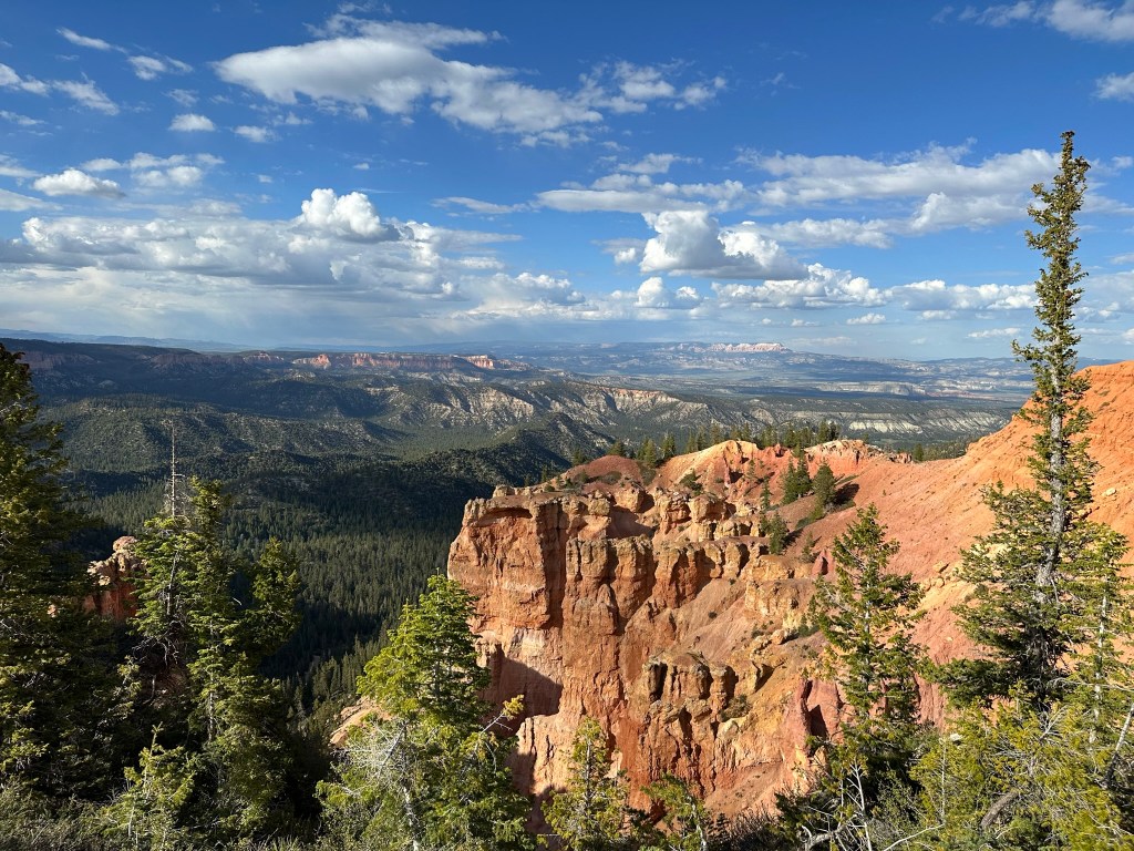
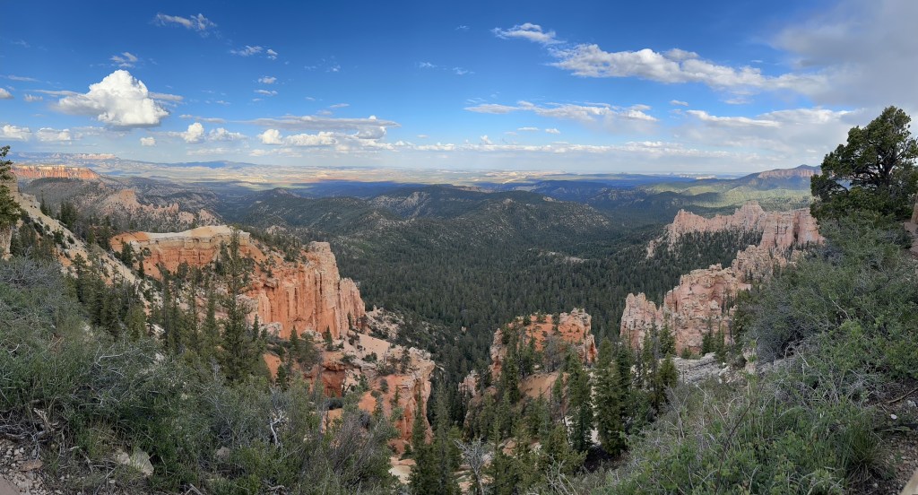
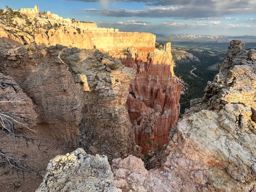
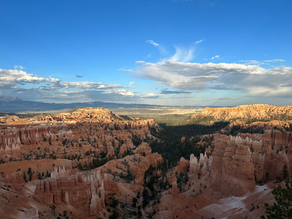
- Tearing ourselves away from the view we drove the Scenic Loop to the end at Rainbow Point then worked our way back while we stopped at all the viewpoints. Get ready for a lot of pictures here. I was just overwhelmed by it all!
- As I said the last spot on the Scenic Loop is Rainbow Point at an elevation of 9,115 feet. The elevation falls as you work your way back to the lodge. Hiking this downhill sounds pretty appealing to me!


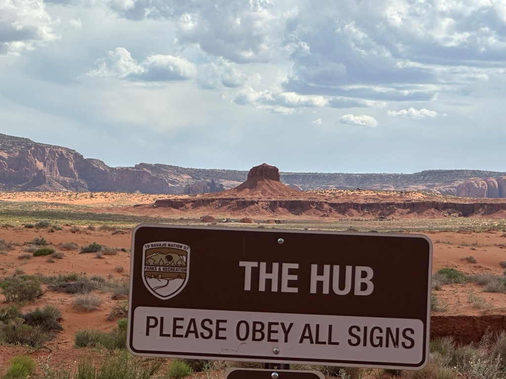
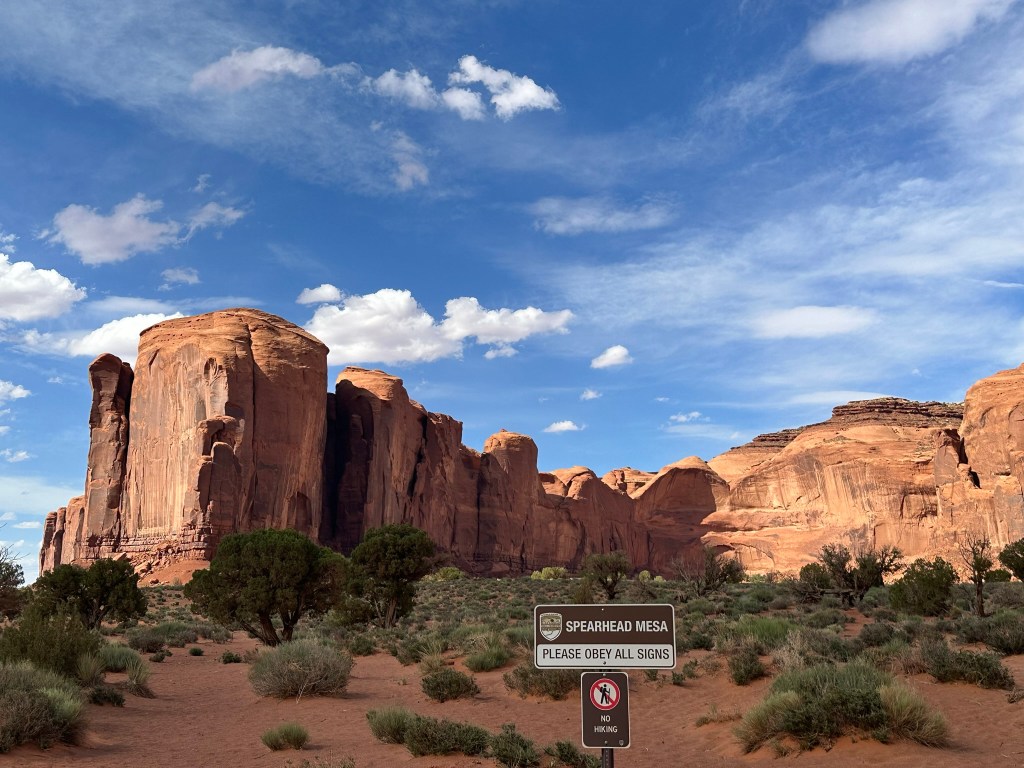
- And now we present an important safety message. Always obey the safety signs!
- Having had a bit of fun as way of a gentle reminder to people we drove on down to Ponderosa Point (elevation 8,904 feet) and Agua Canyon (elevation 8,800 feet).

- Next stop was Natural Bridge at an elevation of 8,627 feet. Natural Bridge is technically an arch. This arch is caused by frost-wedging (remember earlier?), as well as gravity and chemical weathering. The arch spans 85 feet. Here’s a picture of how nature makes it work.

- And since you’ve been a good sport here’s a picture of the arch itself.

- Moving on down in this case was Farview Point (elevation 8,819 feet) and Sheep Creek/Swamp Canyon Connecting trails overlook.
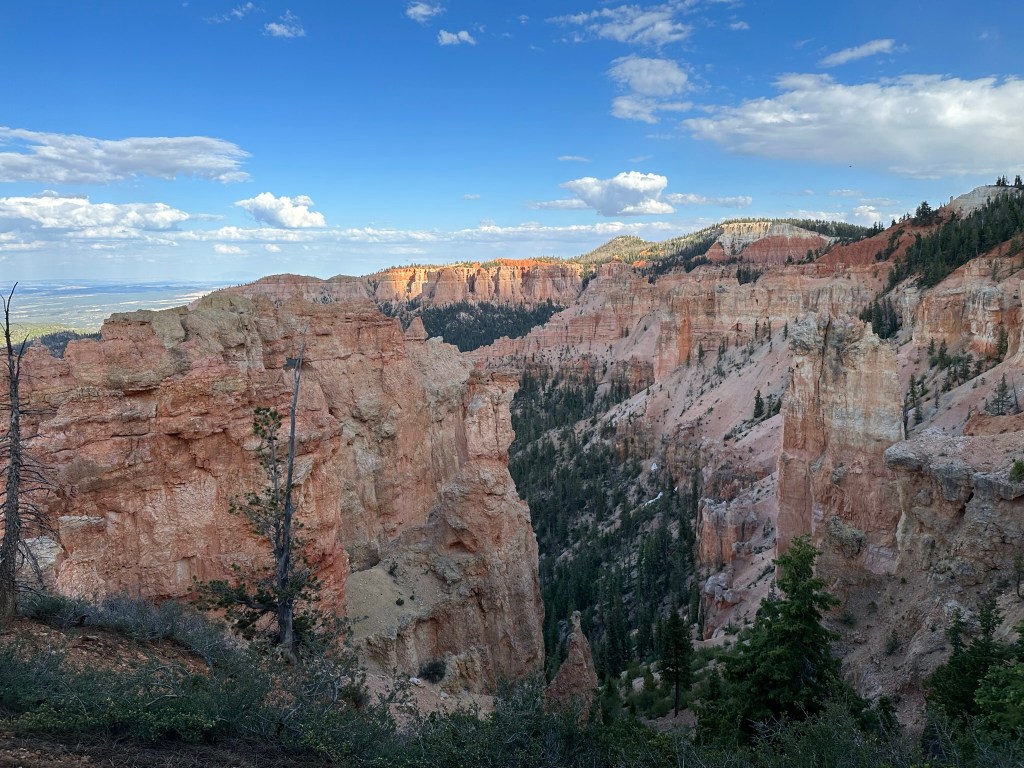
- Quick drive and we were down to Bryce Point at elevation 8,300 feet. Bryce Point was definitely one of my favorite spots to stop and look. Lots of view to see and sights that filled every view.


- Almost there… Next stop down was Paria View; elevation 8,175. It gets it’s name from the Paiute word Paria meaning “water with elk” or “water with mud” depending on context and season. Paria view faces the setting sun unlike most of the cliffs and hoodoos of Bryce Canyon so it’s a good place to see the last rays of the setting sun. It’s also a good place to watch for Peregrine Falcons for all you birders out there.


- Our final stop of the day on the way back to the lodge was Inspiration Point at 8,100 feet elevation. It’s just amazing to see these views in person. I wish the camera could capture the true picture and beauty of being right there looking at all this.

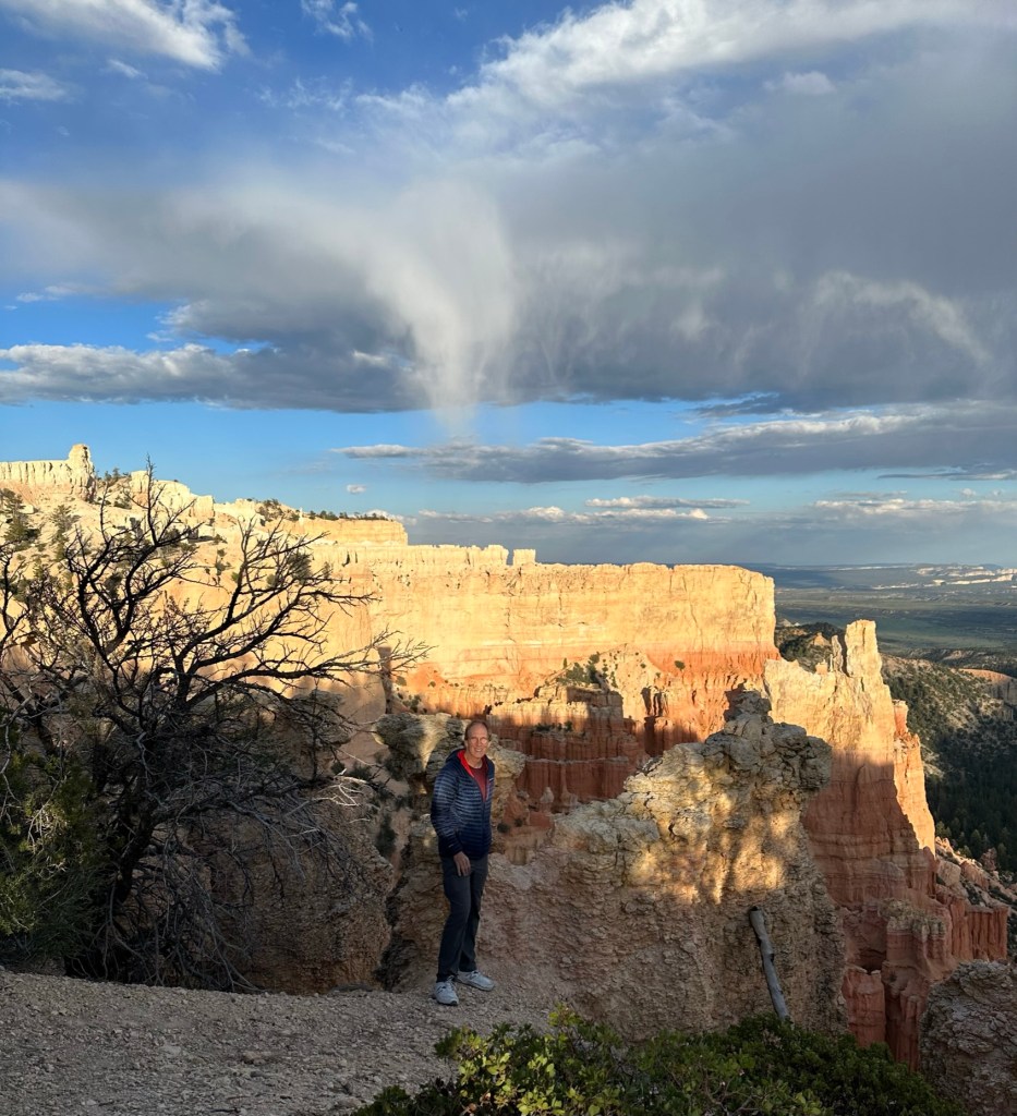
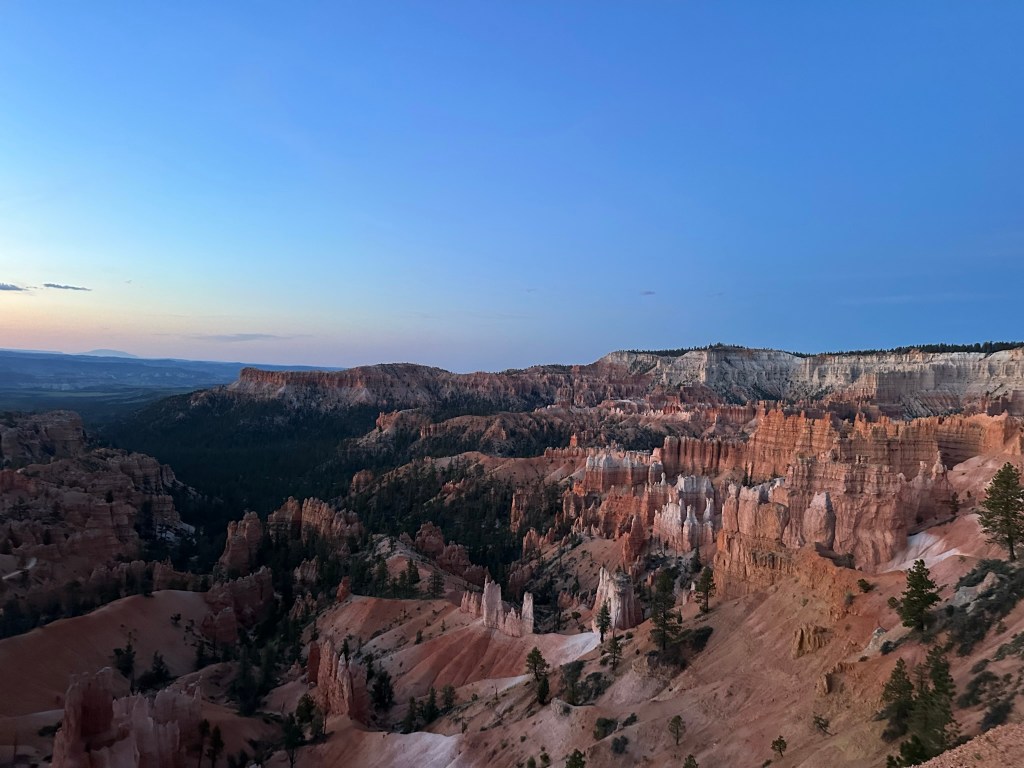
- Leaving Inspiration Point we bypassed Sunset Point (elevation 8,000 feet if you’re keeping track) to get back to the lodge for a quick stop at Phanta to grab some charcuterie makings for a fast snack in the room and then out to the Rim just outside our cabin to watch the sunset play over the landscape. Again, our cabin was right in-between Sunset and Sunrise Point (elevation 8,100 feet). Sunset and Sunrise Point are about a mile apart so we thought it would be a good spot to “split the difference” and enjoy the view without the crowds. For reference it was 8:36pm.


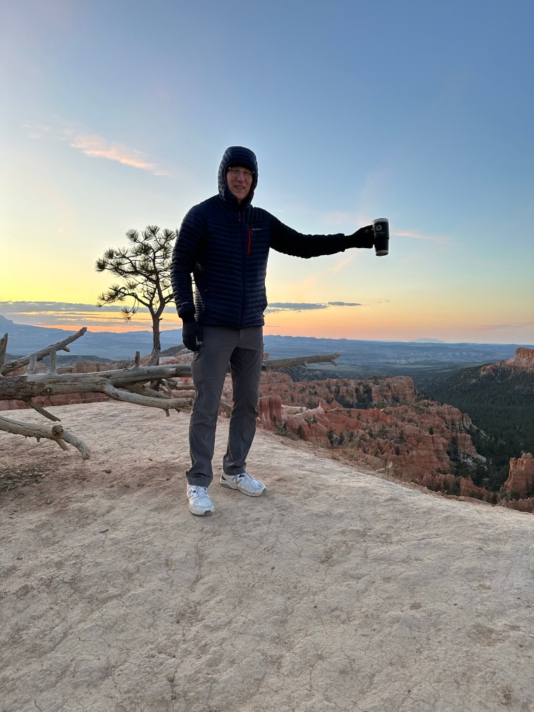
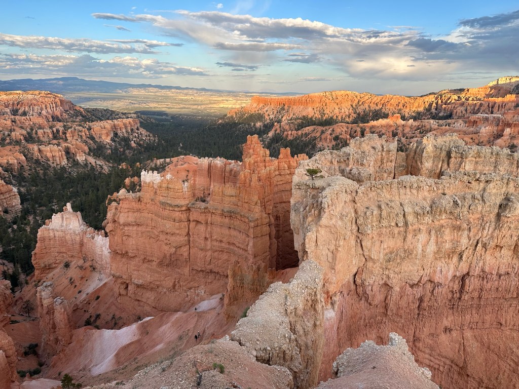
- Back into room about 9pm to finish dinner and then off to bed. About 9:40pm I couldn’t take it though and had to sneak back out to the Rim for a last picture of the night. Well, almost the last. I did go back out again later to look at the stars however I couldn’t get a good picture so you’ll have to make do with this one instead.

Day 12: 06/10/23 (Saturday)
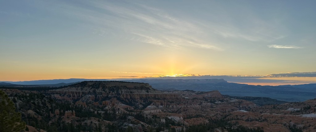
- After the spectacular views yesterday we didn’t want to miss the sunrise so we got up early at 5am to see the sunrise at 6:07am. We were not disappointed.
- Quick walk to Sunrise Point and took pictures of the sunrise. The sun ended up being a little late since it was cloudy however it too made an appearance for us. There were quite a few people at Sunrise Point but no one was jockeying for position or anything. It was really pleasant except for the 43 degree cold weather. Some people showed up in shorts.. We were not those people!


- As you can see a few minutes makes a lot of difference here. It was incredible the way the view was changing by the minute with the play of light on the rock formations and horizon.
- Oh yeah, and don’t be the jerk that was flying a drone either. I hope they caught that person and fined them as it wasn’t legal and the noise bothered a lot of people and really detracted from the moment.
- Walked on back to the room, finished packing, checked on out of the hotel and drove from there to the Red Canyon Visitor Center however it was closed until 10am so we just took a quick hike around the Visitor’s Center and headed on our way. Have to stop and say that we were loving this part of Utah!

- We took the southern way to Monument Valley through Kanab, UT and then Page, AZ to get to our destination. It was a beautiful drive in places and in others not so much. Seemed like it was one extreme or the other. Kanab looked like an interesting town that was a jump off point for a lot of hikes and outdoor activities. Have to look into that more.
- We ended up driving by the Vermilion Cliffs which were stunning. We finally found us a stop off point to eat some lunch while looking at the views and then on our way again.
- Page also looked interesting. They had a huge dam there that you could take tours of and several places were advertising Antelope Canyon tours. We were pretty focused on getting to Monument Valley though so we passed on them all and just admired the view as we drove by. Mainly because we didn’t have time as we had reservations at Monument Valley and wanted to get there with plenty of time to enjoy the views and relax as we had snagged an “edge” cabin for the night. The lodge itself was full except for the third floor which has an obstructed view so we didn’t want to have to deal with that for an early morning view.
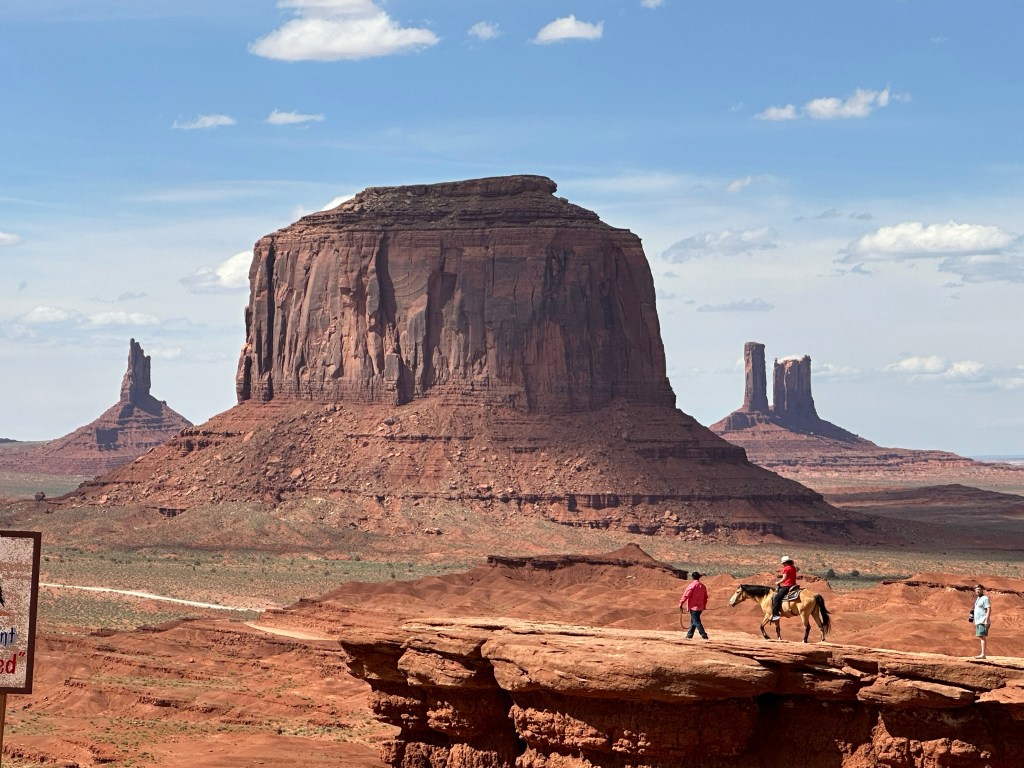
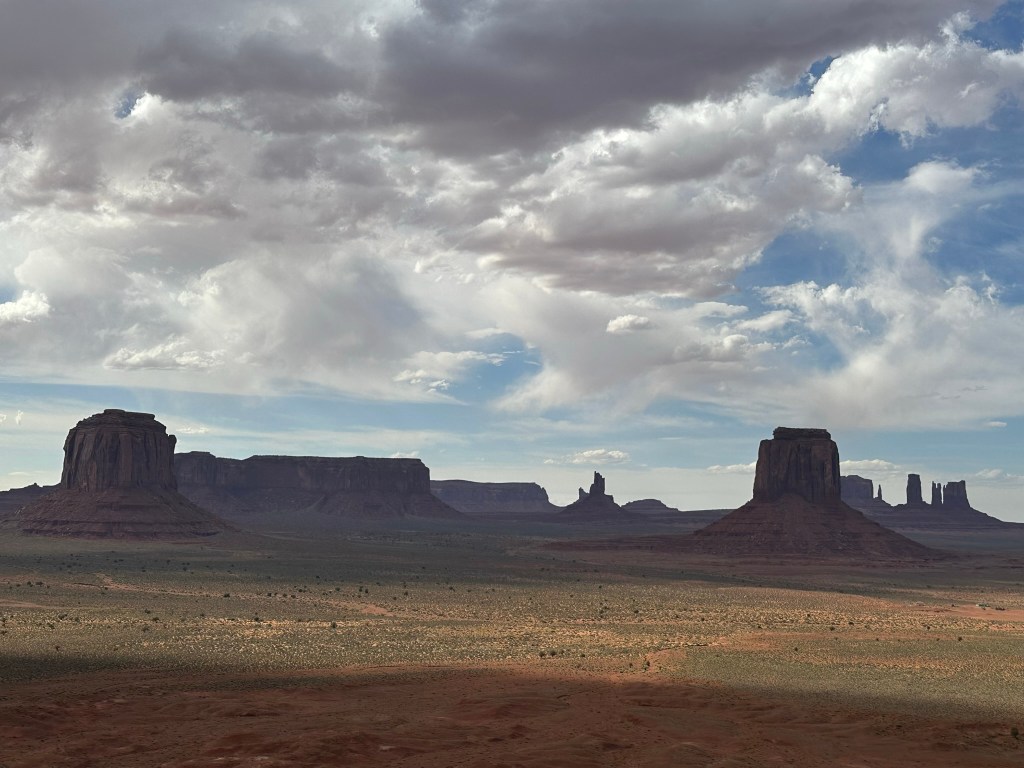
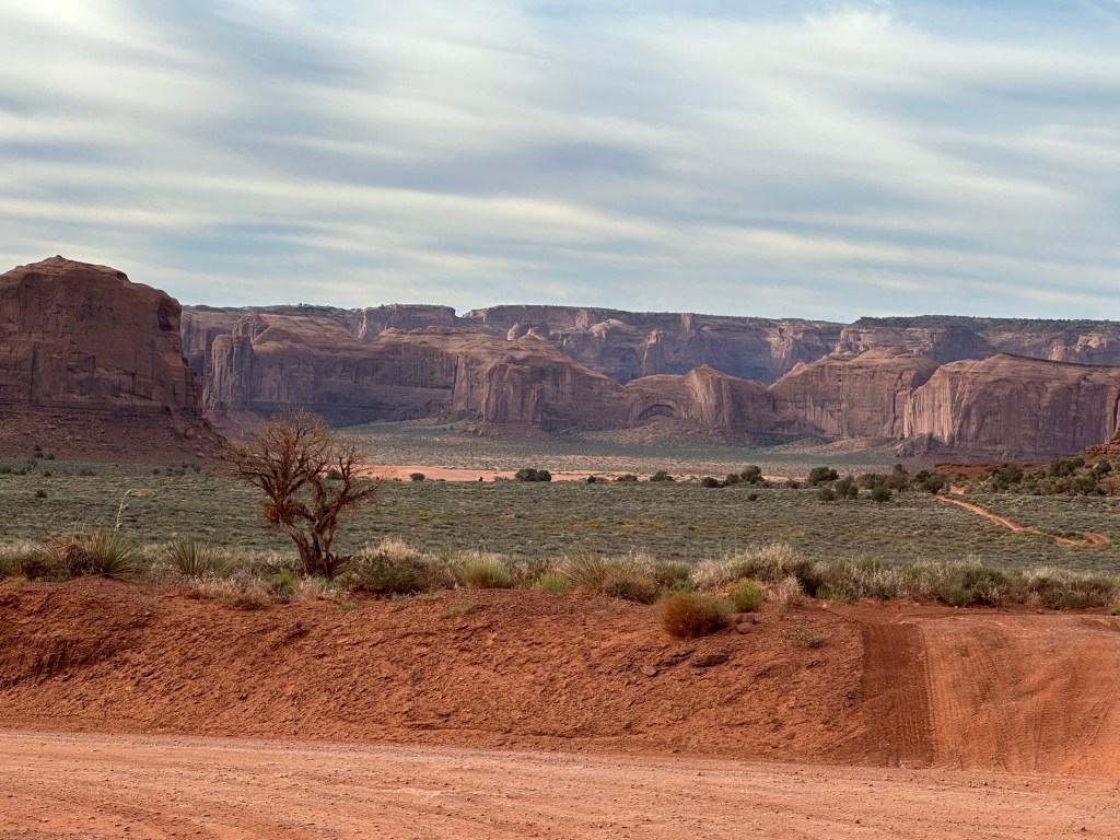
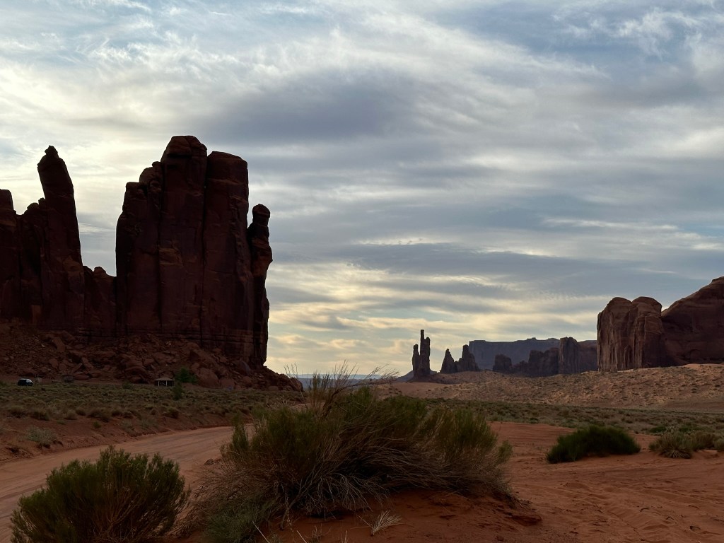
- The drive into Monument Valley was nice as you could start to see the rock formations on the side of the road to give us a taste of what was to come.
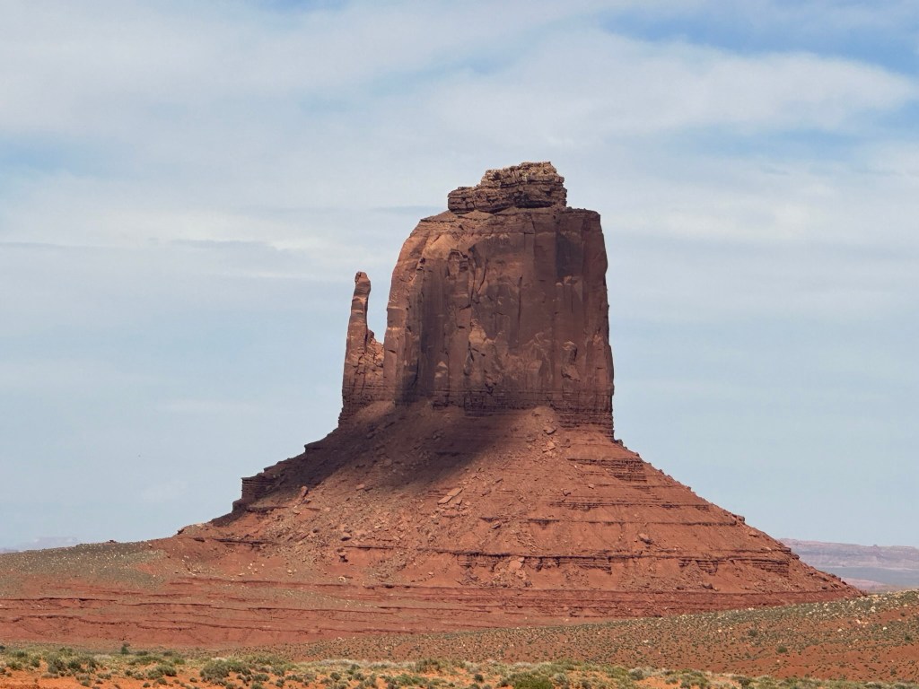
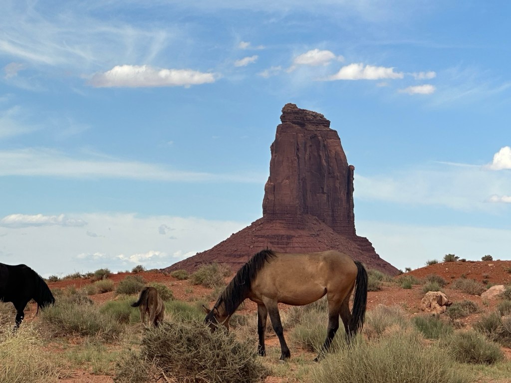
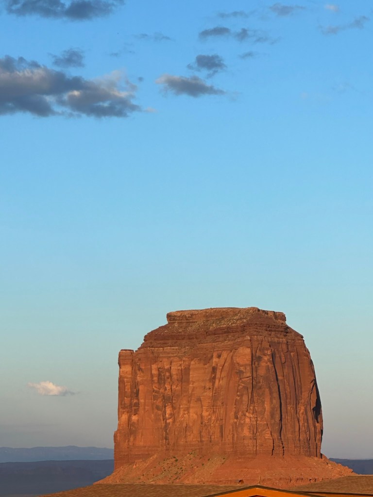
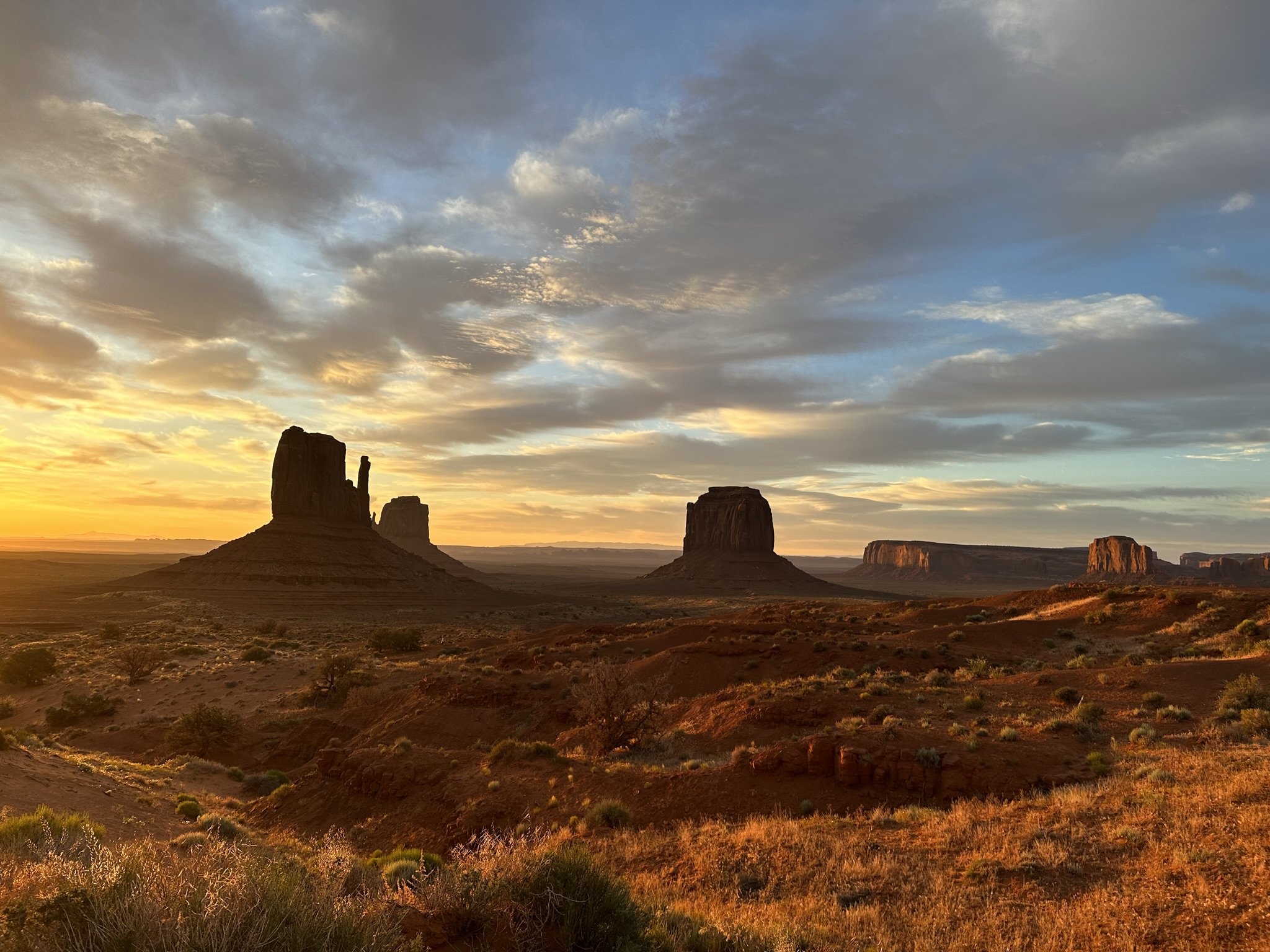
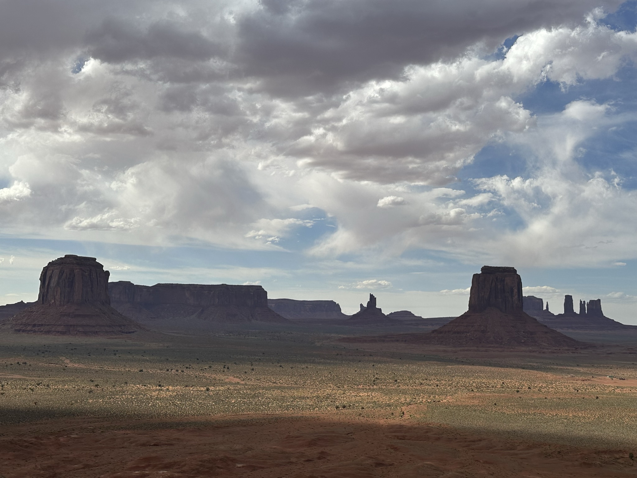
- Arriving in Monument Valley we checked into our room with a great view.

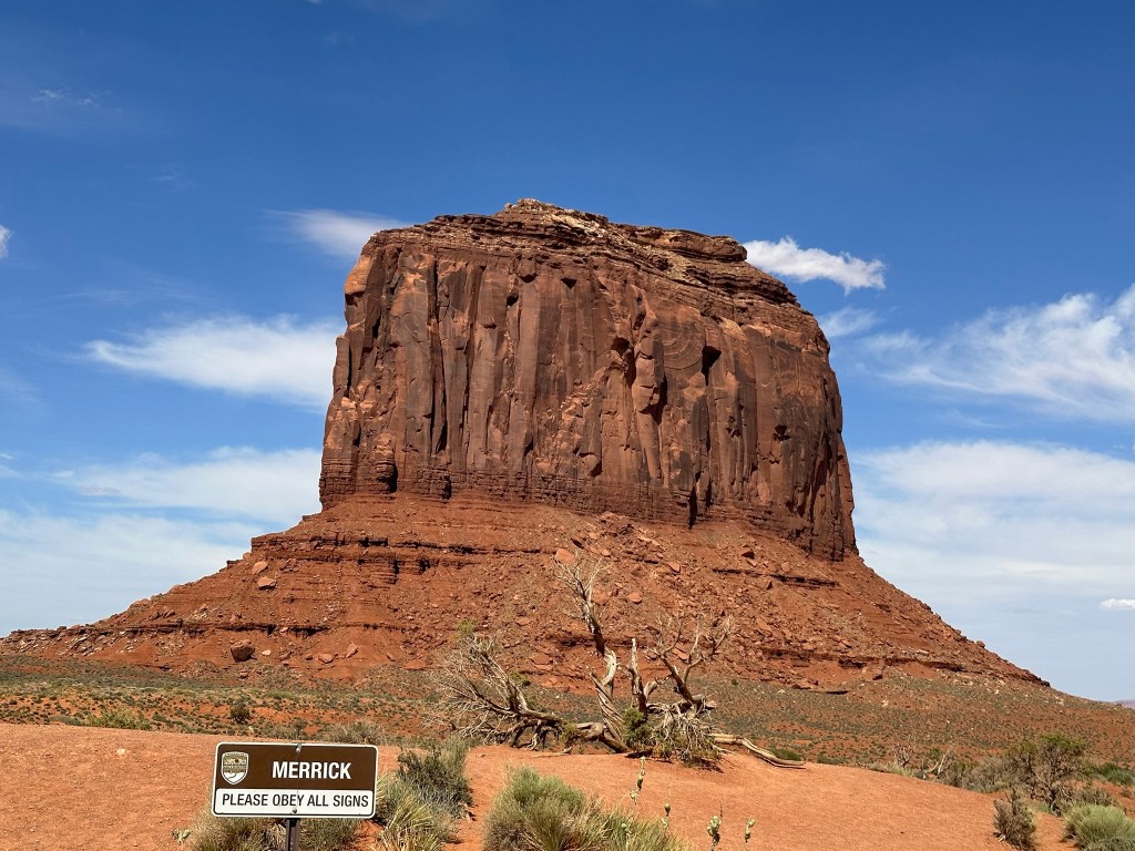
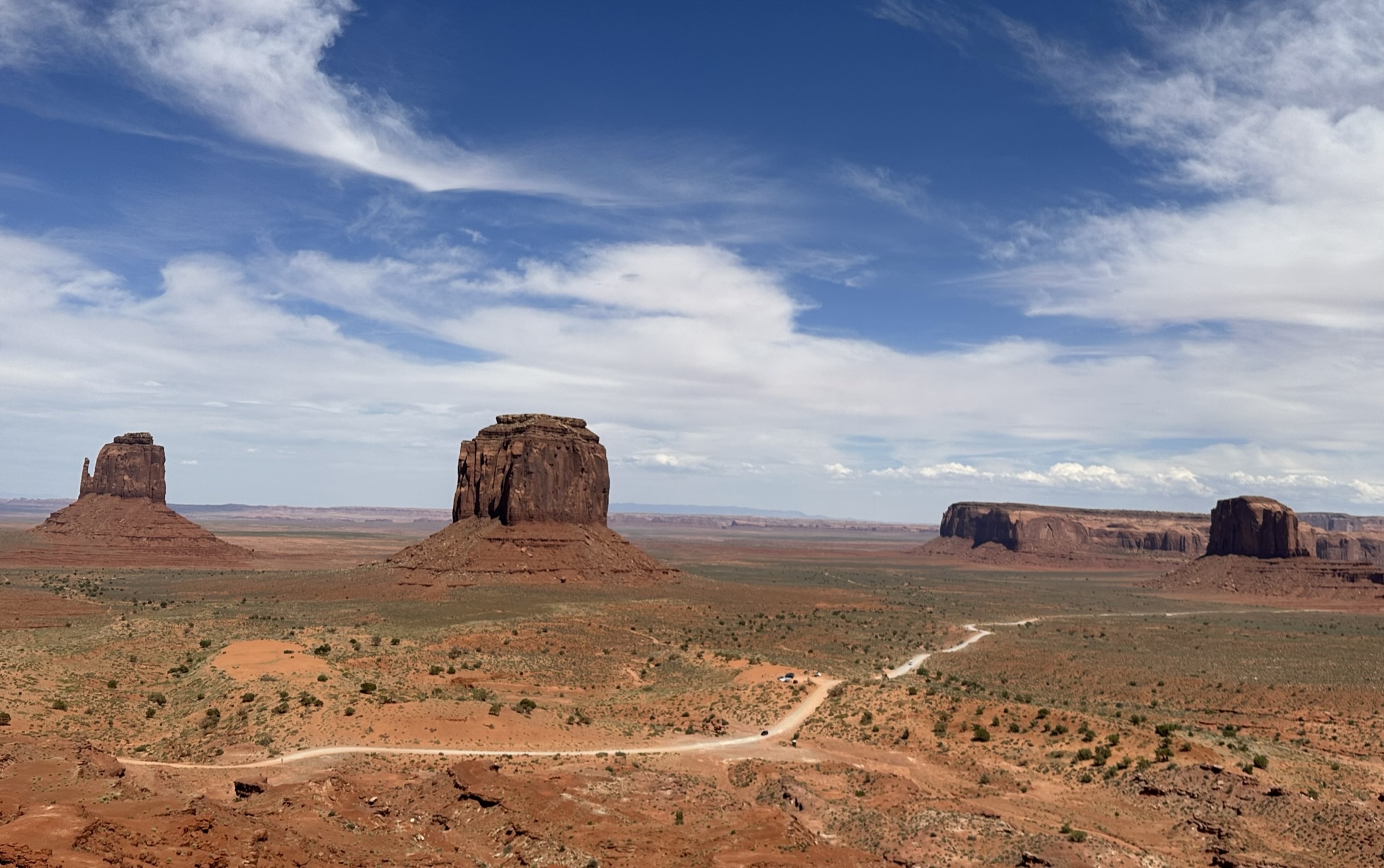
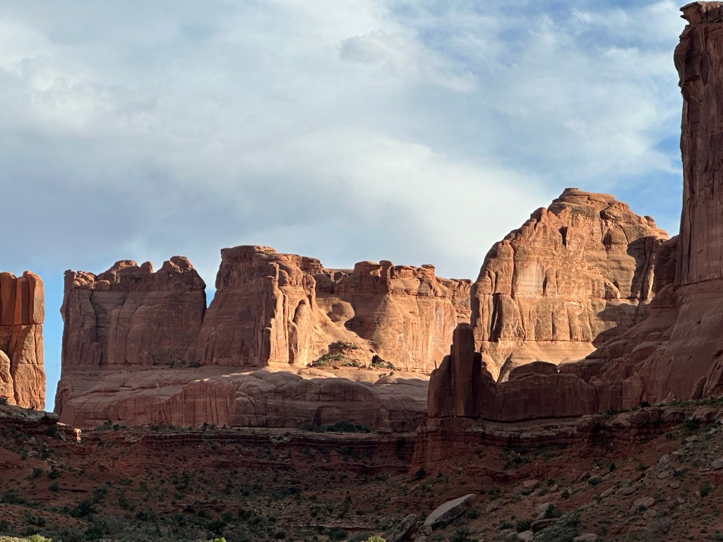
- We were so excited about the view that we went ahead and did the Monument Valley Scenic Drive through the Valley. The drive is about 15 miles long and it’s mainly a loop dirt road that is rough so you won’t be going very fast. We started around 4pm on the drive.
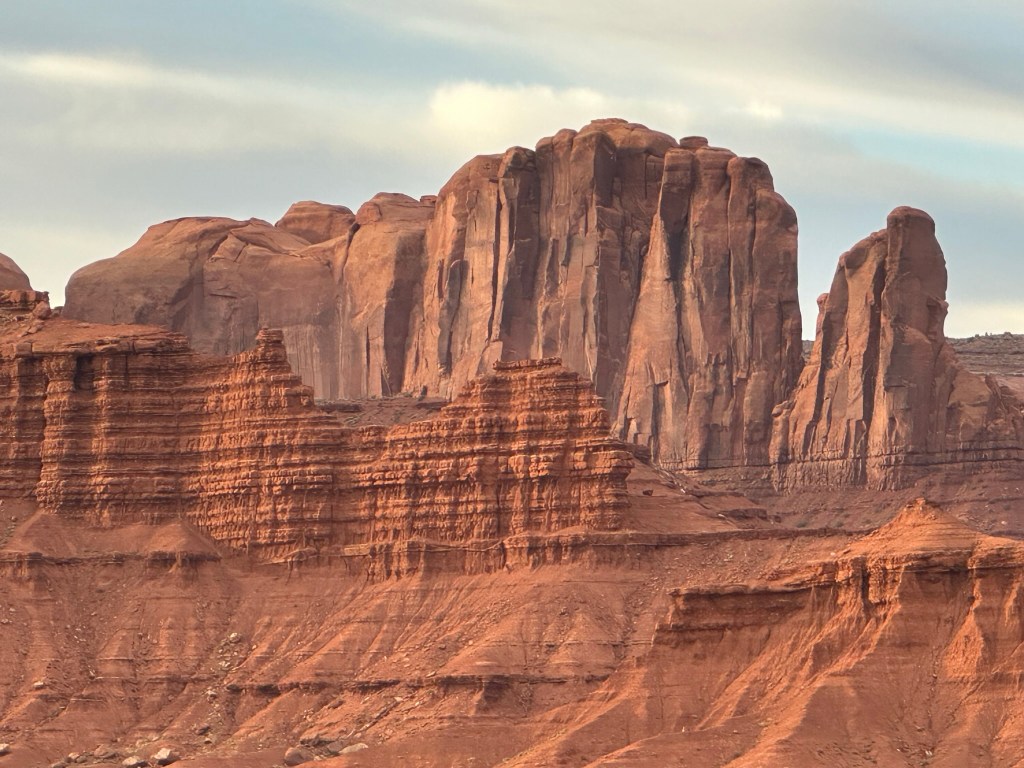
- It was getting late in the day so the light wasn’t very cooperative with taking good pictures however we did the best we could and I’m pretty happy with it overall. There are several stops to take (about 15 if you hit them all). No worries.. I took pictures of EVERYTHING! lol. You could really tell when the “light was right”.


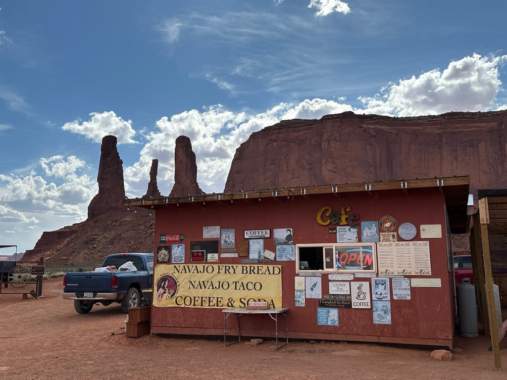
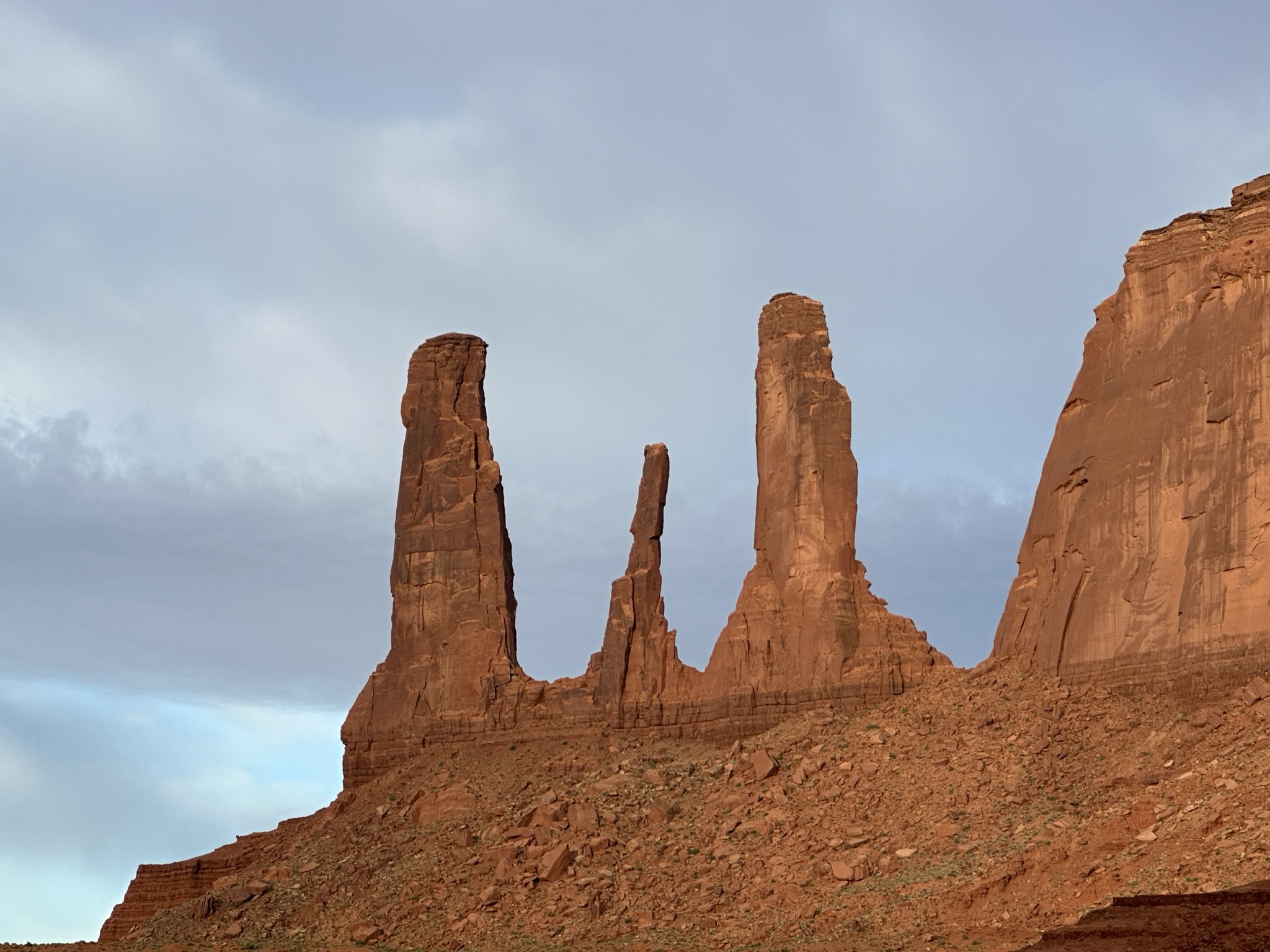
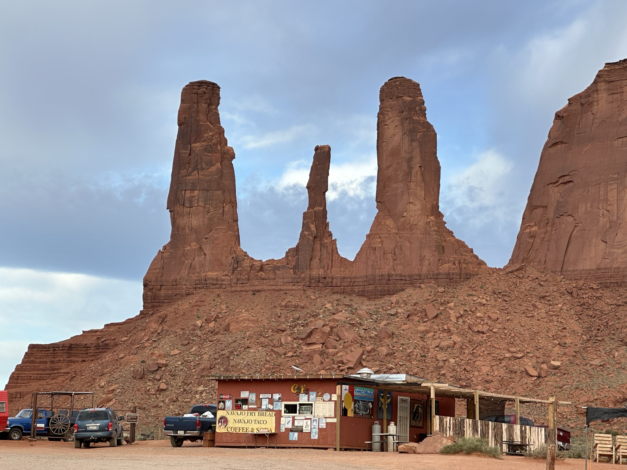
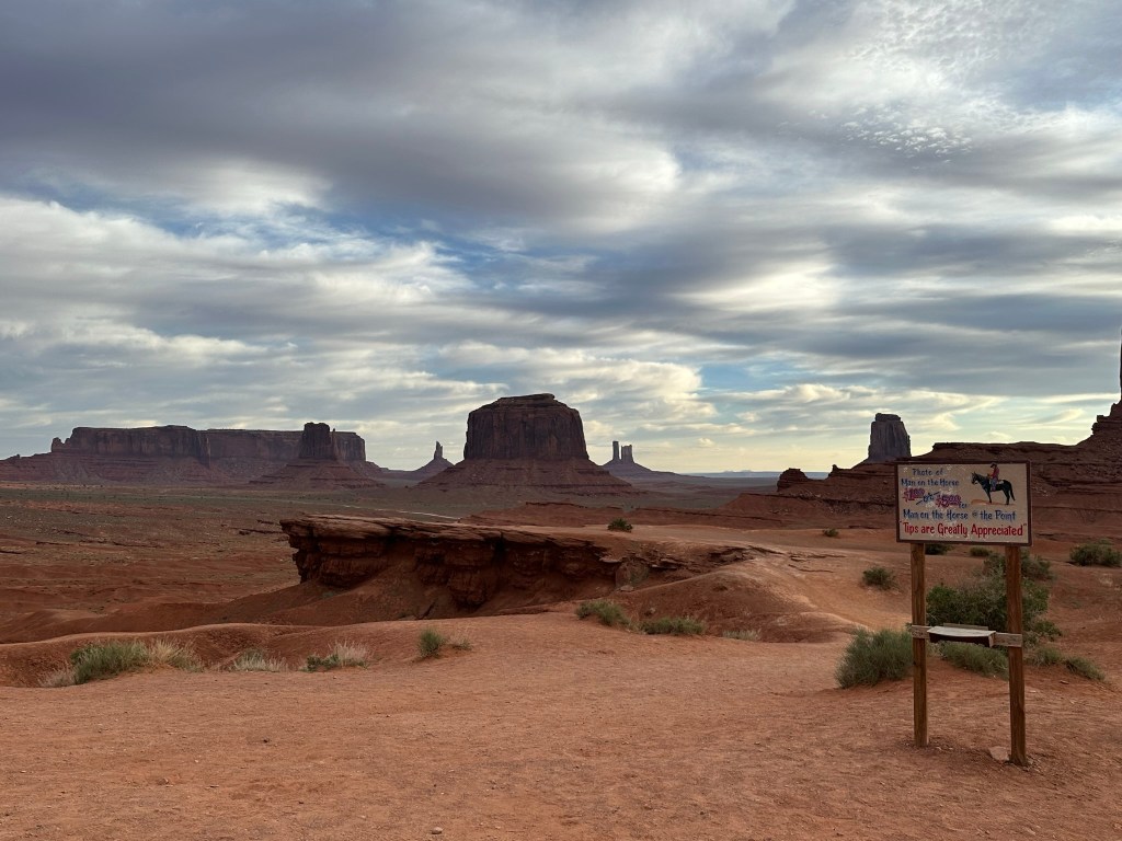
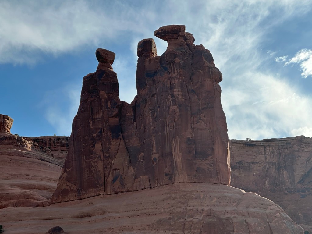
- Pro tip: We did a quick stop off in the Valley to get some dinner for the evening at Linda’s Café which is right by John Ford Point. The food was solid (Navajo burger and green chili taco) but the fried bread was great! We had her put garlic salt and butter on it and we gobbled it up pretty quickly. Much more reasonably priced than the restaurant at the Visitor Center and it’s the same food selection and you cannot beat the view! What a place to sit and eat your food with Three Sisters and John Ford Point being right behind and beside you! Having said that Three Sisters was really hard to get a good shot of in the evening light.

- I included a couple of pictures of John Ford Point to give you an idea of how the perspective changes when you move even a few yards. By the way John Ford was the famous director who put Monument Valley on the map. More about him and John Wayne later at Goulding’s. Make sure to pay the Man on the Horse!


- No pictures of Bird Spring and Sand Spring as it mainly seemed to be red sand dunes.

- Next stop was Code Talker Point. This is a tribute to all the Navajo Code Talkers that were involved in the efforts to deliver secret messages during World War I and II. The parking area is really, really rough here so if you don’t have an SUV I’d say to just park close to the entrance and walk to the point. It’s only about a minute walk so not like it’ll take to long and the views are well worth it.

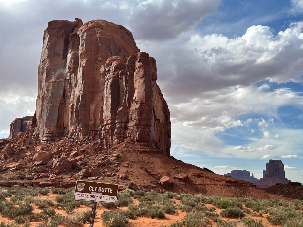
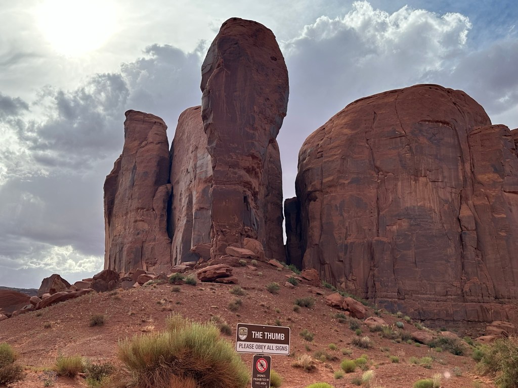
- The Thumb and North Window are right beside each other so it’s a bonus stop! I couldn’t get a good picture of The Thumb no matter how I tried due to the light. The North Window is a nice viewpoint that just gives you the impression of looking through a window. Kinda like The Window Trail at Big Bend National Park.

- North Window is the last stop on the scenic drive so we headed on back (slowly) to the cabin but did get a bonus picture on our way back! It’s about 5:45pm so we took about an hour and forty-five minutes to do the drive.
- Back at the cabin we stopped to take some deep breaths to relax and figure out more of what to do the next day. Mainly though we just kicked back and enjoyed the view.


Day 13: 06/11/23 (Sunday)
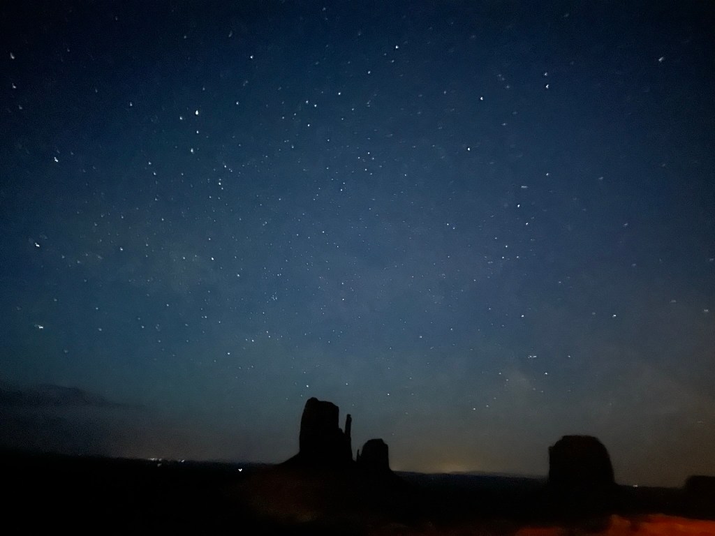
- Good nights sleep overall even though it was a short night. Enjoyed seeing the stars last night. Today is a busy day as we head on to Moab for the next couple of days.
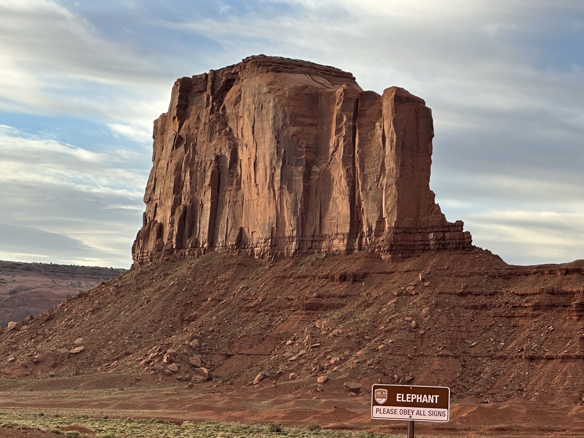
- Let’s go ahead and address the elephant in the room. Monument Valley is in Arizona yet this post is about Utah; well…. Monument Valley is only about a mile across the Utah border into AZ so I’m calling it Utah in this post to keep the time continuum in synch for purposes of this post.
- Lisa beat me up and was sitting on the couch in the cabin when I got up and she had already taken some sunrise pics from cabin before sunrise. You know, when that pre dawn glow is starting to happen and the first light of the day is starting to wake the world up. Today that was about 5:30ish am. I took my pictures just so I wasn’t showed up to badly.


- The park opens at 6am so we took advantage of being right there to drive the scenic trail early and start our morning drive through Monument Valley.
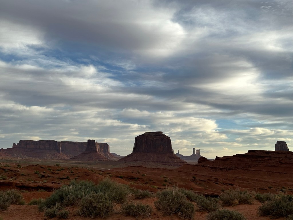
- Some of the Monuments seemed to glow in the morning light. So glad we did this drive again in the morning light. It made all the difference in the world on some of the formations. I’ll post the ones that had the most dramatic difference so you can see for yourself. Based off this I’d really say to stay the night so you can see them in the evening and then again first thing in the morning.
- Just so you get a true “picture”.. Ha!! Pun intended of how different the valley can look in the morning vs the evening I’ll put a few shots side by side so you can see the difference along with the time I took them. The pictures aren’t exactly the same frame but they are taken from approximately the same spot; same iPhone, etc. The only difference is the time. As you’ll see some are clearly better in the morning while some are much better in the afternoon/evening. Make sure you use the slider button in the middle of the two pictures to cover/uncover the photos to their full extent.


- Don’t forget to look to the south (behind you)
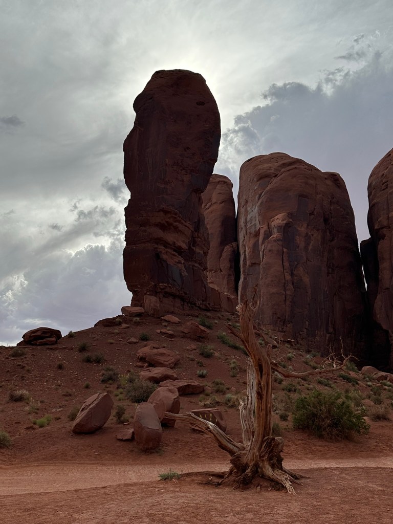
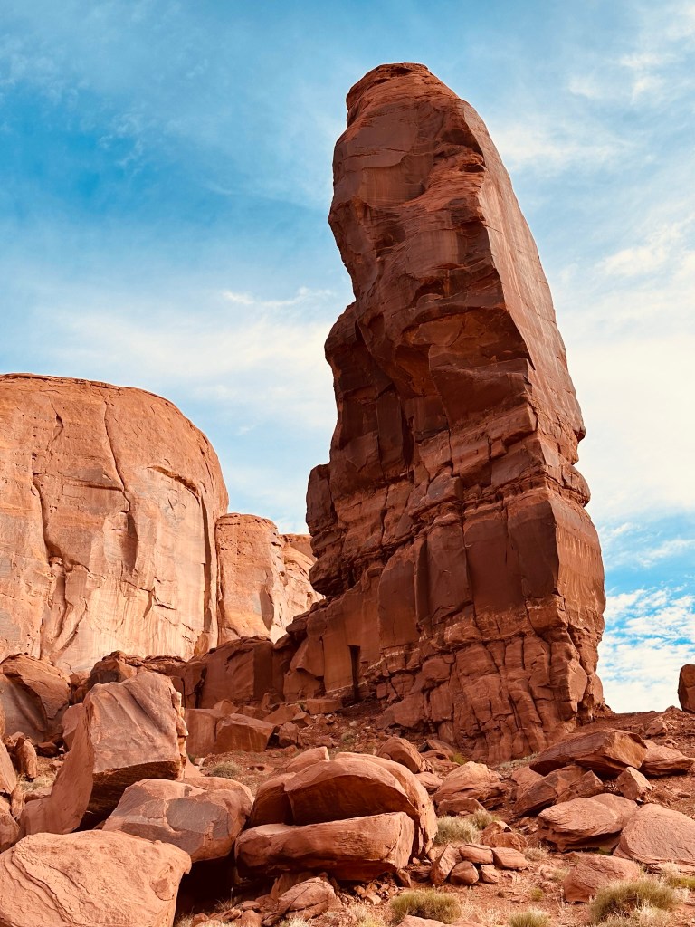
- Driving onward we took a picture of The Thumb from the opposite side. We saw a big toe, a backwards thumb, and a face in it.
- Once you get past The Thumb the one way part of the road drops out back at the horse corral and junction to get to Linda’s and John Ford Point. We drove on up that way to get one last view of the Three Sisters. What do you think? I think it’s one of the best pictures we took that really “feels” like Monument Valley to me.

- Driving back from John Ford Point we ran into some oncoming traffic that I thought was another great memory of Monument Valley. He pulled over so we just snapped a picture as we were driving by. I loved the hay bale on the hood of the car.

- Back to The View for a quick Continental breakfast. Plain Jane continental breakfast however the view from the dining room was fantastic! Then it was back to the cabin to finish packing up.
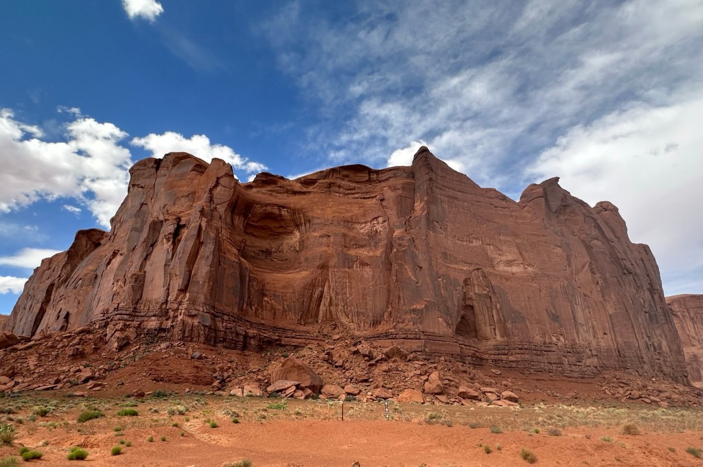
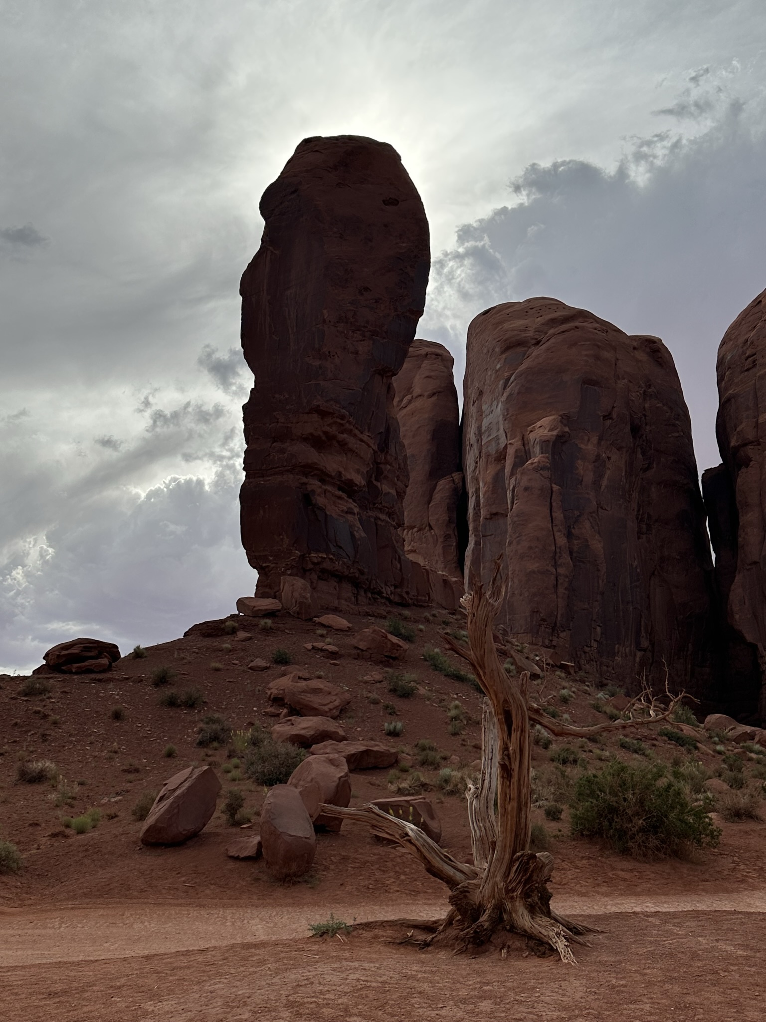
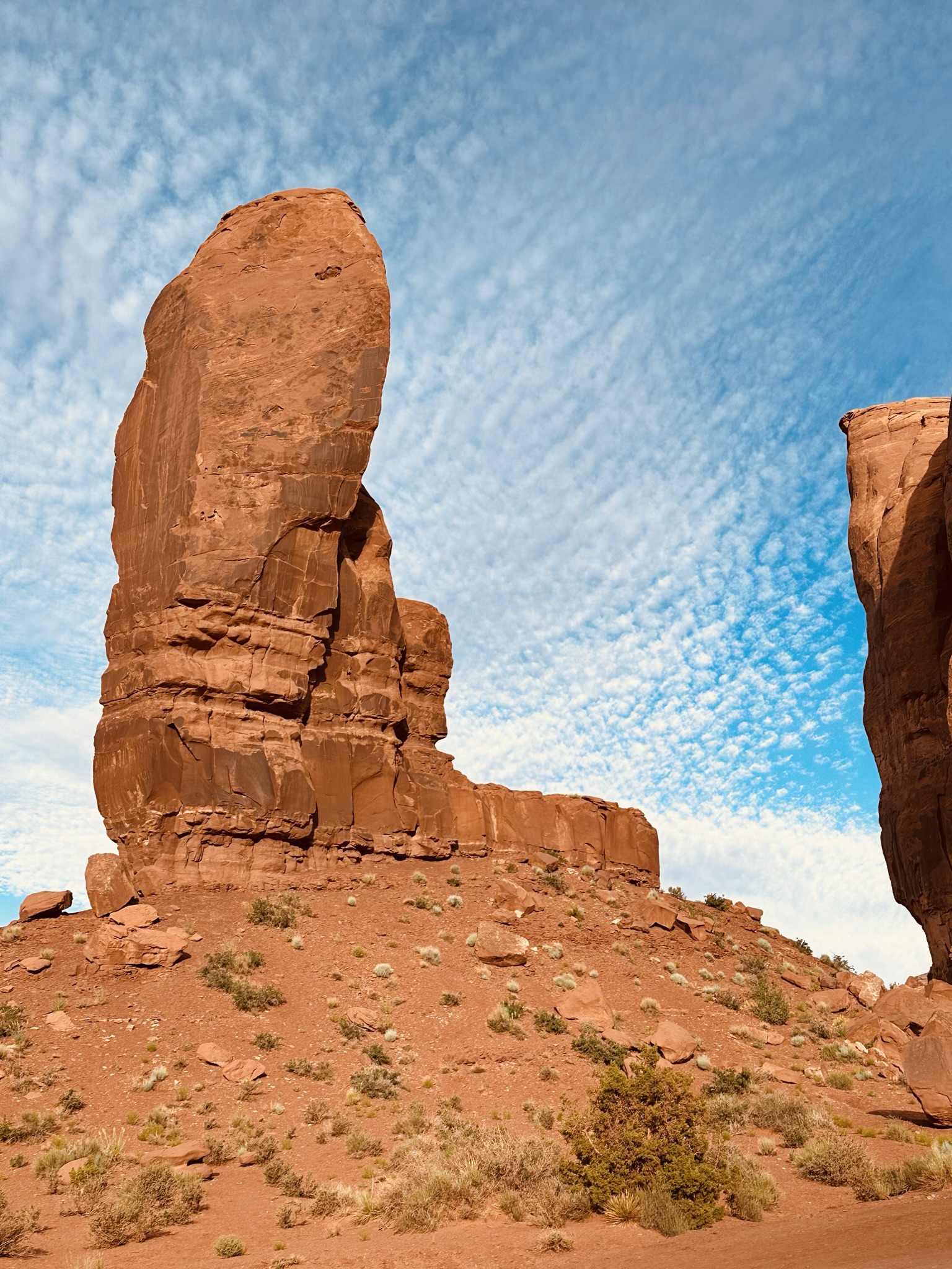
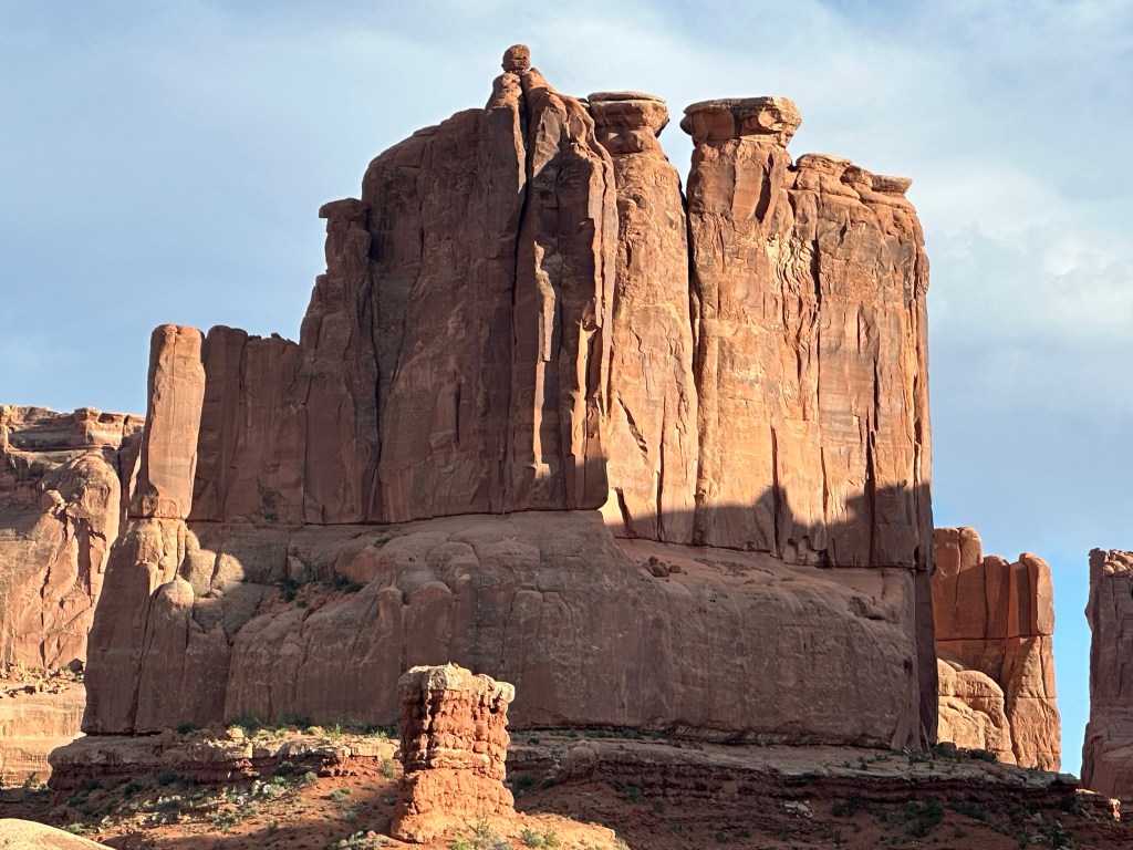
- We were headed to Moab for the night with many a stop in between as you’ll be able to tell from how long the Utah post is getting however every mile and stop was worth it! I thought about breaking this post into a couple of separate ones however I wanted all of Utah to be in one spot so I made the executive decision to keep it all together. Also, here’s a good a spot as any for this. There was sooooo many pictures we ended up taking here and some I didn’t think were good enough to be in the main pics however they were beautiful so I did a photo drop in the gallery below for you to peruse. I also included a map of the scenic drive that we took with all the different points marked so the drive would make a little better sense to you. Monument Valley is huge (91,696 acres) however you can only access a very small portion of it on the loop. Enjoy!!!


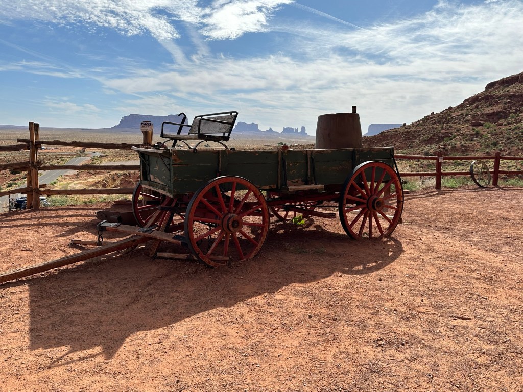
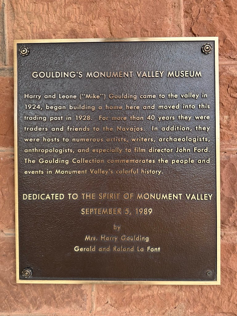
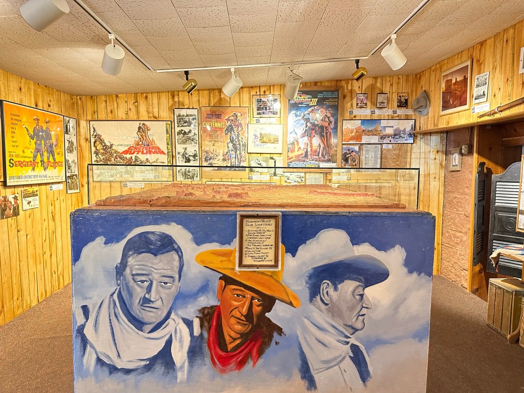
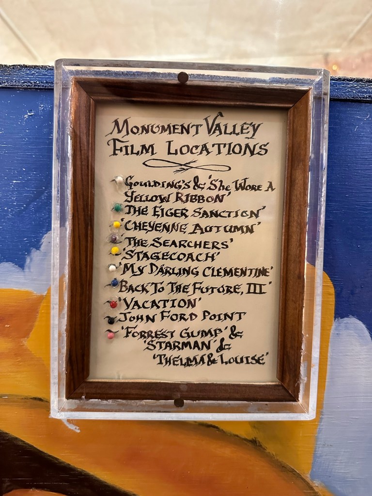
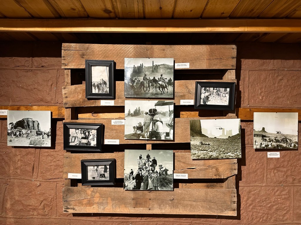
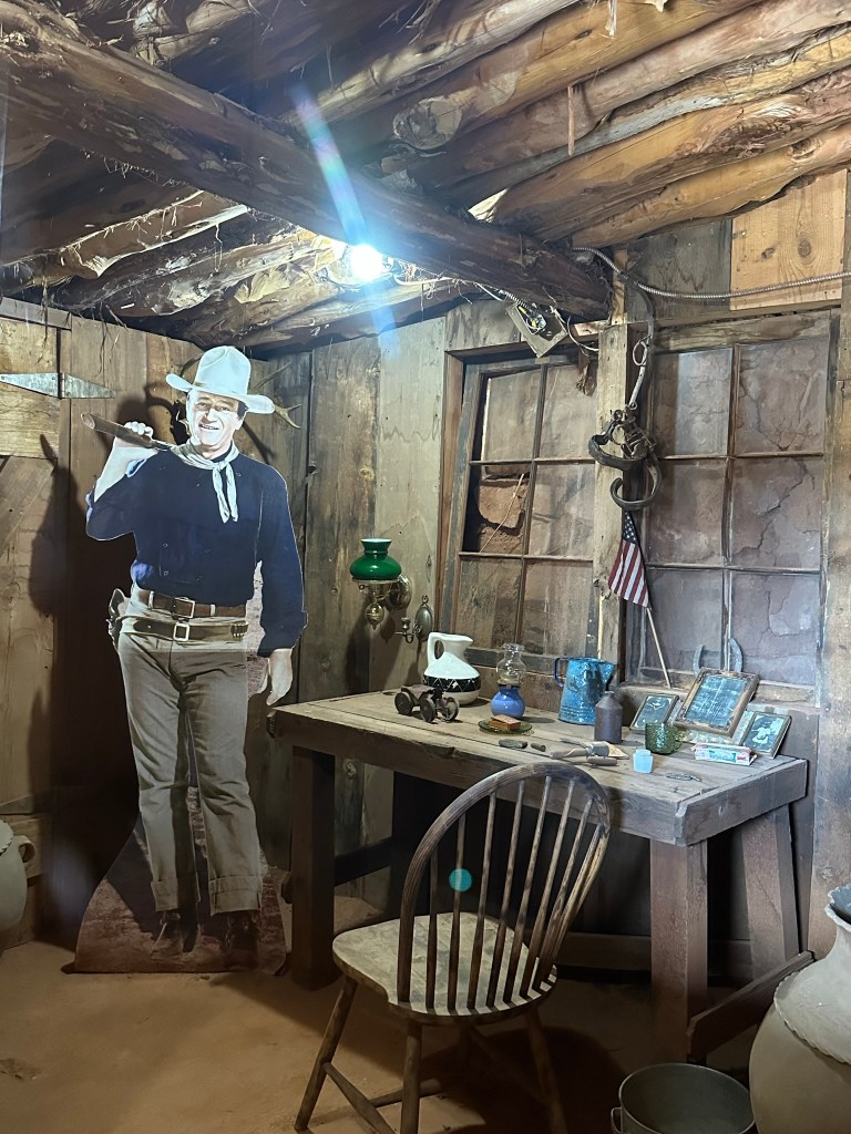
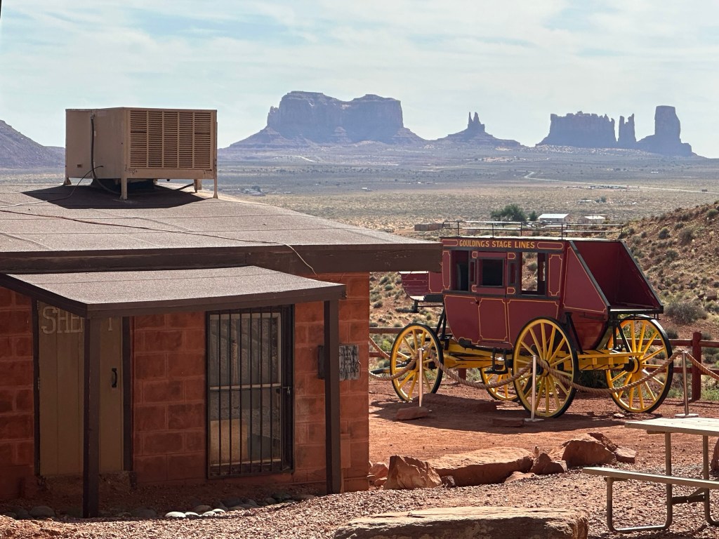
- Goulding’s Museum Stagecoach was our first stop and we got there about 9:20am. It’s about 4 miles away just outside entrance to the park. Goulding’s is a great spot to visit. The Stagecoach Museum was very cool and there is a lot of John Wayne history there, so now I have to watch, “She Wore a Yellow Ribbon” as well as John Ford’s Calvary Trilogy. Several other movies were filmed in Monument Valley and they have a tribute to those also. Fun fact; they weren’t all westerns either. Ever hear of Back to the Future? Yep, part of that was filmed here! They also have a lodge and campground. I think next time if I can stay a couple days I’d do the Rim Cabin in the park like I did this time however if nothing was available or only a one day stay I’d try staying at Goulding’s. The view of the Valley is spectacular! Here are some pictures from around and inside the museum. Lot’s of it is dedicated to the movies because the movie industry revived the area economically plus who doesn’t love the Duke?!


- We drove by but didn’t stop because of the sheer number of people that were at Mile Marker 13. For you non Forrest Gump fans that was where Forrest was tired of running and uttered his famous words, “I’m pretty tired… think I’ll go home now”.
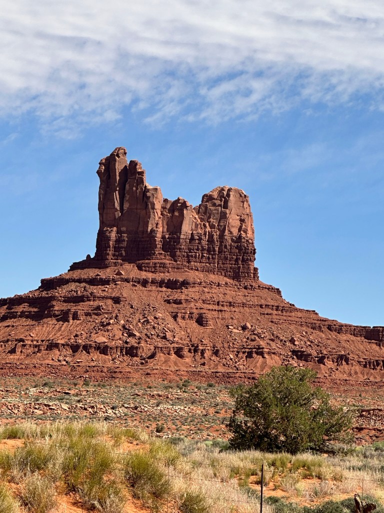
- The scenery continues to be beautiful as we drive through Mexican Hat (the town) and drive on to Mexican Hat Rock which is just outside of Mexican Hat about 3 or 4 miles. Took a quick few pictures of me holding up the Hat and back on our way.


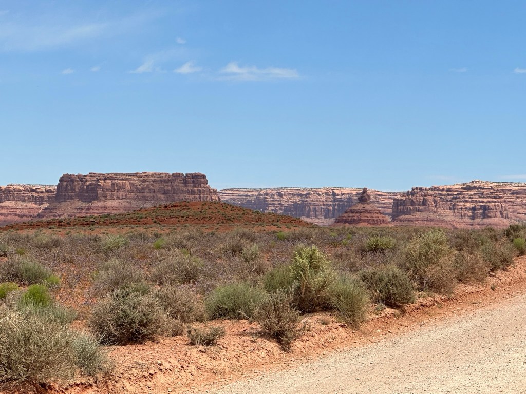
- Next stop up the road was Gooseneck State Park. Gooseneck has a great view and admission was only $5 dollars. Pretty cheap for the view. Couple of pictures but they really don’t do much justice. The video is by FAR much better.


- What a windy, interesting look this place has. There really isn’t anything else around here to do except look at this formation. The RV camping is all wild and just parking on the very rough ground. Go slow if you drive around as it’s very bumpy!
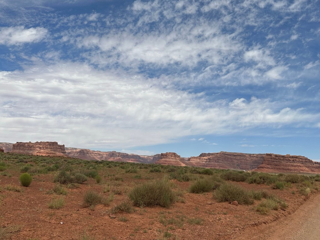
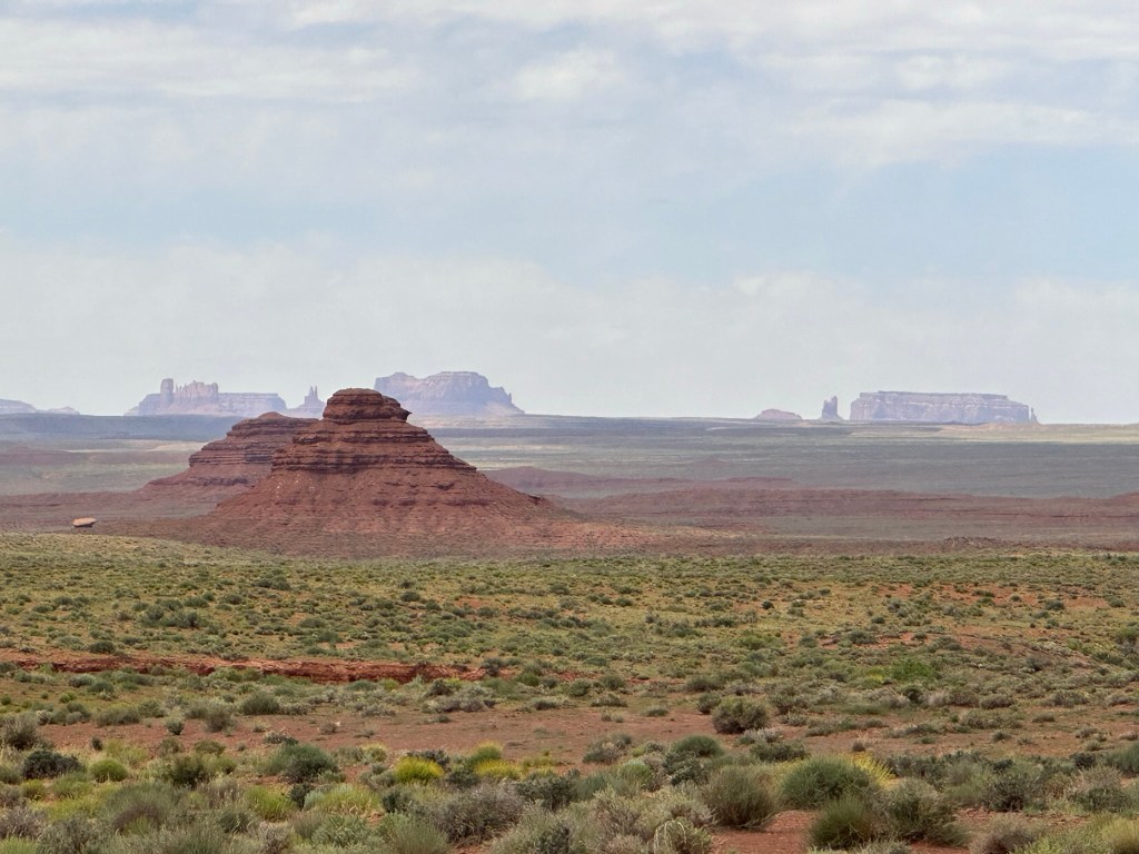
- Leaving Goosenecks we drove up the road to Valley of the Gods. This is a bumpy road that goes into the backcountry past some beautiful nature art. You have to see it and experience to believe it. We were just amazed at how much there was to see and how beautiful it was. Since it was BLM land you could boondock on it for free and several people were taking full advantage of the fact. I’m jealous! I really want to come back here and boondock / camp for a few days and enjoy the place. Again, be aware the road is bumpy so go slow and if there is a lot of rain don’t try it.


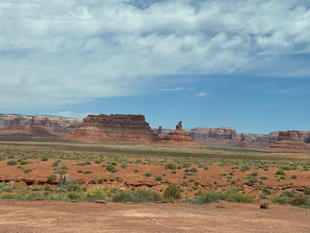
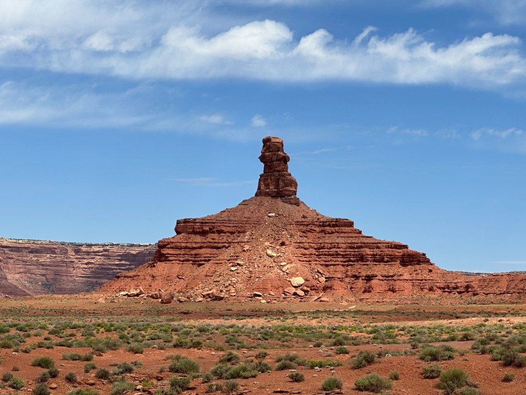


- Don’t drive to fast so you can appreciate the views. The roads to bumpy anyway. Lol.
- Look at the pictures below. I took the pictures about a minute apart at the exact same spot. You can see how the clouds and sun really affect how the look of the formations are constantly changing. Slow down and enjoy the show.


- If you didn’t like the photos try the short video I took. It really shows more of the depth and coloration of the rock formations. Yes, I really loved this place and we didn’t even drive the whole route. Next time, it’ll be different as I’ll be here a few days I think.
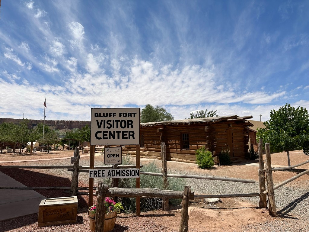
- With loads of regret that we couldn’t stay longer we moved on down the road to Bluff Fort. Again, the scenery on the drive is just amazing. Bluff Fort was established by Mormons back in 1888 is owned by a Mormon Foundation. It’s a beautiful place that is rich in history. The Hole in the Rock Expedition is an amazing story that speaks to just how touch people used to be and what you can accomplish when you have to. Just as an FYI Bluff Fort is not the original fort works. It is a recreation of the fort that has been done with historical accuracy.


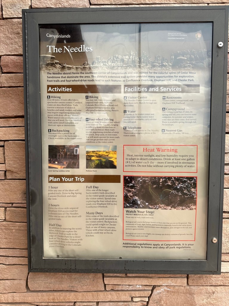
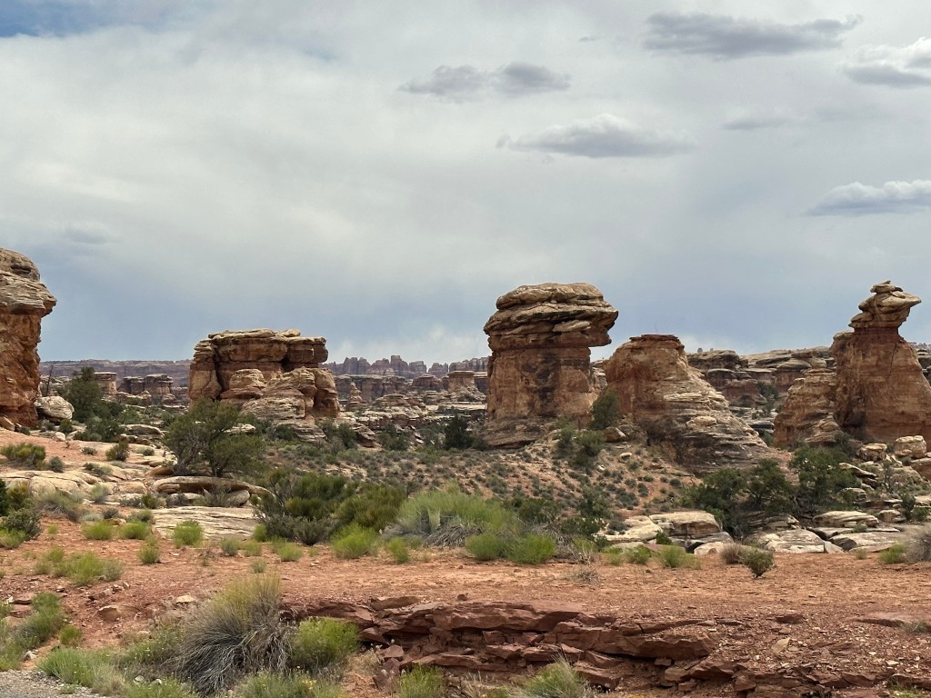
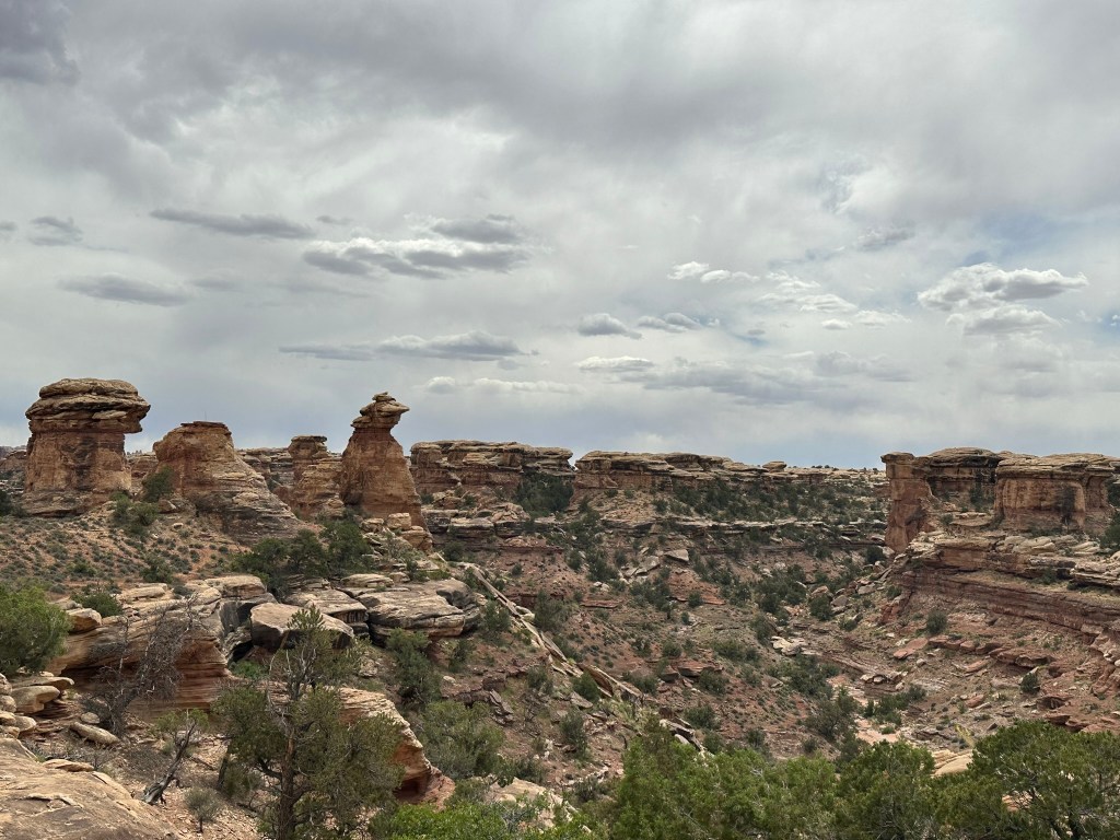
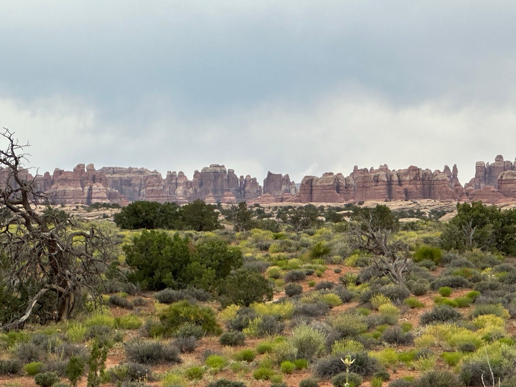
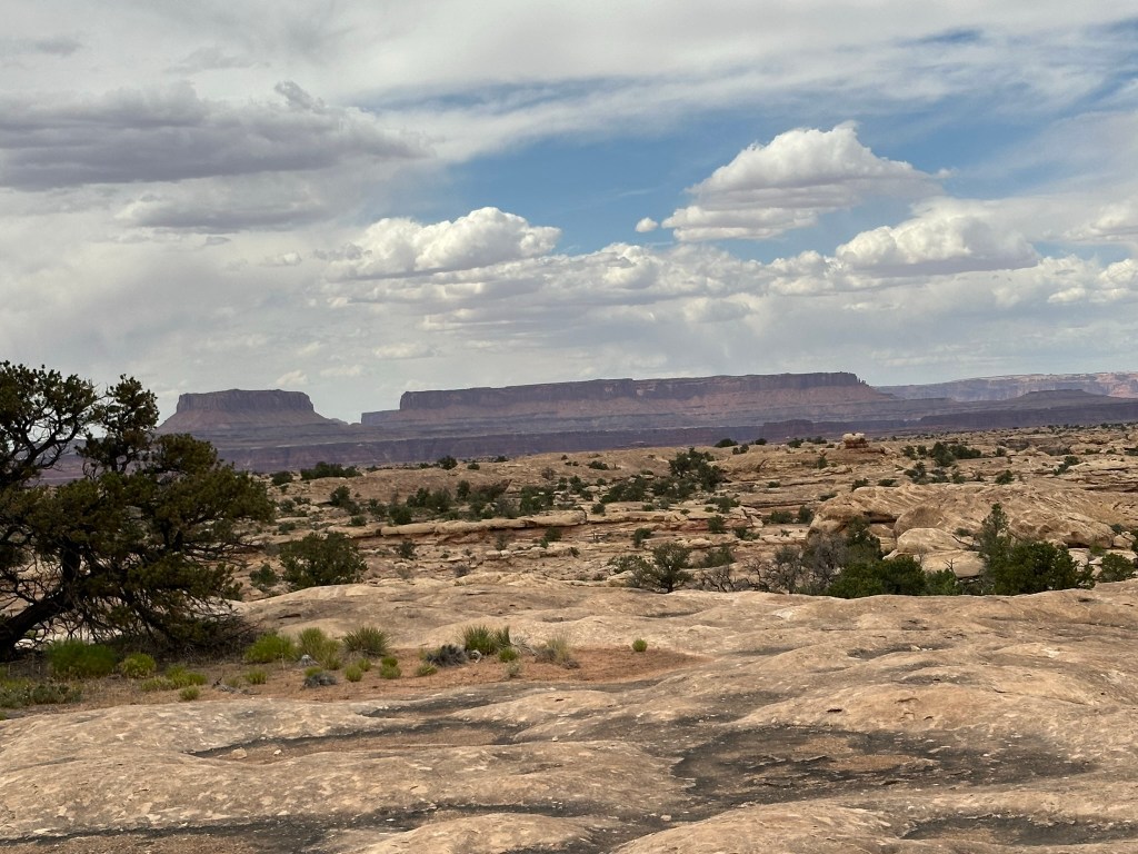
- Still enjoying the scenery we drove on out to Needles District Canyonlands. It’s about 23 miles off the main road on UT-211 but worth the trip. There is an alternate way you can go that has a 7000 plus feet ascent / descent but we didn’t take that one. The way we came in was scenic with some mountains and such but nothing like that.
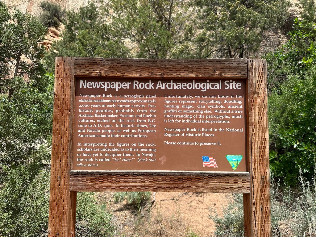
- One very interesting stop on the way in was Newspaper Rock. It’s a huge rock that has petroglyphs dating back from the B.C. times to A.D. 1300. Make sure you stop and see it. We still don’t know what he meaning is for sure or even been able to decipher some of them. It’s amazing to think of the communication that went on here and that it has survived so well for so long! It looks like there are some camping grounds here (Indian Creek Camping) however we didn’t see them. Make sure to click on the pictures to expand them so you can get a good look at them and the history. It’s pretty amazing that it’s survived so long out in the open. If you’re keeping track of the time it’s about 2:15pm right now so we’ve been moving pretty fast….to fast actually with more to go. Hard to appreciate things to the fullest when going through them this quickly.


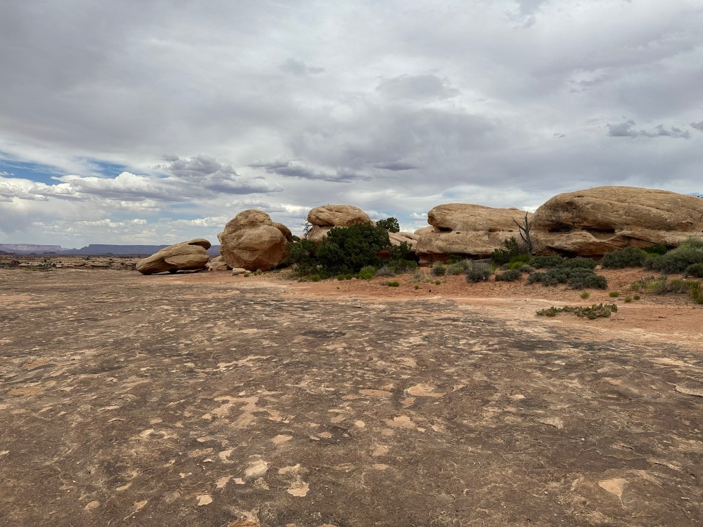
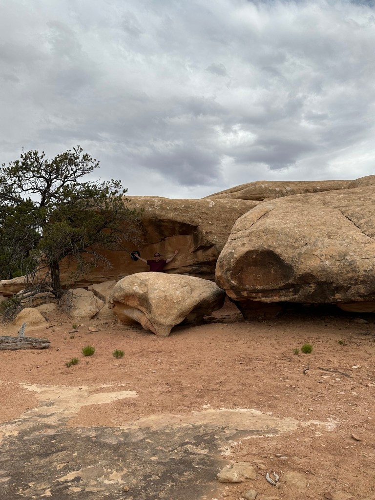
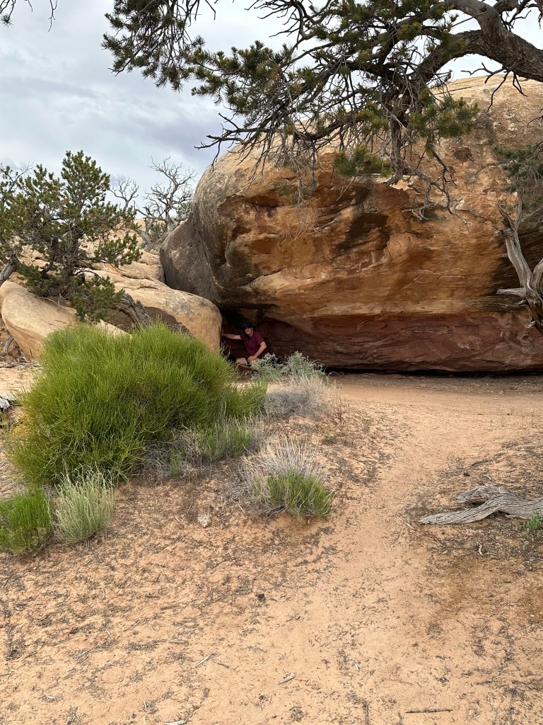
- Needles District Canyonlands is well worth the time to get there. The rock formations are absolutely crazy. The main drive through the park is only about 6 miles or so with a couple other branches but it’s worth it. Lot’s of hiking and cool stuff to look at. Next time I go there instead of the couple hours we spent I’d make sure and camp there for a couple days. No accommodations are onsite (except campground) so come prepared.


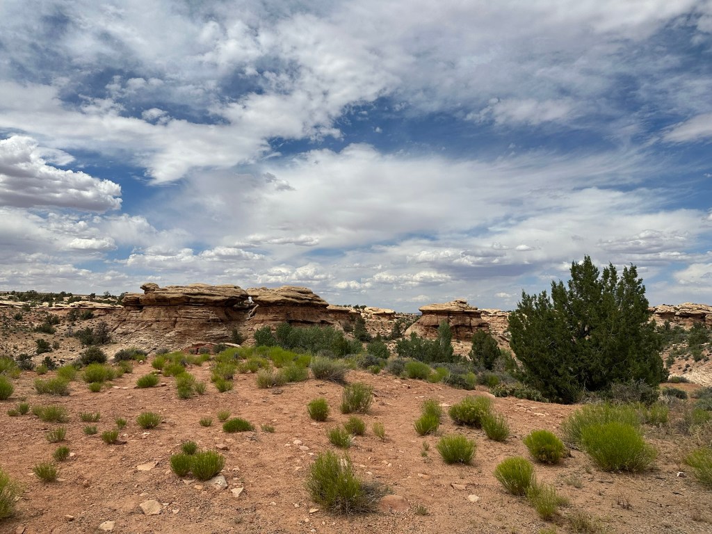


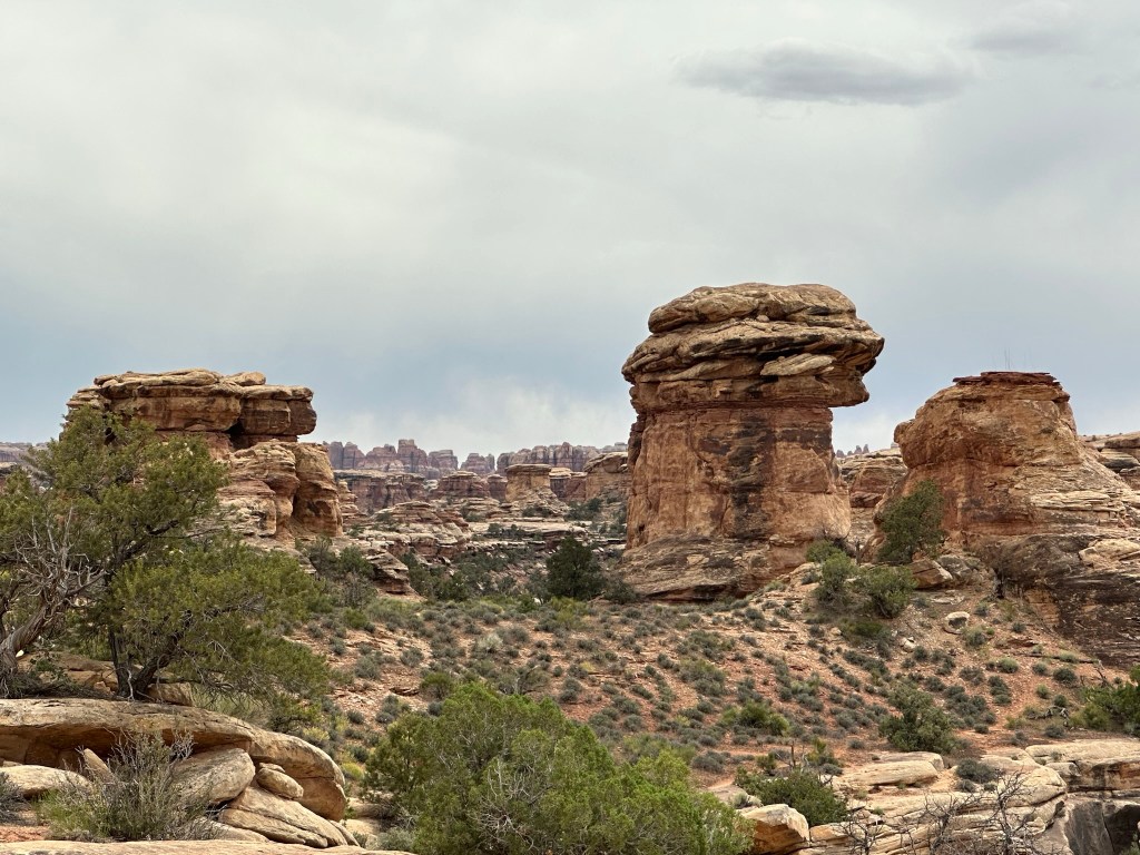


- We did take time to do a quick hike on Pothole Point Trail. The trail is called this because of all the depressions in the rock along the trail. When it rains water fills them up and eggs hatch or dormant critters emerge. Wet or dry don’t walk on them as it will disrupt the fragile ecosystem. I put the hike pictures below so you can see how it all changes as you walk around the loop trail. It’s a very stunning walk filled with many different types of views of the ever changing landscape. It’s pretty captivating. As a bonus you can also see the Needles from this hike and if you’re lucky some beautiful cactus blooming at the very beginning (or end depending how you look at it) of the trail.


- Leaving Needles we drove by House in the Wall and Wilson Arch to get to our hotel for the next couple days. It was an easy check in at the Fairfield in Moab with a great room and an even better view. Storing our gear we drove out to Sultan Mediterranean Grill.

- Sultan’s was only a couple miles away from the hotel and the service and food was excellent! We got a Gyro Platter and Sultan Kebab with Baklava for desert. No pictures however the portions were huge and the taste was outstanding as was the service. I’d easily eat here again and enjoy every bite.
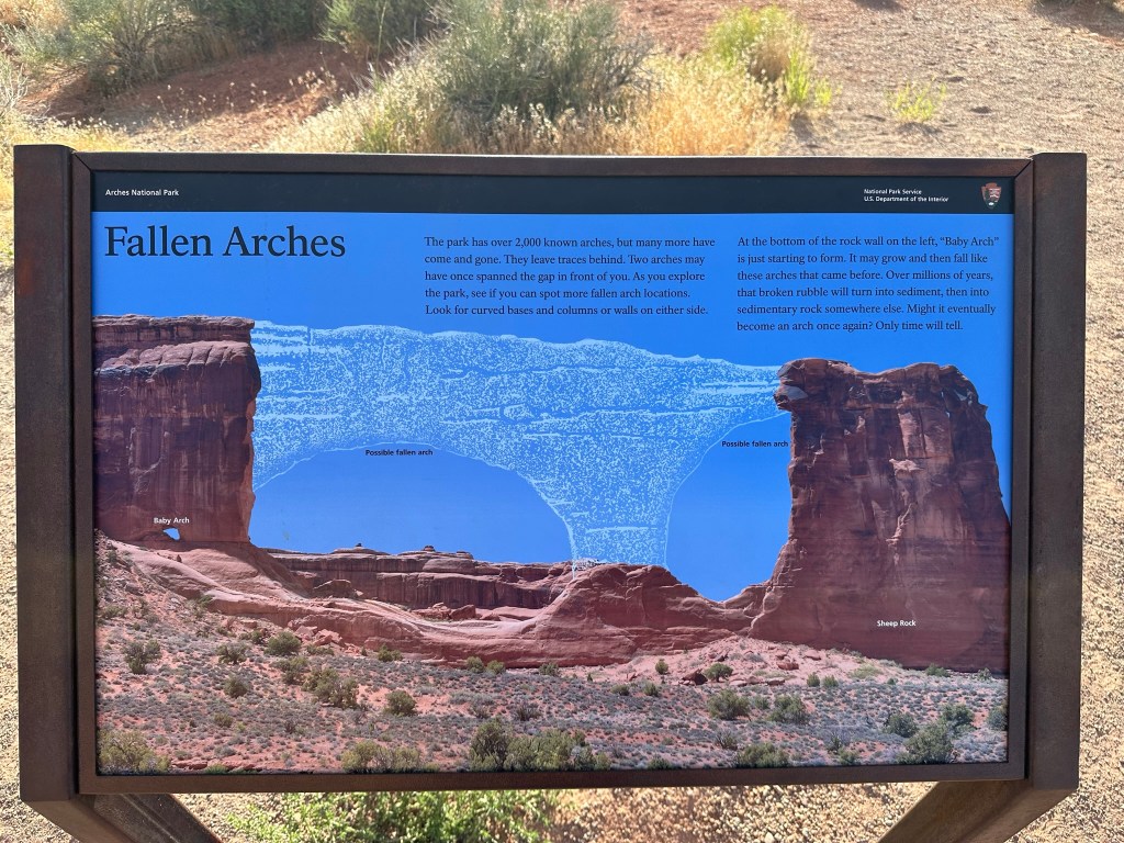
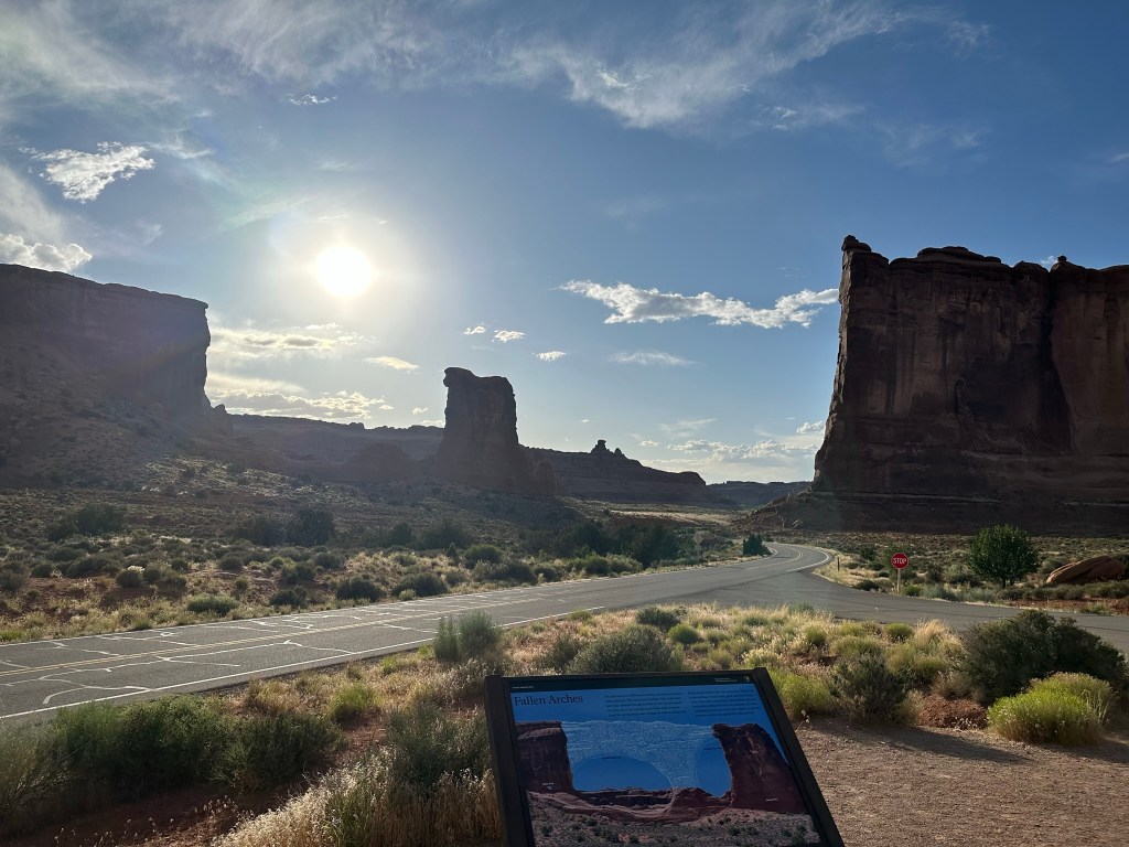
- Refreshed from eating we drove on out to Arches National Park to do a drive through and a short hike. Probably about 7pm by now so some of the light was good and some was not. Regardless we had a great time and the views were wonderful as always. Bonus for us was there wasn’t a lot of people in the park at that time and most of them that were there were busy hiking to Delicate Arch or some other hike. Just weren’t many people driving around. We didn’t really take many pictures since the light wasn’t cooperating very well. If you want to see extensive pictures of Arches see my blog post “Western Ho” from 2022 when Olivia and I went there. Lots of pictures and trail information there and frankly no need to duplicate here. Just because I love Arches though I’ll stick a couple in here.


- Pet peeve alert. So what the heck is it with people and drones in National Parks. It’s freaking illegal people. Yet again, trying to enjoy nature and some rando guy is flying a drone around. Come on people….you’re better than that!
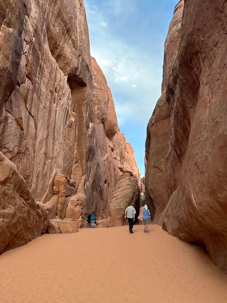
- We snuck in a quick hike at Sand Dune Arch Trail simply because it’s one of my favorite trails in the park. Easy to do, right off the road, and beautiful!


- So you’re not to disappointed here is one more arch picture taken from afar at 8:23pm.

- About 8:45 pm we both decided that we were pretty tired and needed to get back to the hotel for a quick shower and get to bed so we’d be fresh for our day tomorrow. It’s a good one!!!
Day 14: 06/12/23 (Monday)
- Pretty restful nights sleep and ready for the day.
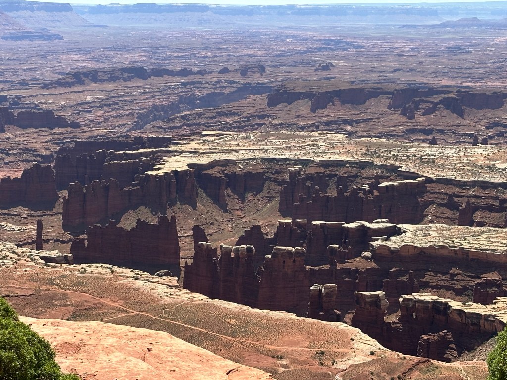
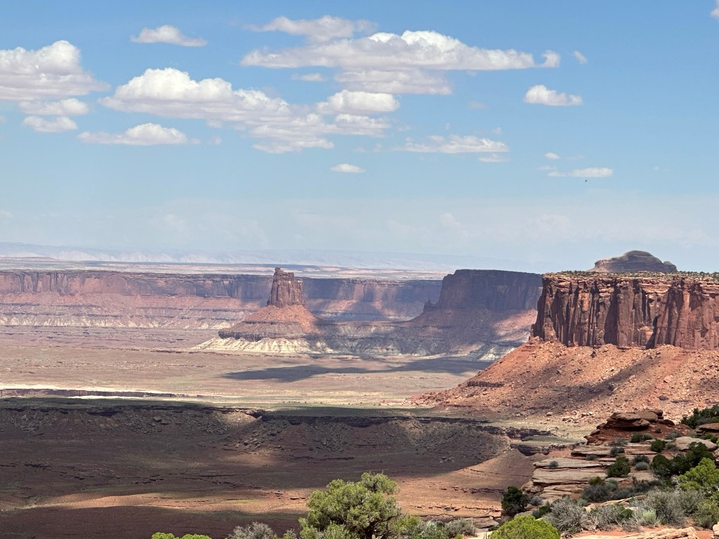
- Super excited to drive on out to Island in the Sky: Canyonlands National Park. Yes, Canyonlands has more than one part to it and none of the three of them are connected. They are the Needles, Island in the Sky, and the Maze of Canyonlands. It takes about 40 minutes to drive from Moab out to Canyonlands so plan your time accordingly. Also, follow the directions on the National Park site and not your GPS. Your GPS can lead you to the wrong spot in this instance.
- Island in the Sky is a mesa that rests on sheer sandstone cliffs that are over 1,000 feet above the surrounding terrain. It’s loaded with beautiful vistas, four-wheel-drive roads, and some nice hiking trails. Here’s a quick cheat sheet to help you plan your visit and understand what’s going on with the geology.


- We started off driving to the Grand View Point to listen to a lecture by one of the Rangers. I have to say that it was pretty informative. I didn’t quite get why he was talking about his hand and going on about it however as he progressed into his discussion he did a really good job of tying it all together. I remember stopping and thinking, “Oh yeah… now I get it. What a great job!”.
- After the ranger talk we took a short walk along the rim at Grand View Point before we headed back down the drive. Here’s a few pics from that walk. I recommend you do it if you have time.


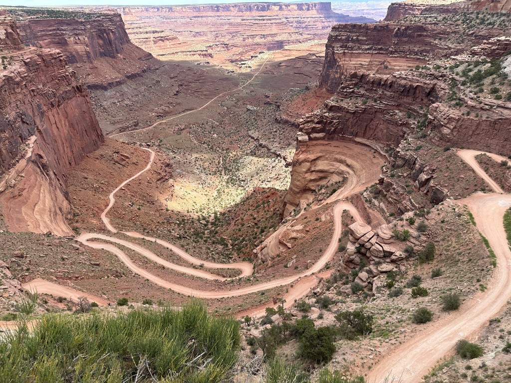
- Driving back from Grand View Point we stopped at Buck Canyon Overlook and then drove out a little ways to see the Green River Overlook. From there we headed back towards the visitor center and made one last stop to get a view of the four-wheel-drive path (it’s called Shafer Trail Road) that you can drive. It looks like a really fun path to drive and potentially camp out on for a while.


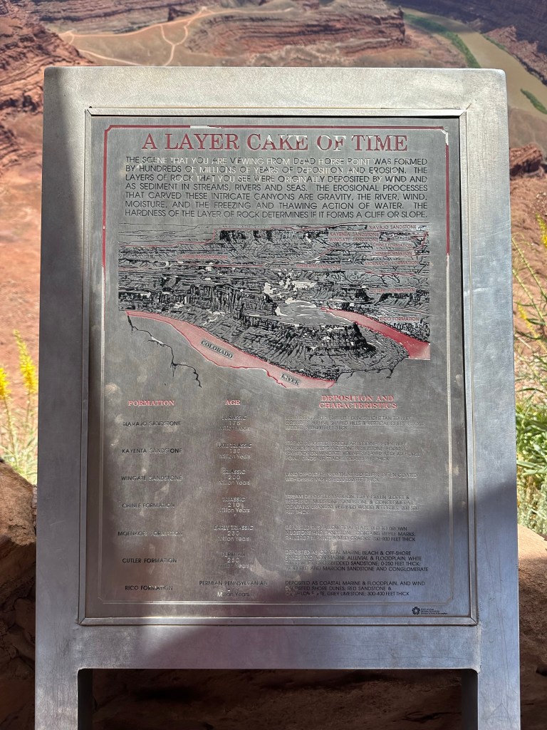
- Leaving Island in the Sky we drove over to Dead Horse Point State Park. That drive will take you about 25 minutes or so.
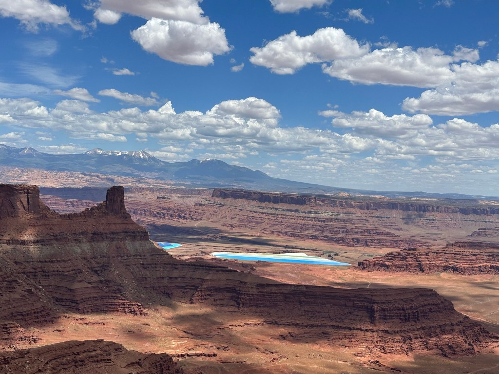
- I didn’t remember seeing the Solar Evaporation Ponds last time I was here in 2022 however you can’t miss them when you’re looking out from the Visitor’s Center. They are for a mine owned by Intrepid Potash and used to mine the potassium chloride which is in turn transformed into plant fertilizer. I’ll post a picture below of the plaque so you can see the process.

- Not much else to be said about this park that I didn’t already go over in my Westward Ho blog from 2022. It’s a great state park and well worth the $20 admittance fee. They have yurts and camping grounds available with obviously awesome scenery.
- We drove on up to Dead Horse Point and took a few more pictures before we left. We only did a short Rim Trail hike however there are more hikes available for you to get your walking legs on. I have to say I was a little envious when I was taking pictures of the vehicles driving the road at the bottom of the canyon. It’s a longer time period than we had so not this time however I’m hoping next time I’ll be able to reserve a spot to camp down there and drive it. It looks like this is the Shafer Trail so I need to double check it but looks like it goes from Canyonlands over to here.
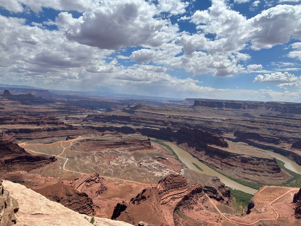


- In fact it’s such an incredible view that I made a quick cinematic recording so you could see it all. Pretend your sweeping your eyes from left to right on this as I pan and see what you think. I did it as cinematic instead of video on my iPhone. I think it means you can depth adjust but I don’t know how to do that. I’ll have to figure it out. Meanwhile enjoy the view!
- It’s about 4pm now and we just made it back to the hotel. We need to do some laundry and such for the night and grab some food. We liked Sultan’s so much that we made the classic mistake of eating at the same restaurant two days in a row. Still good food just not as good as the first time! That’s all for today.
Day 15: 06/13/23 (Tuesday)
- Up and on the road by 8am this morning after a good nights rest.
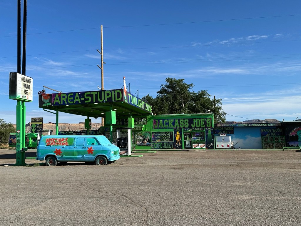
- First stop of the day was an unexpected one at Jackass Joe’s on the corner of I-70 and Highway 191. This is quite the stop as it’s a Roswell lover’s dream store. I didn’t take any pictures of the inside of the store however it’s pretty neat as they sell Unicorn Poop and other assorted varieties as well as jerky and much more. Make sure to use the bathroom as the commode is gold plated. When I talked to the guy running the register he remarked about how “out there the owner is”. Sounds like my kind of guy! Make sure to stop and patronize this place!
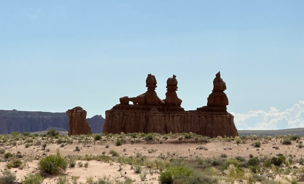
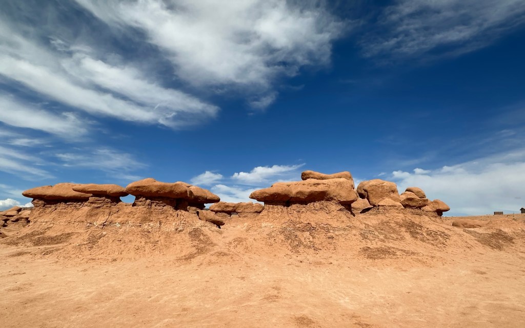
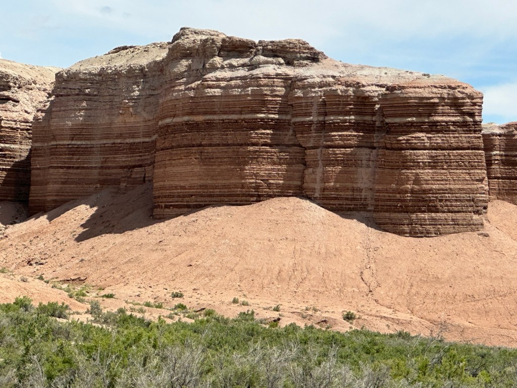
- On down the road quite a ways was Goblin Valley State Park and it’s easy to see why it has that name. They have lots of slot canyons to explore, yurts to camp in and of course Goblin Valley which is filled with these bizarre looking structures.
- About 170 million years ago this area was on the edge of a shallow inland sea. Tidal deposits of sand, silt, and clay sediments were left here. Over millions of years, the distinct layers hardened to become the sandstone, siltstone, and shale layers of the Entrada Sandstone formation. The Entrada is seen here and also in many areas across southern Utah. This is the same Entrada seen at Arches National Park except the sandstone is harder in Arches. So “why goblins here and not in Arches”, you ask. Goblin State Park was a tidal flat area while Arches was dry and covered in sand dunes. The resulting rocks determined the effects of wind and water erosion. The alternating layers of hard sandstone and soft siltstone created goblins here, and the hard sandstone left from the ancient sand dunes created the fins and arches in Arches National Park. This made Goblin (and Arches) a very special place. Event though similar they are totally different!


- As you can see the iconic shot where I tried to duplicate the one in the brochure didn’t quite work out like I had hoped it would. Sometimes the light just isn’t working with you!
- It may not look like it from the pictures however there is quite the extensive amount of them when you are looking at them from the overlook. Once you’re walking among them you realize how big some of them actually are. Let’s meet some goblins!


- You can walk in amongst them and it is extremely beautiful so I’d plan on a couple hours or so just to walk around in the Valley. Overall I’d stay here for 2 or 3 days to explore the canyons and hike around. We walked through Goblin Valley for about 30 minutes before we had to move on and hated to leave it so soon. You could hear everyone around us talking about how many pictures they were taking so it wasn’t just us. One thing though; DON’T climb on the goblins. These geological marvels are easily damaged and they are unstable meaning they can damage you. Don’t take any chances and besides, let the next person enjoy them like you do. It’s not like the Park Ranger is out there every night carving up the rock to make new ones!


- Back to the road and our next stop. The shakaliciously good Stan’s Burger Shak in Hanksville where we split a burger and cherry nut shake. The burger was good although not extraordinary. This is the second time I’ve stopped here and the shake BOTH times HAS been extraordinary. Bottom line is stop here and get a shake if you like shakes. You won’t be disappointed.
- There is also a neat looking convenience store called Hollow Mountain that non surprisingly enough is inside a mountain! I didn’t stop here but will next time to go in and look around. The other thing I wanted to note about Hanksville is the Whispering Sands Motel. I have no idea how it is to stay in however the location makes it a good place to stop to spend the night if you want to drive on into Capital Reef National Park the next day or stay there instead of driving to Moab from Capital Reef. I didn’t really make it plain however the drive through this entire area is pretty spectacular.


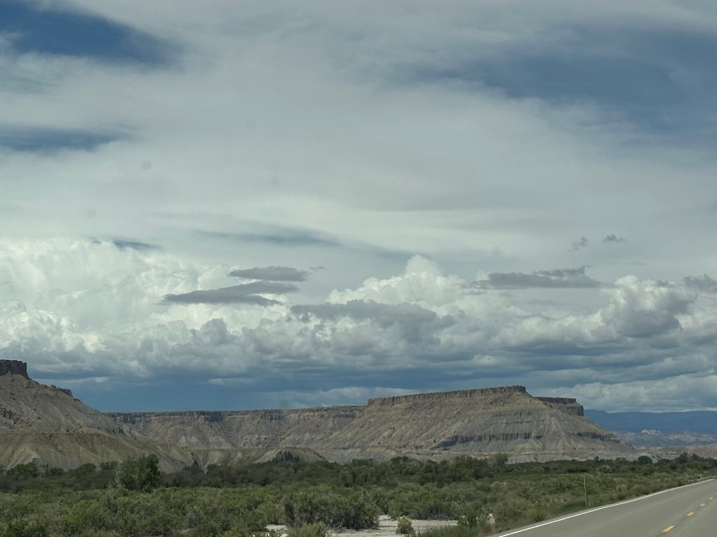


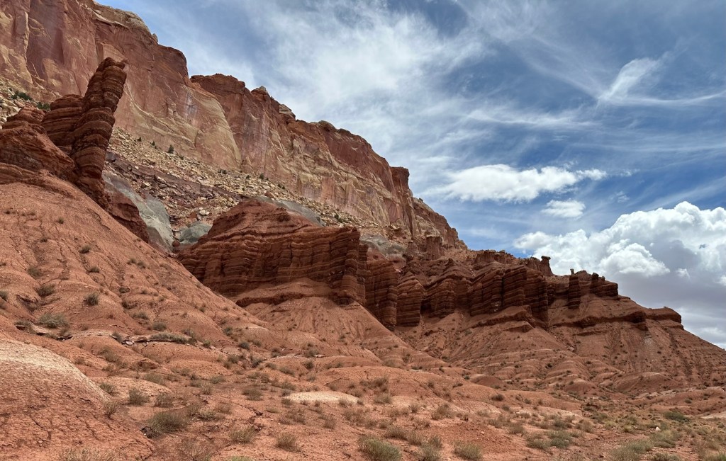
- Driving some more we made it to Capitol Reef National Park. This is a pretty cool place that we didn’t do a lot of justice to as we didn’t stay that long. We drove the scenic drive and Capitol Gorge however there were a lot of people around and it was pretty crowded. In addition there were black clouds hanging in the sky and you don’t want to get caught in the low spots or canyons there when it rains due to the flash flooding. Lastly, just the time element. Long story short; I’ll be back when I have 2 to 3 full days to spend here so I can hike some trails and drive some of the other backcountry roads. The beauty of this place is amazing! So, yes….yes, I’ll be back!


- Once you get to the end of the paved part of the scenic drive it will let you go on to the unpaved portion. There are restrooms here also if you need to use them before you head on into Capitol Gorge.
- Make sure you take the time to drive Capitol Gorge if you have any extra time at all. You won’t be disappointed! The views are breath taking. As an FYI Capitol Gorge used to be an old road connecting towns however since it washed out after every heavy rain they eventually stopped using it and built a different road. The takeaway here is to NOT be on this road if there is a chance it is going to rain! There is a hiking trail you can do at the end of the road however that also was pretty crowded and we couldn’t even find a parking spot.
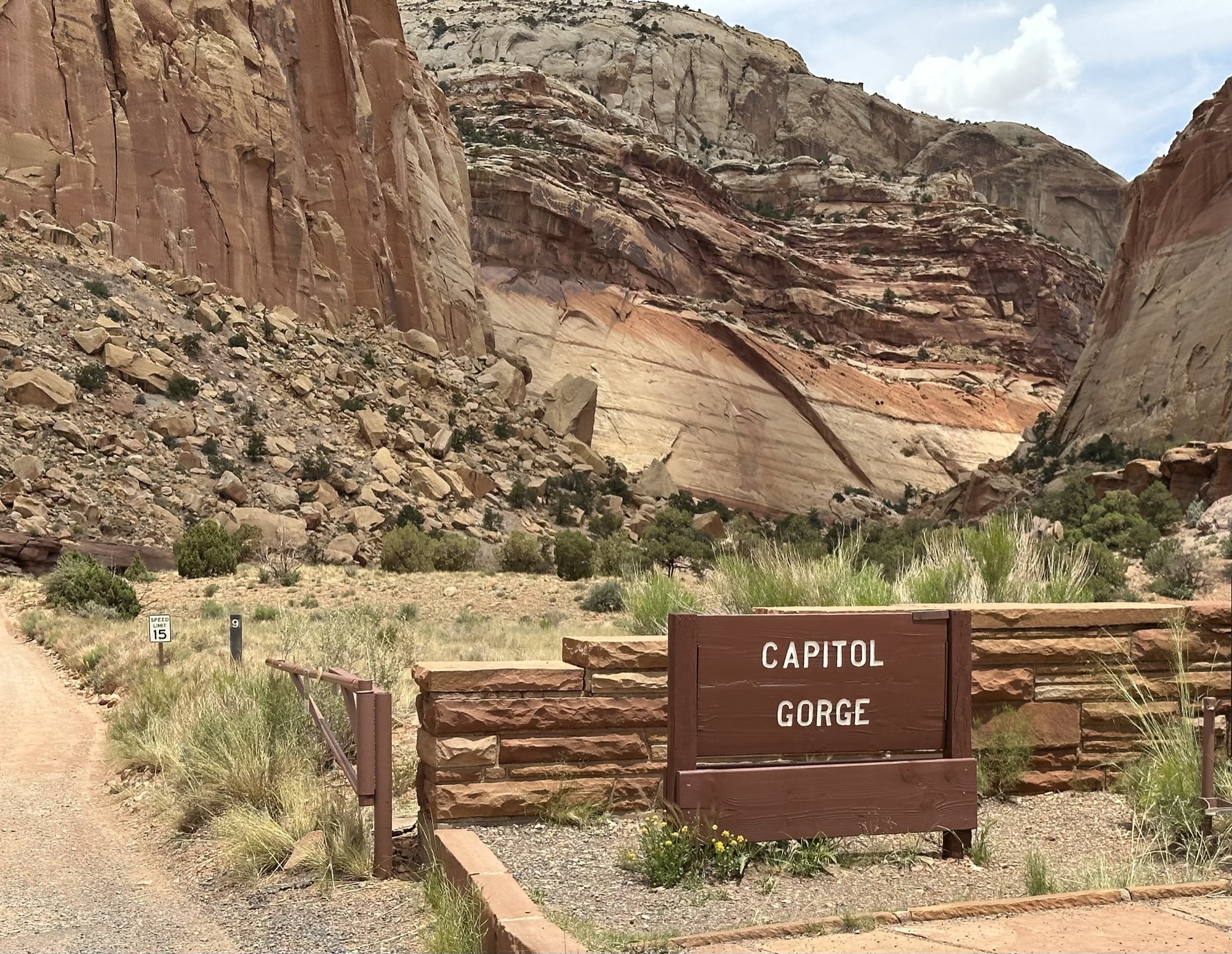

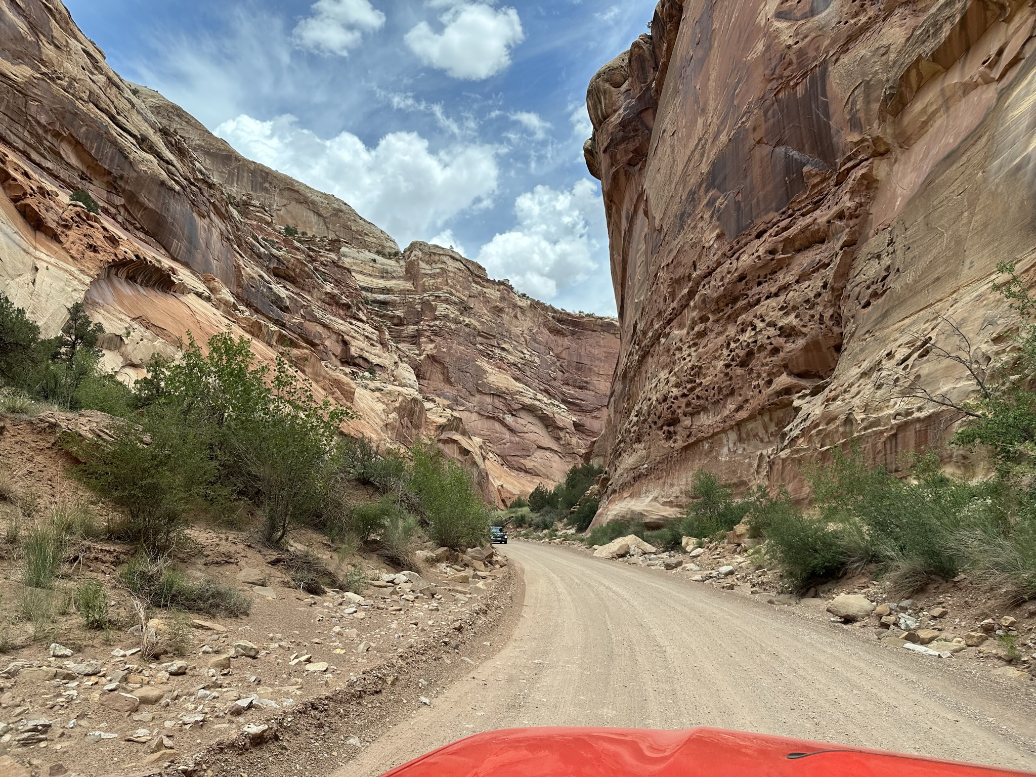

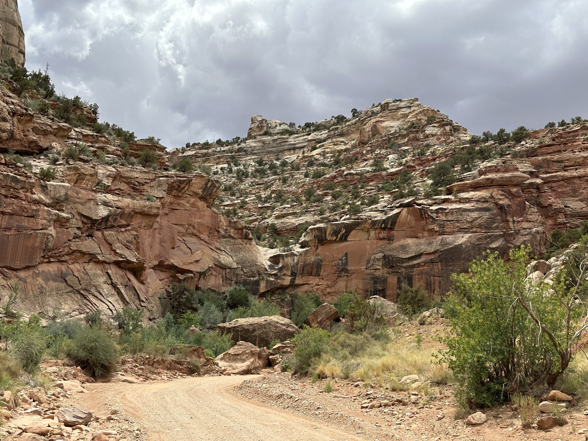
Capitol Gorge is a drive you won’t want to miss!
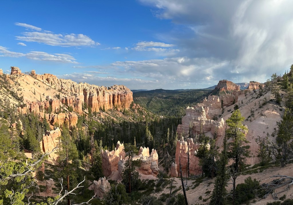
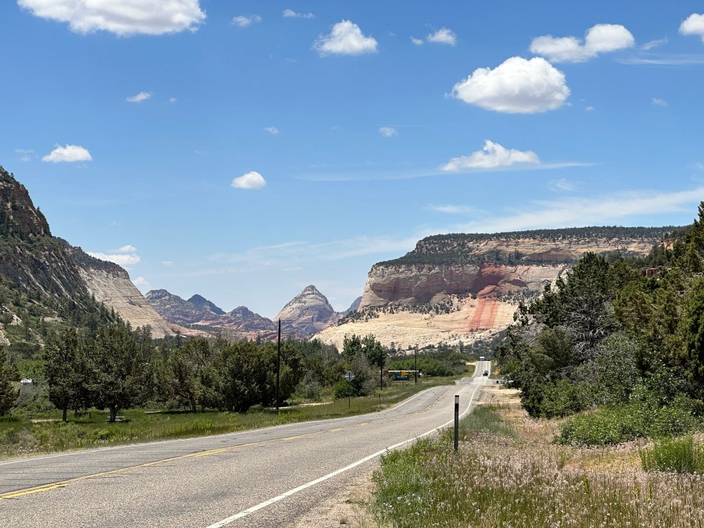
- Alas, all to soon we had to say goodbye and keep on driving. We had reservations at Bryce Canyon Lodge for the night (yes, I know we were there just a few days ago) and we wanted to get there at a decent time to enjoy the view. We took Scenic Highway 12 down to Bryce Canyon and the views were spectacular.


- Plan on about three hours for this drive as you’ll want to stop at the viewpoints and look around. There are definitely mountains you get to drive up and down and some very tight curves so make sure to follow the speed limit and drive the road conditions. For us it was smooth sailing with great views. I’ll make sure to always come this way. Now, if you are a Butch Cassidy fan he grew up in a town not far away and you’ll go through it if you take the other way around. Anyway we did the scenic loop and had a blast. In places there was still snow on the ground and at one of the stops it was 46 degrees!
- We did make a stop in Escalante to fill up full of gas and I finally found me a fresh donut even though it was late in the afternoon. That maple glazed donut never tasted so good as I ate it in record time. I even committed the strict “do not ever do” rule and took a bite of it in the store before I bought it. Don’t do that!
- Escalante looks like a super fun little town. Kinda like a Kanab or small version of Moab where everyone does outdoor stuff or guides others who do. We were impressed with the town and want to come back and spend a few days there vs Moab next time in the area. The two places we saw that I want to look into further to stay at were the Yonder which had cabins, campgrounds, RV, etc and the Slot Canyon Inn. I need to pull some reviews on them but they looked pretty neat from the road.
- There was also a State Park that had Petrified Trees that I want to stop at next time to take a look at.
- Still marveling at the landscape we stopped just a few miles outside of Bryce to hike to Mossy Cave just off the road. It’s only a 0.4 mile hike and looked like fun. We started on the hike and I started feeling raindrops so I wussed out and headed back to the vehicle. Good decision as it turns out it poured down rain just a few minutes later as we were safe and dry in the vehicle cruising on down the road.


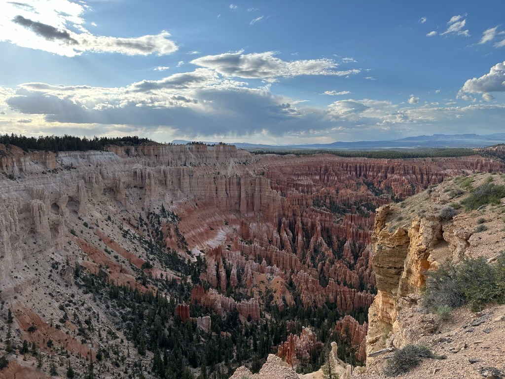
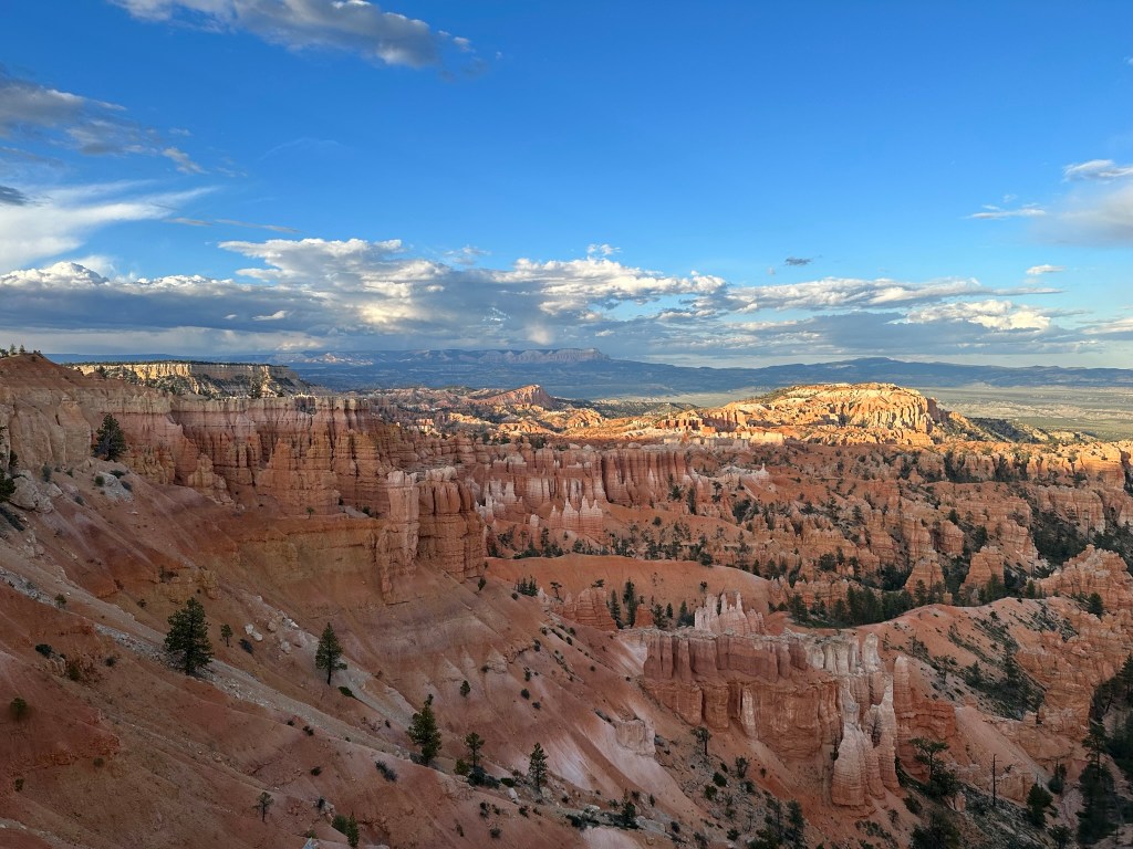
- Happy to report after that we made it safely back to the Lodge at Bryce Canyon and got to stay back in the Sunrise Lodge again even if it was only for one night (one night was all they had available). Talking with the front desk we asked if we could get a scenic view as a couple days ago we were in #108 which was great but no view. He was great and put us up on the second floor with a view.
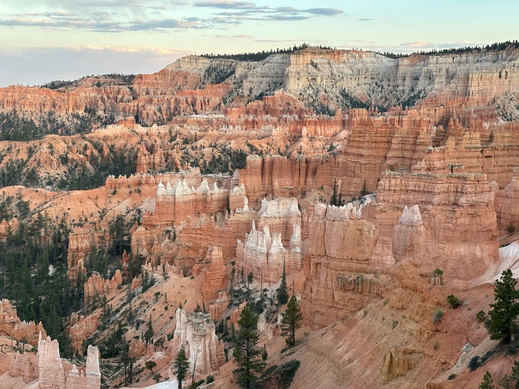
- Up to the room and a quick walk around to view the canyon for the evening as we were hoping to catch a good sunset view this time. We walked out to the rim from the room (about 3 minutes) and just WOW! I think we hit it right this time. Definitely click on the pics below to see the full screen version of them. It’s worth your time.


- Back to the room and off to bed feeling pretty smug about our day.
Day 16: 06/14/23 (Wednesday)
- Good night’s sleep however there were a couple lessons to be learned here. Lesson number one is stay on the bottom floor so you don’t have to lug your stuff upstairs. Lesson two is there really isn’t a view to be had as you are only looking at a few trees. Lesson three is that the floor squeaks terribly on the second floor so pick the first floor with an even number room if you can. The even numbers face the main lodge and don’t have a lot of foot traffic and are very quiet. Lesson learned!!
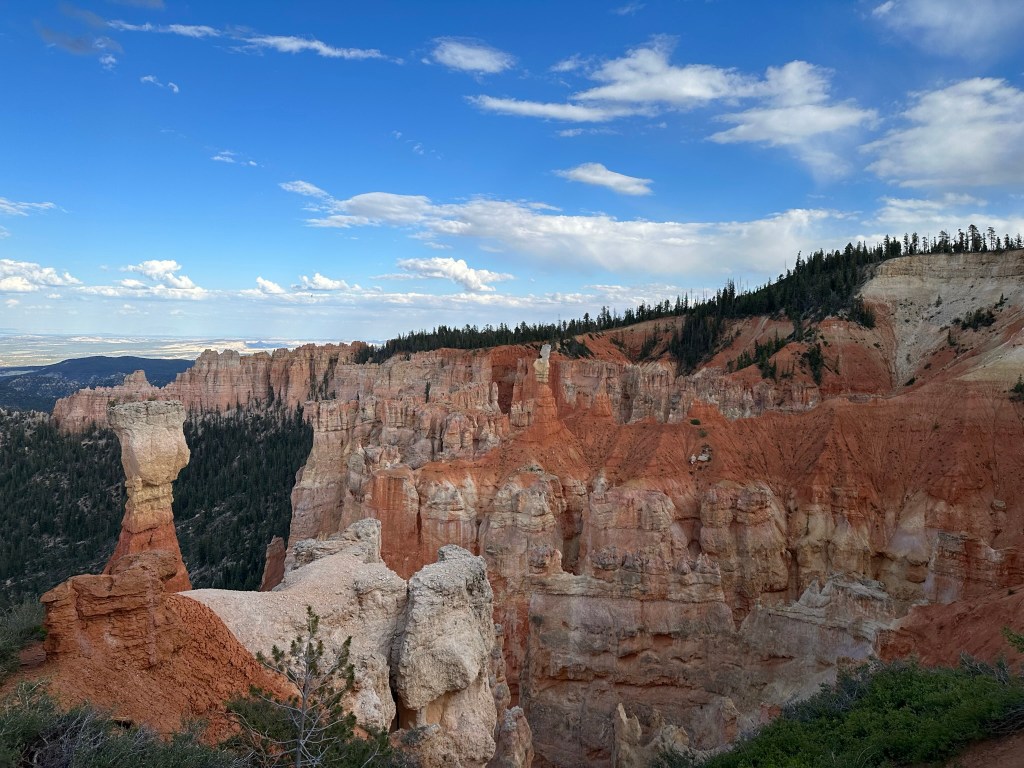
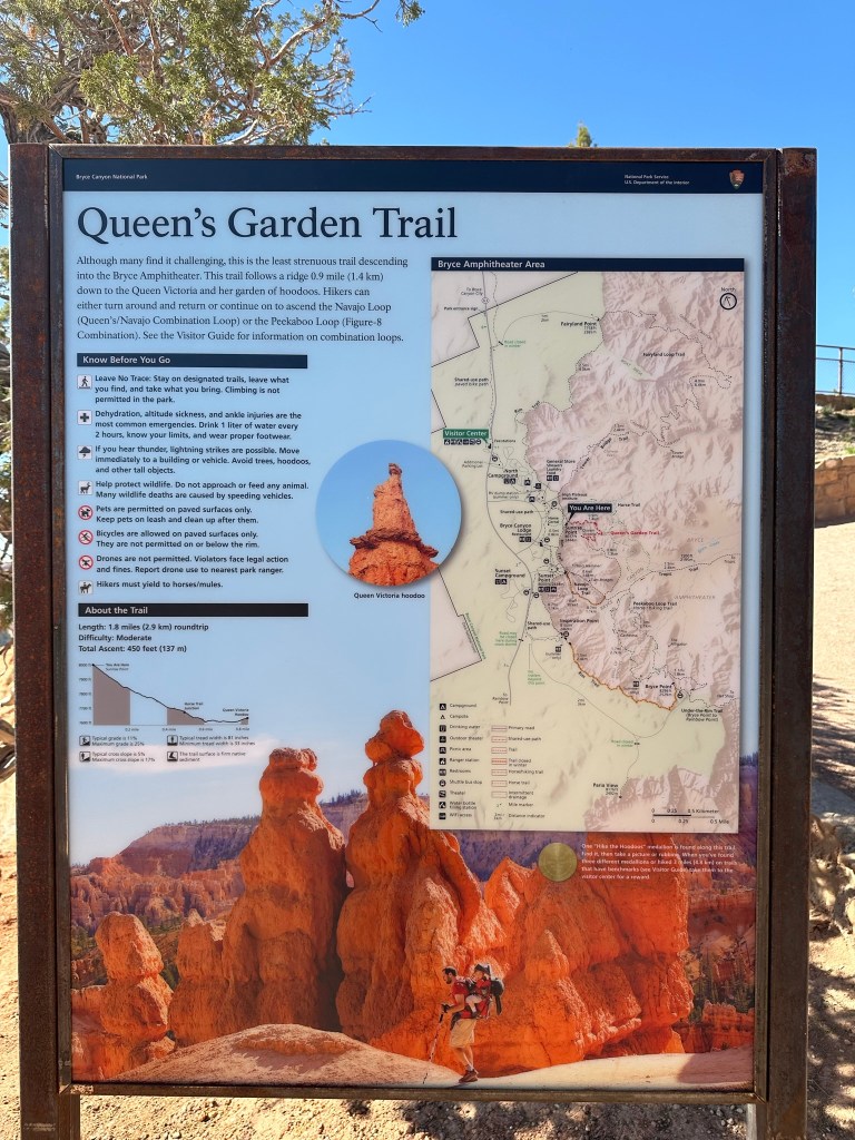
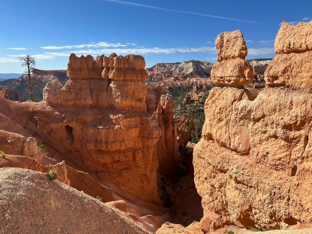
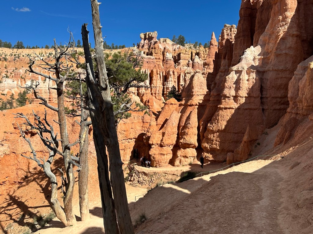
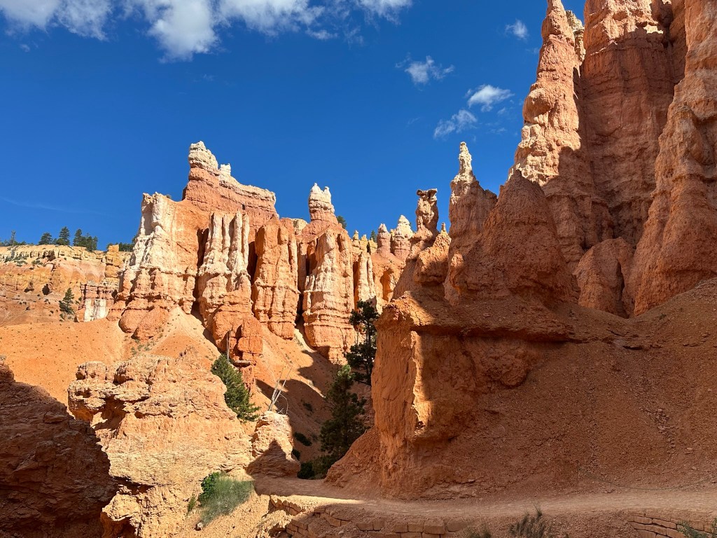
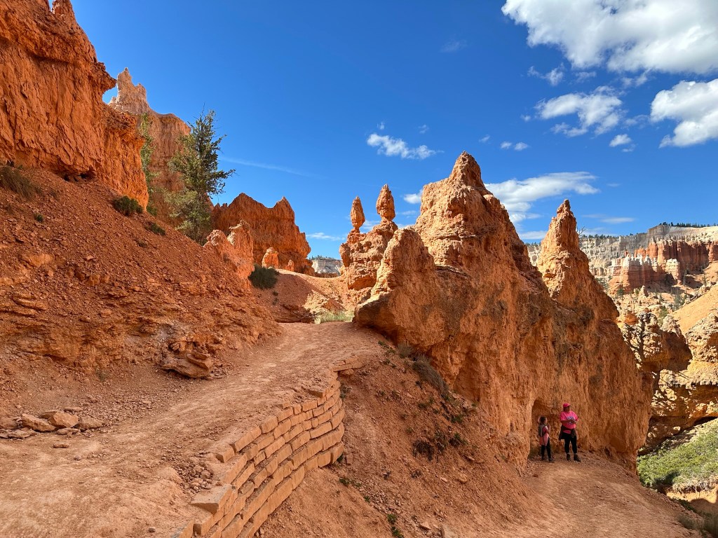
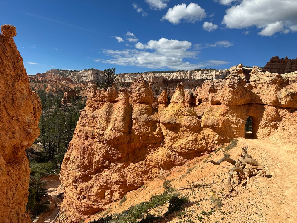
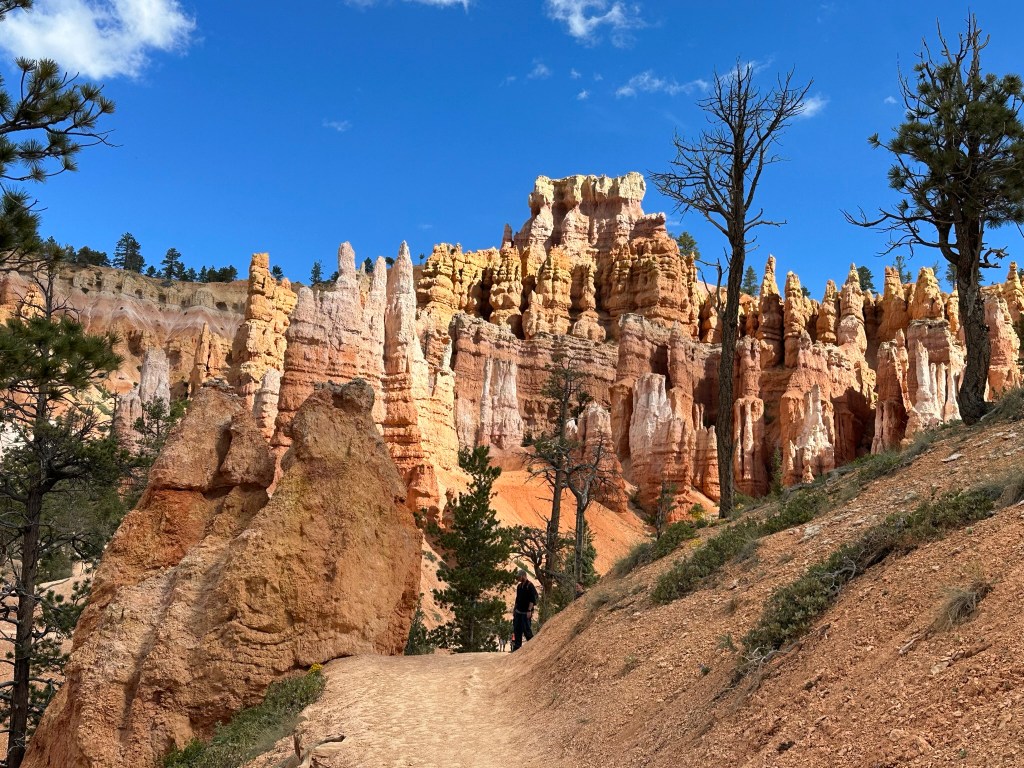
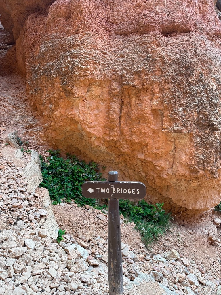
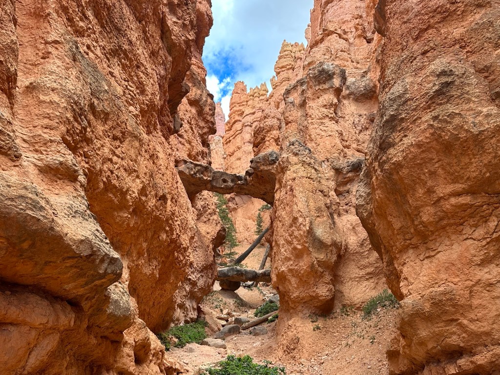
- Before we left we wanted to do a short hike or something since we weren’t able to last time. We decided to do the Navajo Loop and Queens Garden Trail. It’s a 3.3 mile trail that starts at Sunrise Point and then ends at Sunset Point. The total elevation gain is 784 feet. In other words the way down is easy while the way up is more than a little challenging!


- The trail is really amazing and you won’t regret doing it at all. We had such a blast hiking it that it was well worth the effort on the way back up. I thought I was done taking pictures after our last visit here however I think I took even more pictures this time than last. It seemed like ever step changed the viewpoint enough to create an entirely new sight. Obviously we really enjoyed it. We finished the hike about 11:30am (we didn’t get started until mid morning). Here are the pictures from it. As you can see I went kinda nuts with the camera but I think you’ll forgive me when you start looking at the pictures. It was a perfect morning for the hike in every way. The pictures are in the exact order we did our hike.


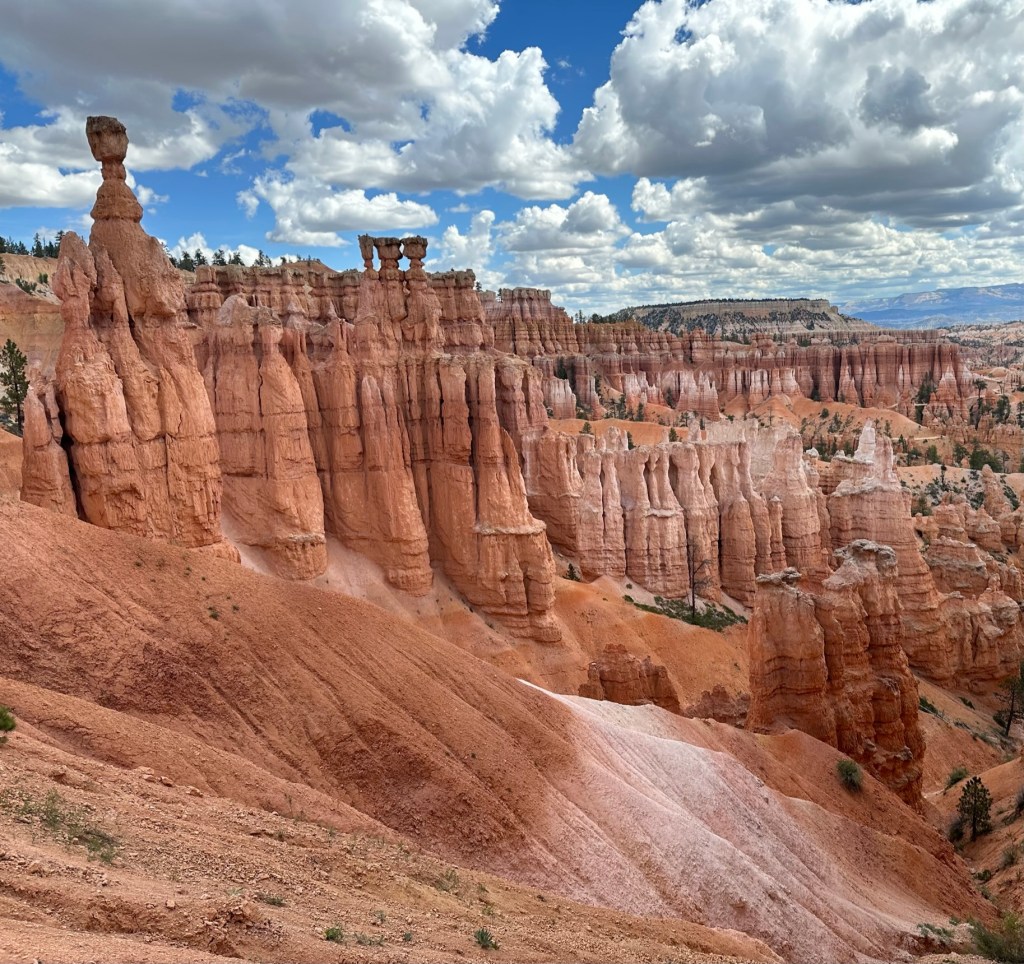
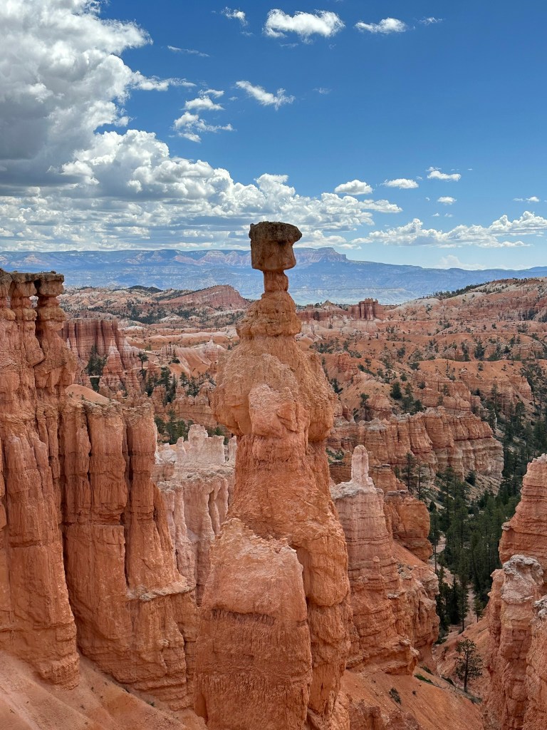


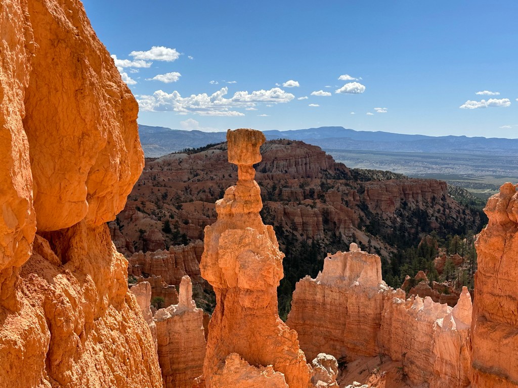
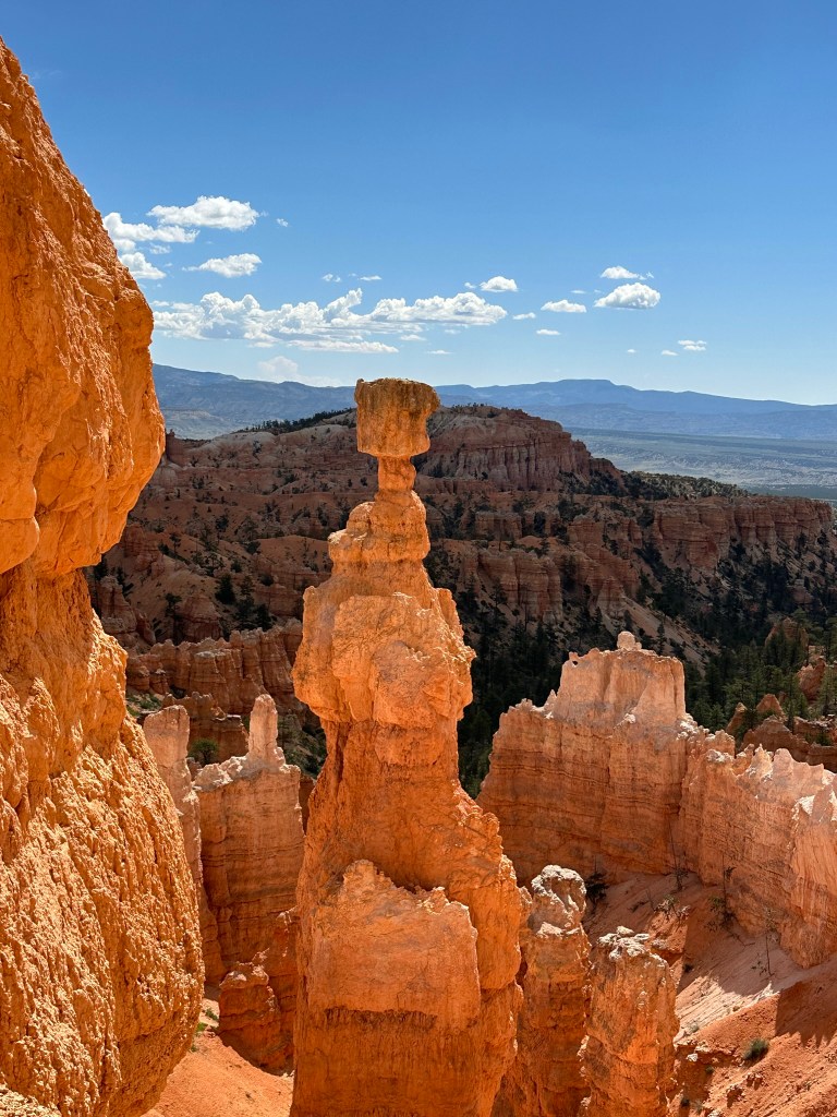


- One final thought on Bryce Canyon before I leave it all behind. Just moving a few steps will change the entire landscape perspective here. Combine that with the light changing it can make an incredible difference on the appearance of the formations on a literal minute by minute basis. Be patient on your walks! See if the sun is about to pop out behind a cloud before you leave the view behind. Not always can you make it go your way, but sometimes it works out. I know I said the same thing about Monument Valley as well. Here’s another illustration of what I mean below. This is of Thor’s Hammer from our hike. Swipe on the pictures below. They were taken just a couple steps and three minutes apart. No photo enhancement; just had the sun pop out and I moved a couple steps. Thoughts??
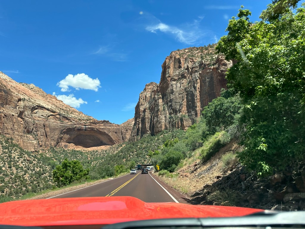
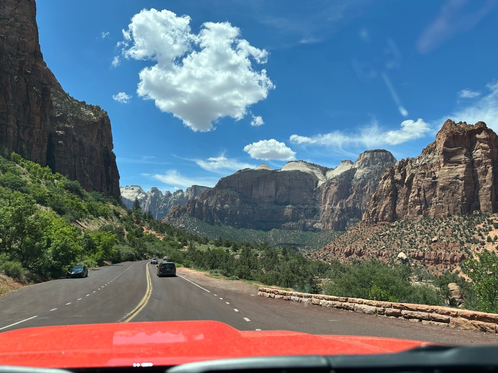
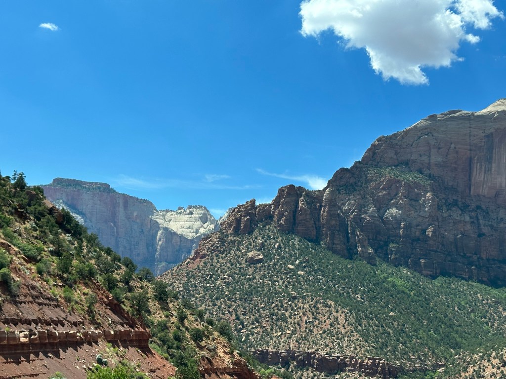
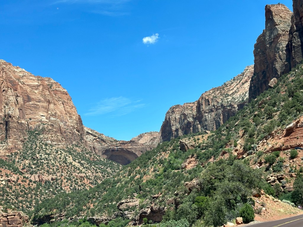
- Leaving Bryce we headed on our way over to Zion National Park to do a drive through the park. Fortunately we saw where the Visitor’s Center for Red Canyon was open on our way out so we stopped there to grab a stamp in our book and just look around. We did find a cool CCC patch that we had never seen before so we picked that up and continued on our way.

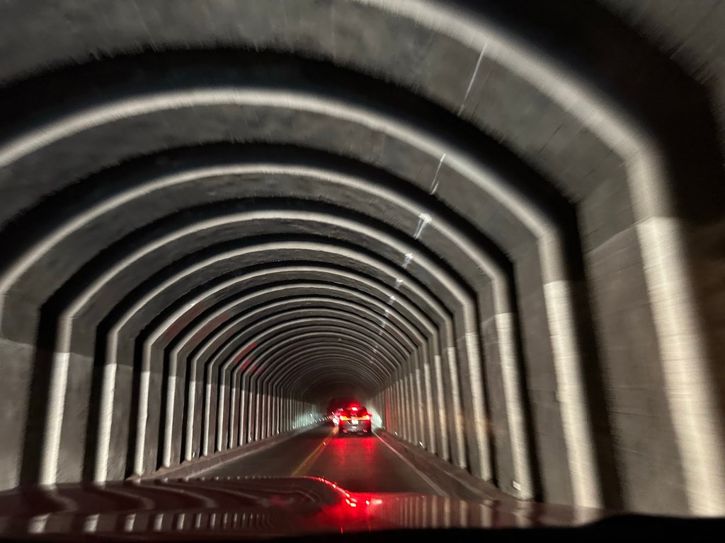
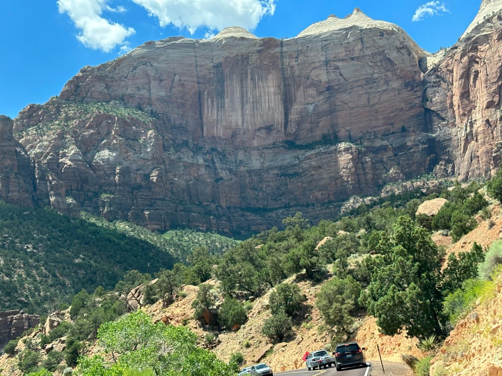
- We drove Hwy 9 to Zion and came in through the east gate. Not much of a line at all so we thought we’d be home free. Not…. the park was super busy and the tunnel was really backed up. Once we were finally able to make it through we saw where someone’s vehicle had stalled on the other side and really backed things up over there. That felt like one long tunnel!

- We drove on through the park but didn’t stop until the Visitor’s Center which is on the west side of the park. It was crazy busy. We did finally find a parking spot, got our stamp and patch and moved on. The scenic drive access was limited and everything was very crowded. It was a beautiful park however we thought that it would be better to move on and come back another time when it wasn’t so busy so we wouldn’t have to fight the crowds for a simple hike. That means all you get are some pictures from the road. No hiking pictures this time. Here is a quick video though for your to check out.
- Just a few “still” shots for your viewing pleasure as well.


- Coming out of Zion we drove on to Kanab and spent the night at the Hampton Inn there. Great place. Rooms clean and quiet, front desk friendly and the price is right. I’ll stay here again.
- Got our luggage in the room and decided we wanted to go grab a good meal. Based off Trip Advisor we decided to eat at Vermillion 45 however when we got there a tour bus had just dropped off a whole busload of people so they couldn’t even serve us for over an hour. They recommended we go across the street to Wild Thyme Cafe.
- Oh, what to say about Wild Thyme… Food wasn’t too bad. Service could definitely have been better. The flies were something else. We had one that wouldn’t stop bothering us and we tried to get a fly swatter to kill it or chase it away but they wouldn’t do it. Just told us they couldn’t control the outdoors… Hmmm.. we were sitting inside their restaurant so not sure what they couldn’t control. Made the eating experience unpleasant. Looked like there were several other flies in there also. Towards the end of the meal we put our utensils down and the fly promptly divebombed directly into the sauce on the plate. Doesn’t do much for your appetite or digestion much less want to have desert. The waiter didn’t care at all. Sent them a message through the contact us feature on their website. Guess we’ll see if management cares and go from there.
- Back to the hotel and made sure to tell them about the issue so at least they could not send people there until they had the fly infestation under control.
- Pretty anticlimactic for an ending to Day 16 but that’s all she wrote as they say. It was time to plan out for the next day and call it a night!

Leave a comment