
Cover Photo: Badlands National Park in South Dakota
Adventure Map Days 1-3
06/14/22: Day 1
- Left home early to get a good start on the day as had about 721 miles to drive today to get to our hotel for the night. We drove up north and took some “back roads” to see a little more of the countryside. As you can see we ended up going through Mineral Wells north to Wichita Falls, Vernon, Elk City, Woodward and finally stopping in Hays, KS at the TownePlace Suites by Marriott.
- Couple items to note on this drive. One, it is a very pretty drive in places and in other places not so much, although it’s one I’d do again. As we drove by the west side of Mountain Park (west of Lawton, OK) there was some nice mountains and rocks that were interesting to look at. Seems to be some mining in the area also.
- More general good views on the drive and cool small towns as we proceeded north. Around the Dodge City area we had to stop and wait out a hail storm that was brewing in the distance so that caused us a little bit of a delay but better safe than sorry.
- As I noted above we stayed at the Marriott in Hays, KS for the night. It was a good hotel that was clean and quiet so we enjoyed the nights rest we got.
06/15/22: Day 2
- Good nights sleep and pushing on from Hays to the Badlands today to spend the night in Wall, SD.
- Never one to take the direct route we took the scenic route. Ended up driving through some reservations and beautiful grasslands. Makes you realize how the buffalo could roam the plains given how high it was growing and swaying in the wind.
- Bryan Bridge is a neat spot to stop on the way. It’s by the town of Valentine, NE. It’s just a small detour off Highway 20 but worth it as it gives you a great vantage point of the scenery and the Niobrara River. It’s special because it is an arched cantilever truss bridge connected in the center with a single pin! It’s the only one of its kind in the United States and was built in 1932. Beautiful area that I unfortunately don’t have a picture of. Don’t know why, but I don’t. You’ll have to look it up or better yet, stop there and have a sandwich while you enjoy the scenery and send me a picture!
- More grasslands to drive through and then north on Hwy 377 to the Ben Reifel Visitor Center at the Badlands National Park in South Dakota located at 25216 SD-240, Interior, SD.

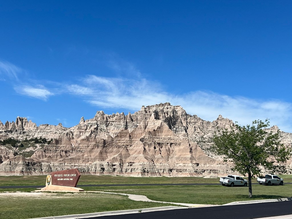
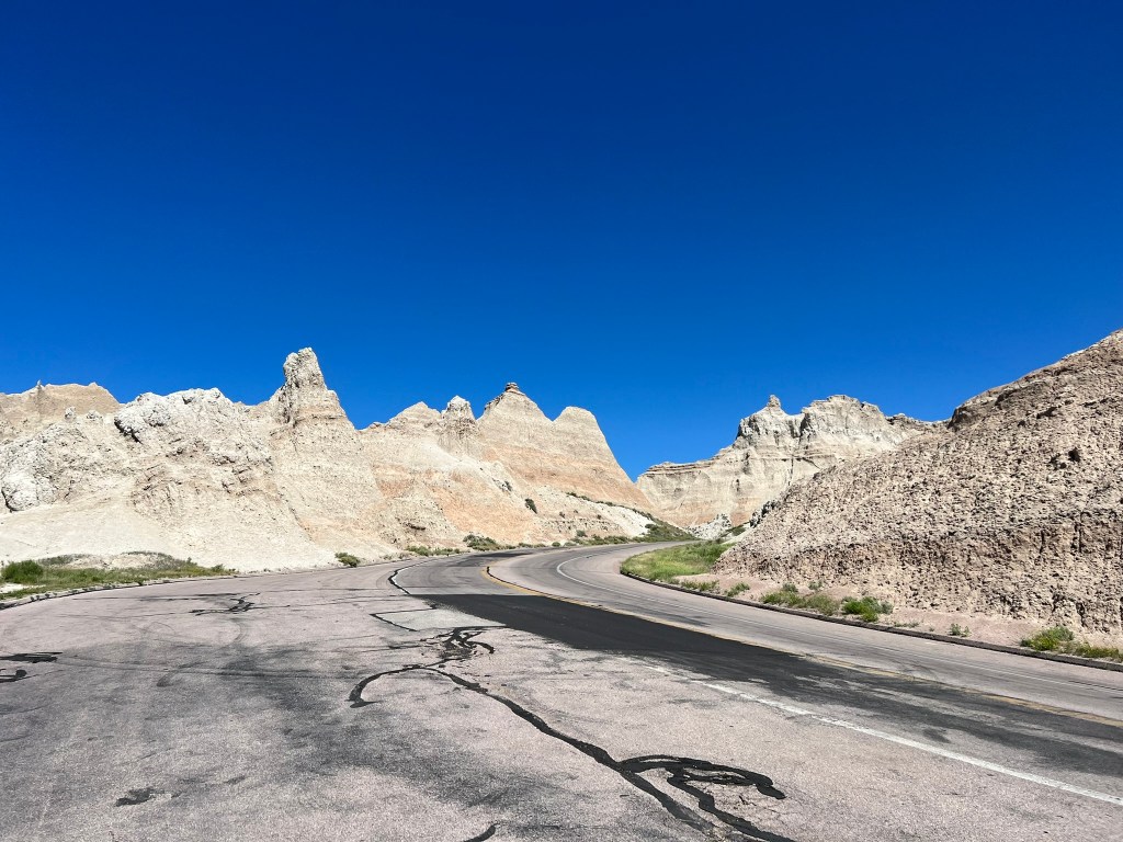
- After visiting the Visitor Center and being duly impressed, (It IS a very cool place with fossils, history, and even it’s own archeological section. You should plan on spending some time here to take it all in) we headed on into the park for a quick drive thru on the Badlands Loop Road.
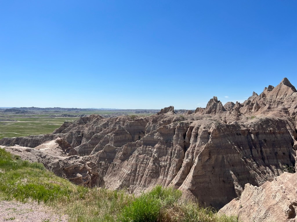


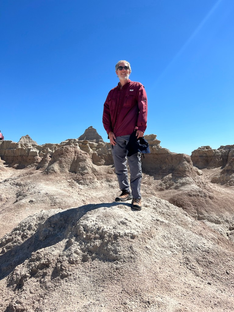

- Make sure you look at the Bands of Time in the picture above and then see if you can spot them in the background of the photos. They are easier to see in the batch below however you’ll see it pretty much everywhere here. I have to say I didn’t know what to expect when I first hiked on them. I thought they would be sandy however they seem to have more of a “crust” on top of them with some density underneath them. Lot’s of mixed type prairie grass in the area also. Make sure you keep an eye out for fossils when you hike. The rains can uncover them at any time and it’s possible you may spot something. If you do see something do NOT mess with it. Mark the location and go tell a ranger!! One of the hikes we stopped to do had an active fossil dig occurring in it so you never know!


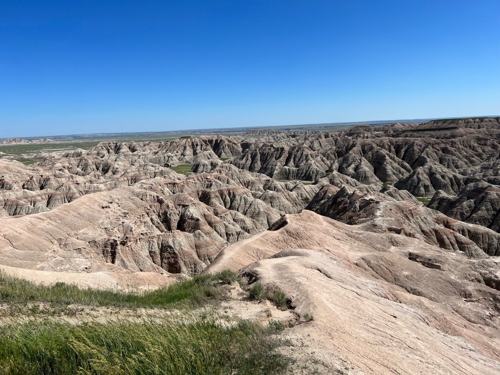

- One more quick sidenote. The look of the badlands is due to rivulet erosion. I’m talking about the patterns on the hillsides. The narrow rills merge to form a network of larger channels per the National Park Service. It’s why the land changes shape with each rain shower. Coulees are steep, narrow valleys formed by the water erosion. They are usually dry except during thunderstorms. Coulee means “to flow” in french and back in the 1800’s the French fur trappers were the ones who began calling them that. That’s your history lesson for the day.
- Driving on up to Wall we had one last surprise for us just before we left the park. Just inside the park limits look what we found!


- Arriving in Wall we discovered most of the rooms were already rented so we had a difficult time finding a place to stay however we were finally able to get a room at Anns Motel. Ah… what to say about Anns Motel. They were friendly and they were extremely nice so I did like that. I didn’t like the location or the quality of the rooms quite so much. Could also have been the group of guys that decided to stand around in front of our door and drink beer, smoke, and talk until I asked them to move along please. They were nice about it and so was I, but come on people!! Think a little!
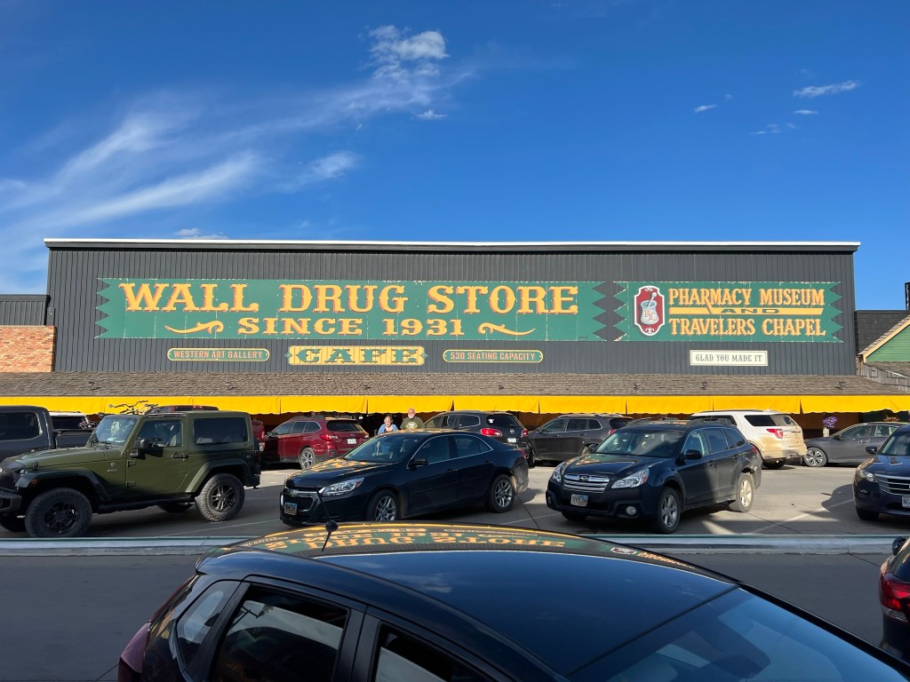
- We were both hungry and the Motel had given us so coupons good for a free drink at the Badlands Saloon & Grille just across from Walls Drug. The beer was good and cold, service was great, and the bison burger was excellent and perfectly cooked. I’d definitely eat here again next time I passed through town.
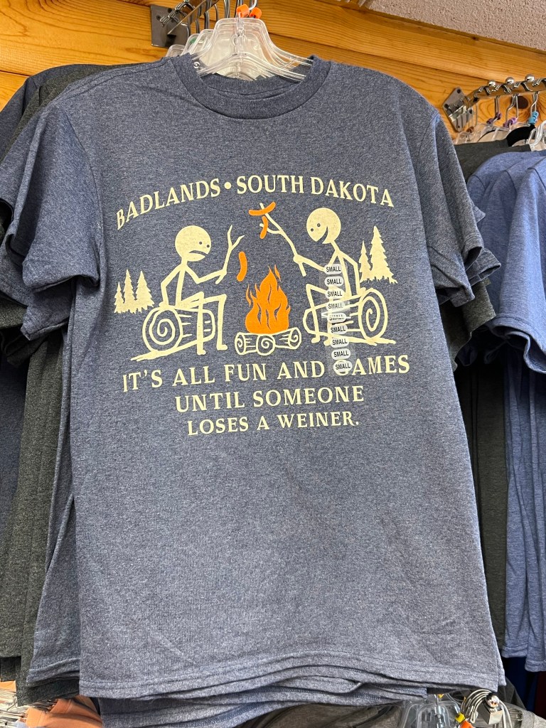
- Having eaten our fill we journeyed across the street to go through Wall Drug Store. It’s got quite the history and is a really cool place. Started by a pharmacist years ago it’s grown into a musum, chapel, western art gallery, donut shop, souvenir shop, pharmacy and much, much more. I had to throw in a few pictures of some of the more “racy” type souvenirs however it’s a very fun, family friendly place that the kids will love.


- Finished our shopping and walked back to the motel to call it a night. Got ready for bed and then got to go talk to the people outside (lol-see above story). Sleep wasn’t the best in the world however it was a bed and let us not sleep in the vehicle.
06/16/22: Day 3
- And good morning….sort of. lol. Let’s see what magic we can work to make it better this morning. It’s going to be a busy day!
- As should be common knowledge by now I’m a Sasquatch nut so I can never miss a photo opportunity when presented so I’m proud to show you my photo shoot from 6:15 am fresh from Wall, SD.

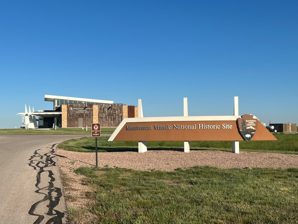
- Having had my new modeling career jump started this morning we headed on out via I-90 E towards the Minuteman Missile Historic Site. Unfortunately it was closed when we were in the area (it was 6:45am lol) so I’ll have to go back to take the tour next time I’m in the area. Looked super interesting though and from what I read was a very interesting tour you could take. Next time!!!


- From the Missile Historic Site we got back on I-90E to SD-73N towards Lemmon where we stopped at the local IGA to fill up with some gas and try their donuts….gas was good, the donuts not so much… One has to try though when the opportunity for a donut exists.
- One sad event on the way up to Lemmon was when we were driving on SD-73N just minding our own business we had a literal storm of insects hit the windshield for about 5 seconds. Sadly it was honey bees…Someone had left some bee boxes to close to the road and the bees must have been trying to get across to the other side. Since my daughter loves honey bees we felt extra bad about this and had to give her a call with our condolences.
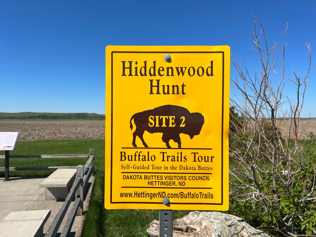
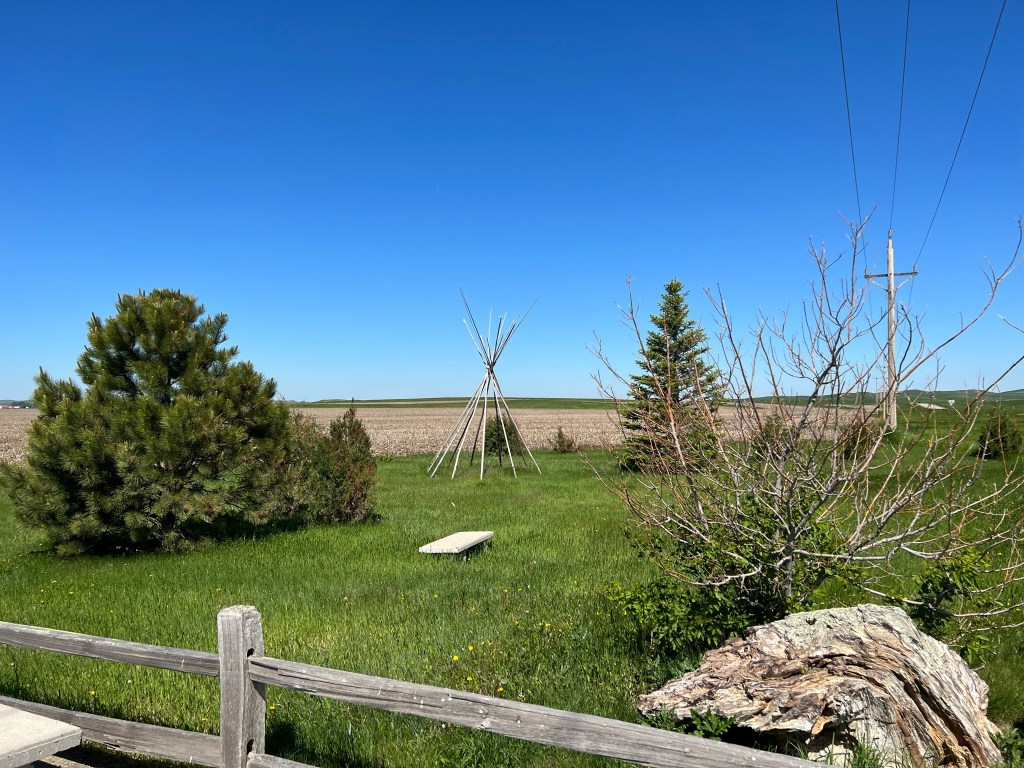
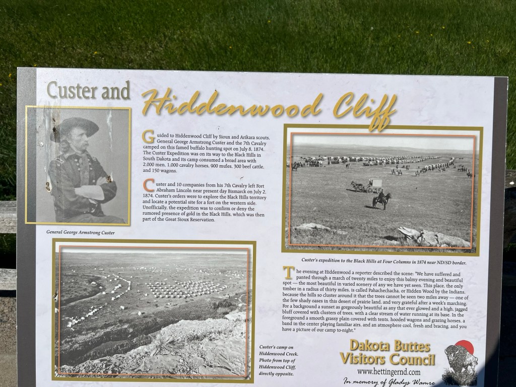
- At Lemmon we took US-12 W towards Hettinger, ND. Around halfway between the two towns you’ll go through White Butte and then just a smidge past that (or two smidges depending on your smidge; in all serious it’s about 14 minutes from the IGA stop) you’ll come to a sign by the side of the road called Hiddenwood Hunt Site 2 of the Buffalo Trails Tour. It’s a self guided tour in the Dakota Buttes and it is VERY informative. If you like history or buffalo you should stop here. Next time I head this way I’ll be making time to do the entire Buffalo Trails Tour as I love buffalo and the history was very well done. I’ll put the pics below. Please take time to read through these as they are very informative and interesting.


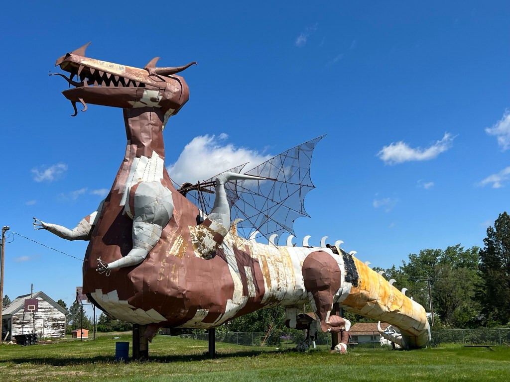
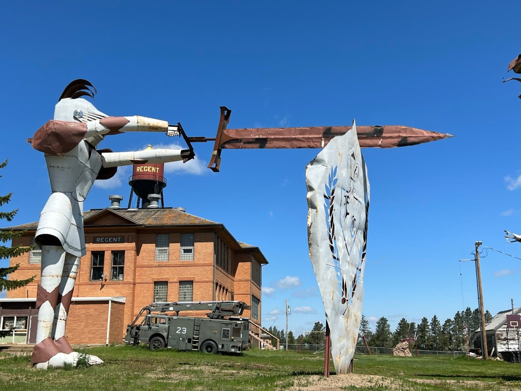
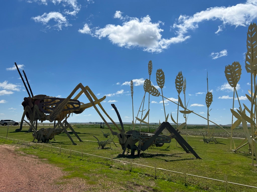
- Feeling refreshed from out buffalo stop we headed on up to Reagent, ND to our first stop on the Enchanted Highway with it’s myriad of roadside sculptures. The Enchanted Highways is the brainchild of Gary Greff who is frequently found at the Enchanted Castle Hotel if you want to stop and say hi to him. It’s a collection of may different sculptures over a 32 mile stretch of road. Well worth the drive and just fun in general. Technically we drove the Enchanted Highway backwards since you should take Exit 72 on I-94 near Gladstone and end your trip with a stay at the Enchanted Castle Hotel in Regent, however we were headed north towards Dickinson so we this is the way we did it…..no judgement!!!! lol.
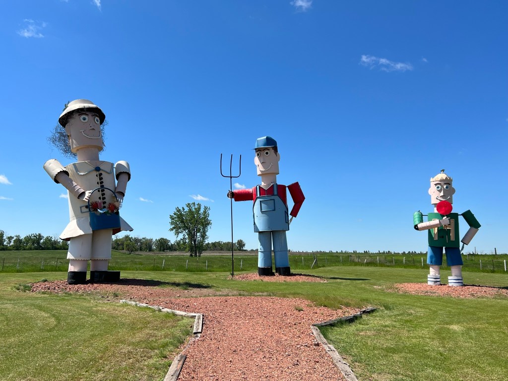
- First stop was the Enchanted Castle Hotel in Reagent. As you can see it looks like a pretty happening place. In fact, rather than going stop by stop let me just put the pictures below for you to peruse. They each had their own qualities that made them a fun stop and much to my wife’s chagrin we stopped at each and every one of them to stretch the legs and take a pic or two. It was pretty funny to see who the interested parties were at each stop by the amount of eye rolls you could see happening on significant others faces when the “cool” kids started talking about the roadtrip! Oh, forgot to mention there is a phone number (701-566-5566) you can call to get talking points on the sculptures. It’s listed by the sculptures along with the “Talking Point” for each one.


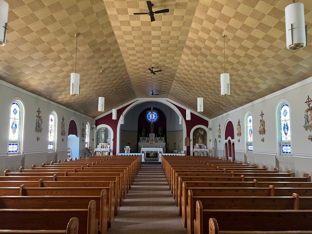
- After the grasshoppers we stopped in Lefor to see St. Elizabeth’s Church and the remnants of the Lefor State Bank (all that is left is the old bank vault and you’ll see why when you see it.) Lefor is a small, unincorporated town however it is beautiful. The church is quite stunning to me as I felt a spirit of welcoming, peace, and calm when we walked in. Make it a stop.


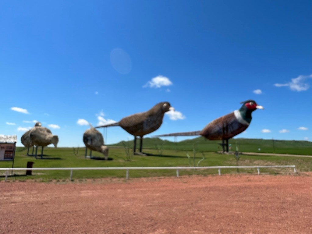
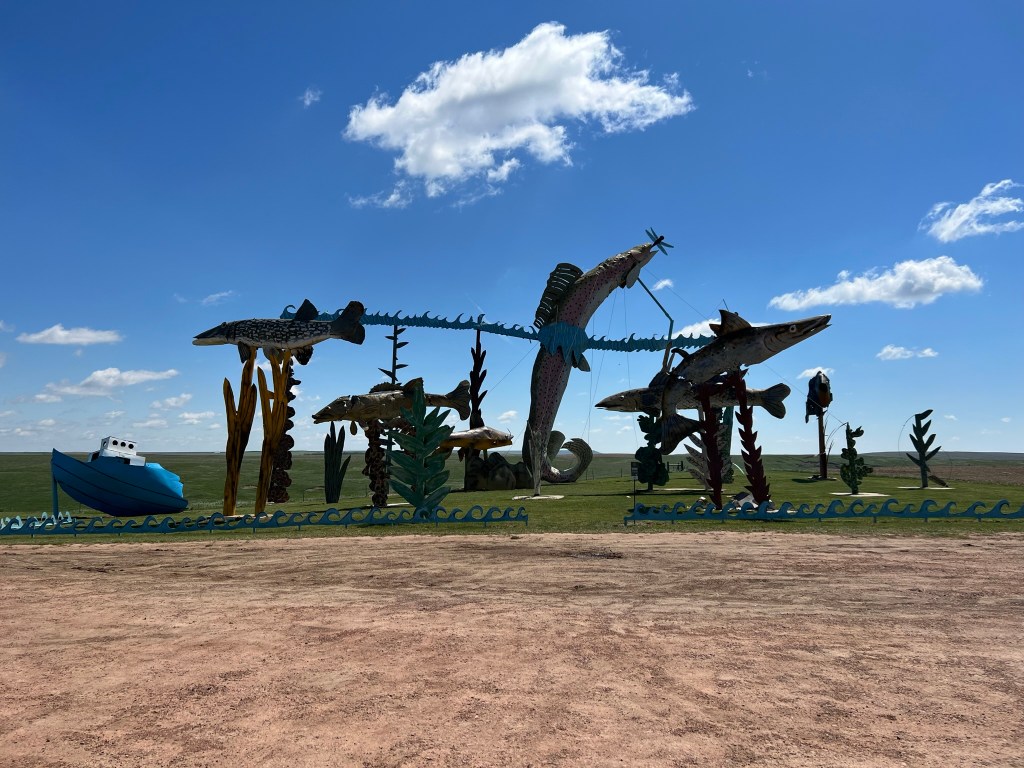
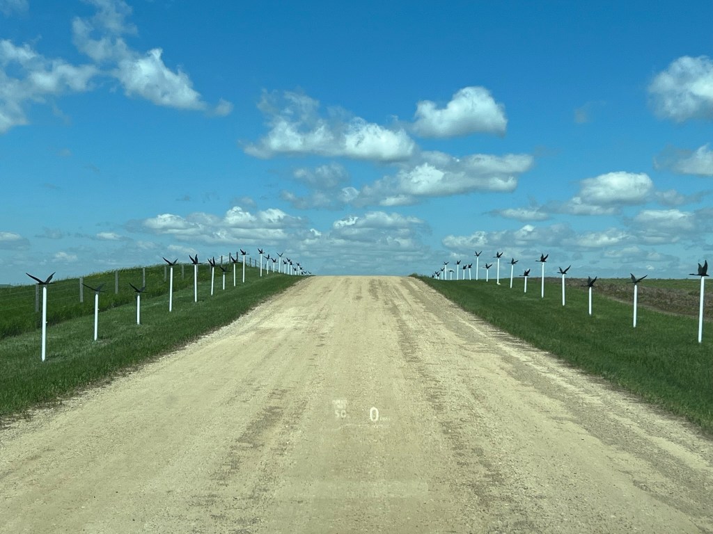
- Leaving Lefor it was back on the Enchanted Highway for more sculptures and fun and it did not disappoint! I should note here that I didn’t stop at every sculpture nor take pictures of each one so make sure you take the journey yourself to see everything.


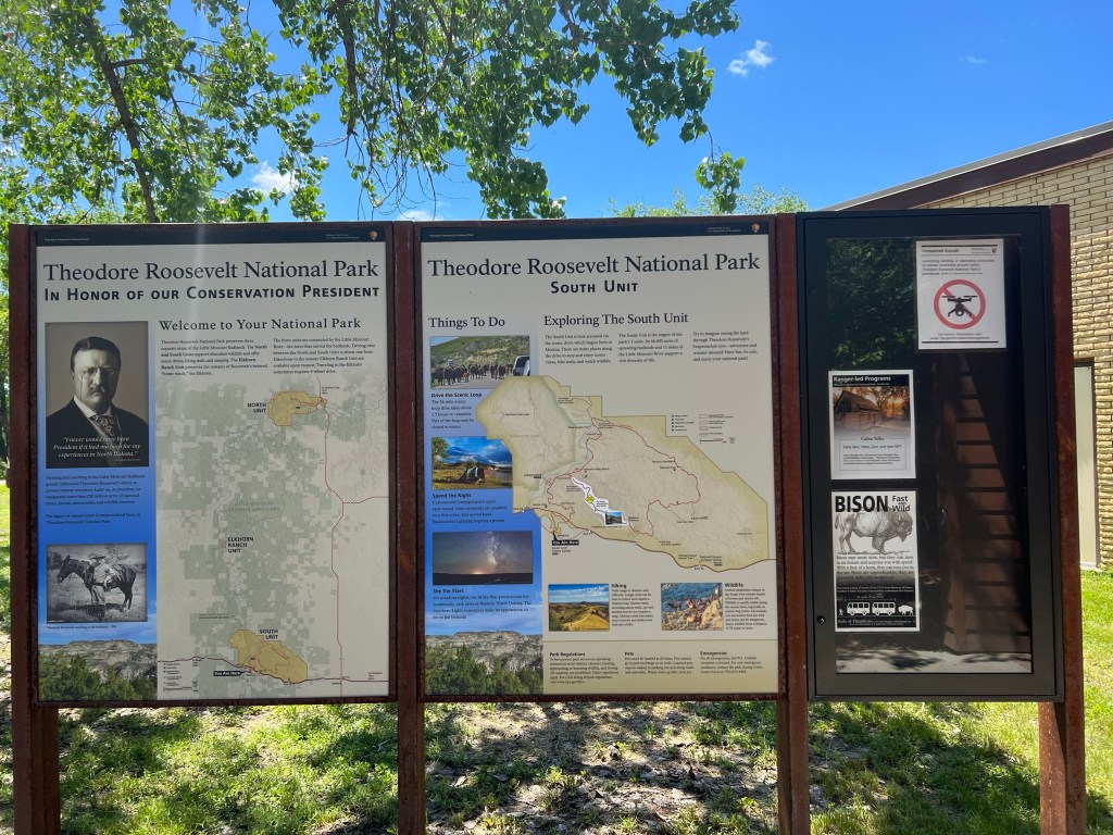
- The end of the Enchanted Highway coming way to soon we continued on up to Dickinson where we were going to Theodore Roosevelt National Park. We were staying in Dickinson tonight at the TownePlace Suites (which we liked) however we thought we’d go ahead and head over to Medora and start going through the South Unit (Theodore Roosevelt National Park has a North and a South Unit) since it was only noon.
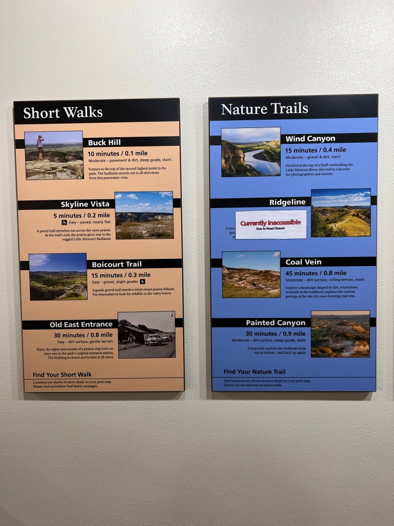
- Here is some general information on the park, hikes, and the general time to do each.


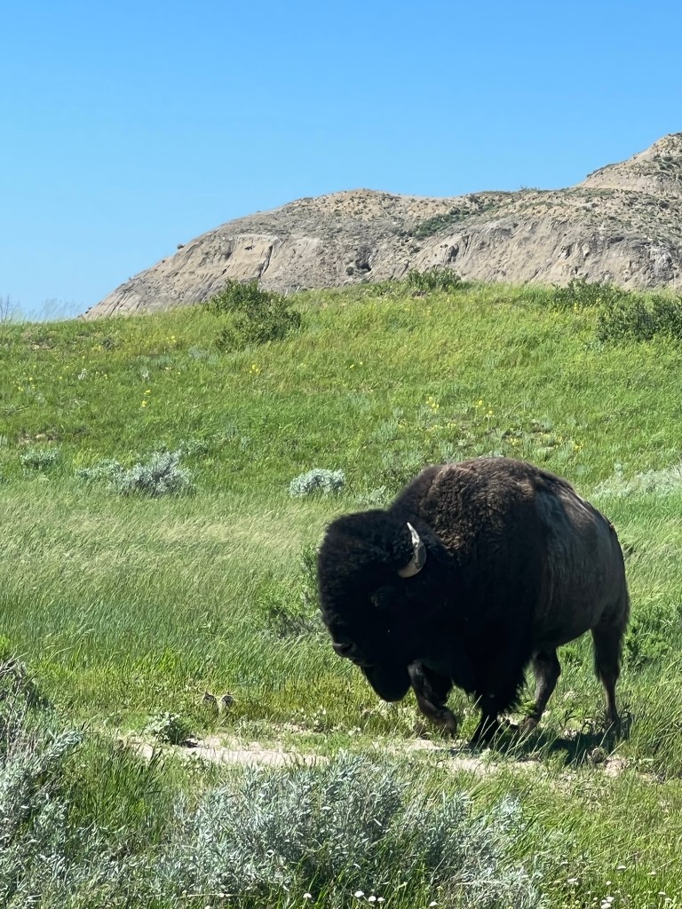
- Heading into the park from the visitor’s center we did a quick drive through the park. The park is beautiful and we did a quick hike or two followed by saying hi to our wooly friends from the safety of our vehicle. Lots of pics below.


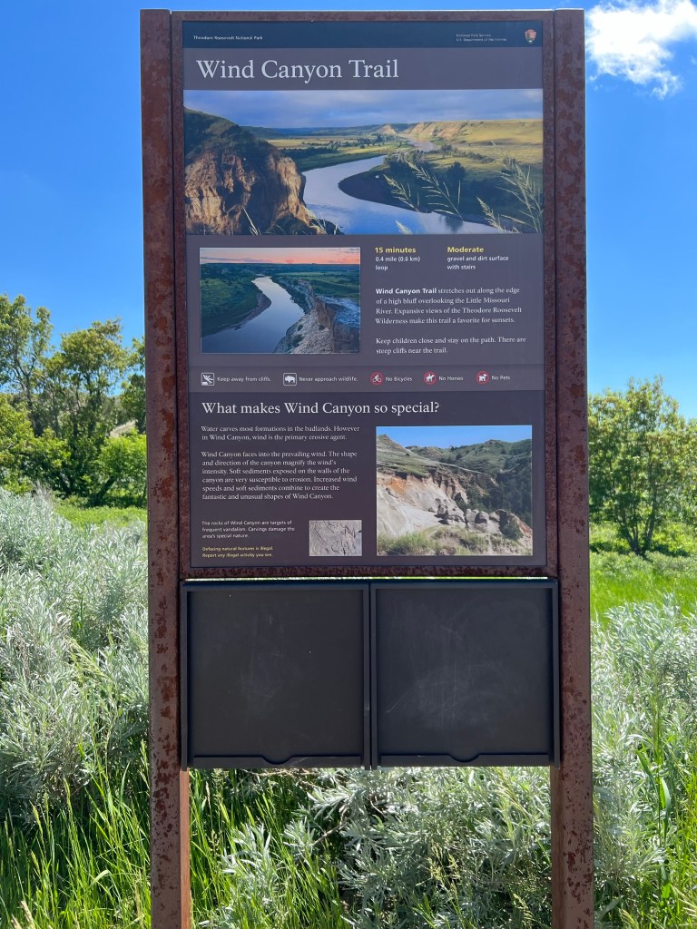
- Second stop was Wind Canyon Trail.

- Our surprise visitor as we were driving along. Many more to follow in the days to come.
- Boicourt Overlook is a great spot to just stop and look around.


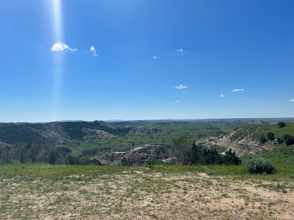
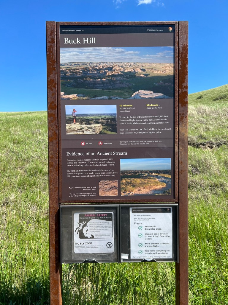
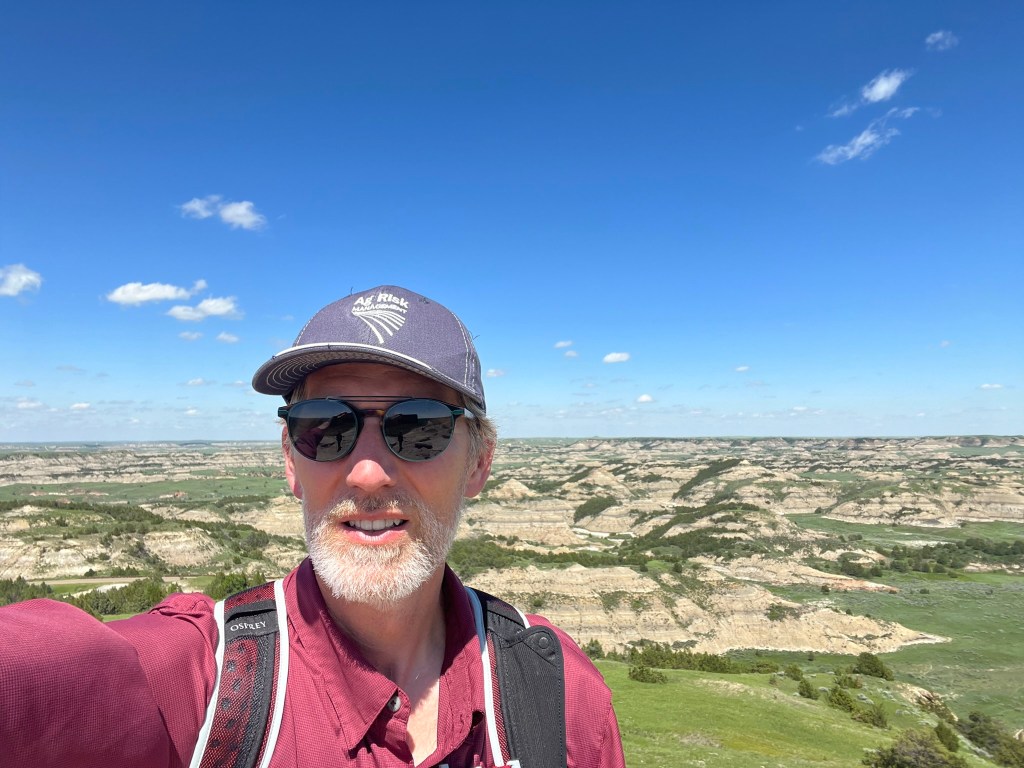
- Driving onward a quick stop at Buck Hill which is the second highest point in the park. Great panoramic views here!


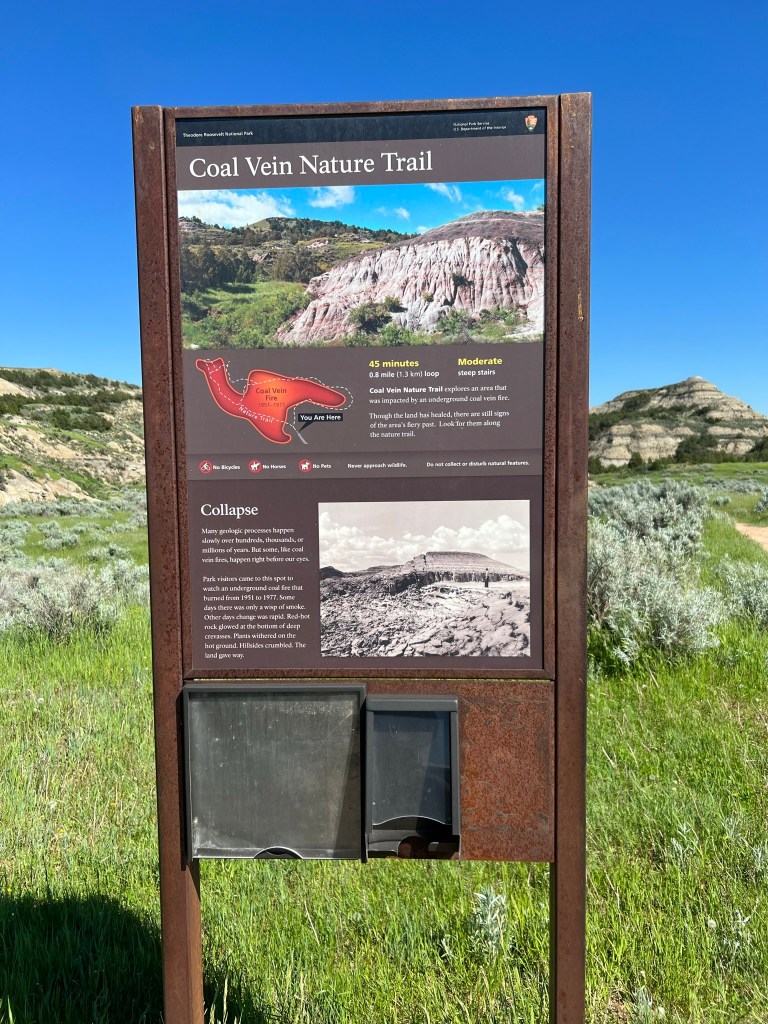
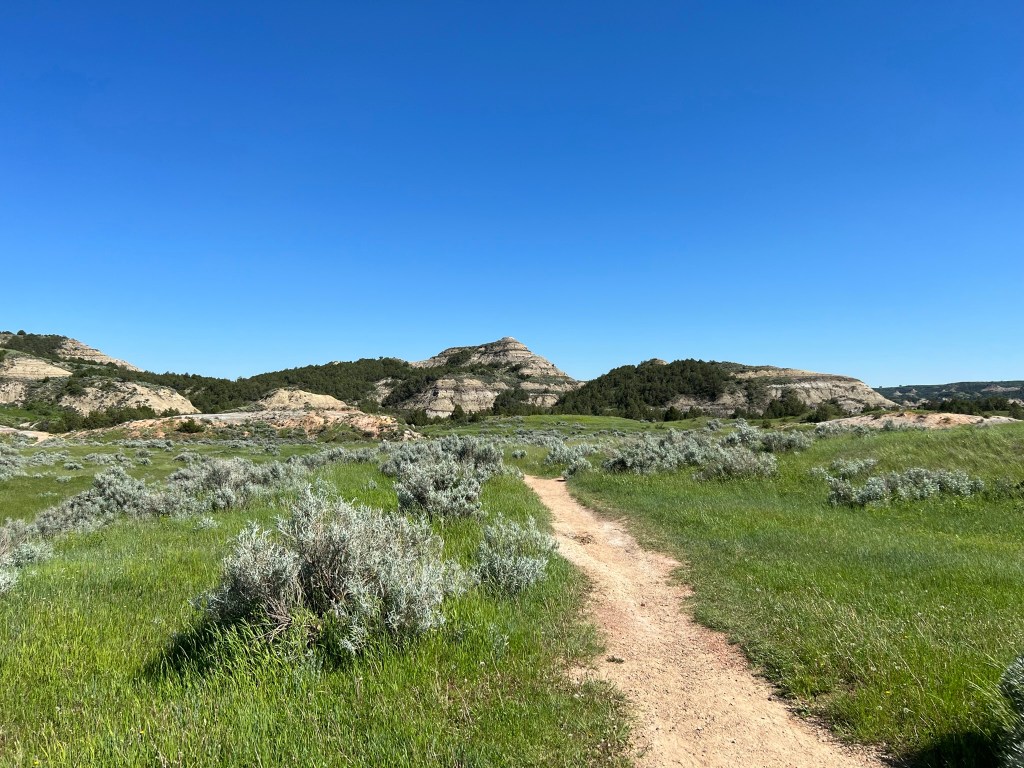
- Every onward next stop was the Coal Vein Nature Trail for a quick stop and very short walk
- Having successfully wandered through the park (very quickly today) we decided to drive to the Wannagan Creek Cabins we had booked for the following night. The easiest and best way to get to the cabin as to drive through the park (there was another way but it was extremely loooooong and roundabout) and since we were in the park just made sense.


- Having seen the cabins we went ahead and headed back to our hotel in Dickinson for a bite to eat. Whewww… that was a long day wouldn’t you say? We were happy to see the hotel after we ate and get a good nights rest. That’s the end of Day 3. Told you it would be a busy day!

Leave a comment